Slatington, Pennsylvania
| Borough of Slatington | |
| Borough | |
 619/621/623/625 Main St., Slatington, Pennsylvania | |
| Nickname: The Slate Capital of America | |
| Country | United States |
|---|---|
| State | Pennsylvania |
| County | Lehigh |
| Elevation | 490 ft (149.4 m) |
| Coordinates | 40°45′09″N 75°36′33″W / 40.75250°N 75.60917°WCoordinates: 40°45′09″N 75°36′33″W / 40.75250°N 75.60917°W |
| Area | 1.4 sq mi (3.6 km2) |
| - land | 1.3 sq mi (3 km2) |
| - water | 0.1 sq mi (0 km2), 7.14% |
| Population | 4,232 (2010) |
| Settled | 1738 |
| - Established | 1864 |
| Timezone | EST (UTC-5) |
| - summer (DST) | EDT (UTC-4) |
| ZIP code | 18080 |
| Area code | 610 Exchanges: 760, 767 |
 Location of Slatington in Lehigh County | |
 Location of Slatington in Pennsylvania | |
 Location of Pennsylvania in the United States | |
Slatington is a borough in Lehigh County, Pennsylvania. It is located 20 miles north of Bethlehem, in the Lehigh Valley region of the state. It is 62 miles south of Scranton, and 98 miles west of New York City.
Slatington is included in the Allentown-Bethlehem-Easton, PA-NJ Metropolitan Statistical Area, which is also included in the New York City-Newark, New Jersey, NY-NJ-CT-PA Combined Statistical Area.
Geography
Slatington is located at 40°45′9″N 75°36′33″W / 40.75250°N 75.60917°W (40.752561, -75.609229).[1]
According to the United States Census Bureau, the borough has a total area of 1.4 square miles (3.6 km2), of which 1.3 square miles (3.4 km2) is land and 0.1 square miles (0.26 km2) (4.35%) is water.
Slatington's elevation is 738 feet above sea level. Slatington's elevation varies from 330 feet at the Lehigh River on the east side of town to 750 feet by the Union Cemetery on Route 873 to the south.
Slatington is home to Victory Park, the location of the community pool and a disc golf course.
Demographics
| Historical population | |||
|---|---|---|---|
| Census | Pop. | %± | |
| 1870 | 1,508 | — | |
| 1880 | 1,634 | 8.4% | |
| 1890 | 2,716 | 66.2% | |
| 1900 | 3,773 | 38.9% | |
| 1910 | 4,454 | 18.0% | |
| 1920 | 4,014 | −9.9% | |
| 1930 | 4,134 | 3.0% | |
| 1940 | 4,062 | −1.7% | |
| 1950 | 4,343 | 6.9% | |
| 1960 | 4,316 | −0.6% | |
| 1970 | 4,687 | 8.6% | |
| 1980 | 4,277 | −8.7% | |
| 1990 | 4,678 | 9.4% | |
| 2000 | 4,434 | −5.2% | |
| 2010 | 4,232 | −4.6% | |
| Est. 2015 | 4,276 | [2] | 1.0% |
| Sources:[3][4][5] | |||
As of the census[4] of 2010, there were 4,232 people, 1,743 households, and 1,190 families residing in the borough. The population density was 3,354.6 people per square mile (1,297.0/km²). There were 1,867 housing units at an average density of 1,412.5 per square mile (546.1/km²). The racial makeup of the borough was 96.23% White, 1.42% African American, 0.20% Native American, 0.38% Asian, 0.02% Pacific Islander, 0.77% from other races, and 0.97% from two or more races. Hispanic or Latino of any race were 2.03% of the population.
There were 1,743 households, out of which 35.7% had children under the age of 18 living with them, 48.7% were married couples living together, 13.9% had a female householder with no husband present, and 31.7% were non-families. 26.4% of all households were made up of individuals, and 12.5% had someone living alone who was 65 years of age or older. The average household size was 2.51 and the average family size was 3.01.
In the borough the population was spread out, with 27.1% under the age of 18, 7.5% from 18 to 24, 32.4% from 25 to 44, 19.7% from 45 to 64, and 13.3% who were 65 years of age or older. The median age was 36 years. For every 100 females there were 94.7 males. For every 100 females age 18 and over, there were 89.3 males.
The median income for a household in the borough was $36,531, and the median income for a family was $43,542. Males had a median income of $32,101 versus $23,796 for females. The per capita income for the borough was $16,189. About 10.6% of families and 12.3% of the population were below the poverty line, including 14.1% of those under age 18 and 10.1% of those age 65 or over.
History

In 1737, Nicholas Kern was the first white settler in what would become Slatington. The Lenni-Lenape Native Americans were already living along "Warriors Path," which would become Route 873. Kern established a sawmill shortly after arriving. In 1756, Benjamin Franklin reported to Governor Morris that he had procured boards and timber from Kern's sawmill. In the 19th century two Welshmen, who recognized its properties and importance from being used in Europe, discovered slate. A quarry was set up in 1845, and, in 1847, a factory was erected. In 1864, Slatington was incorporated into a Borough of Pennsylvania; its first Mayor was Robert McDowell.
Historically, structural iron, knit goods, and silk were manufactured in Slatington, and there were abundant slate quarries in the area.
In 1900, 3,773 people lived in Slatington, and, by 1910, that number had grown to 4,454. Between 1910 and the 2010 census, the population reduced slightly, to 4,232. The U.S. postal code (zip code) for Slatington, PA is 18080.
Slatington was settled in 1738 and incorporated in 1864.
The Fireman's Drinking Fountain and Slatington Historic District are listed on the National Register of Historic Places.[6]
Public education
The Borough is served by the Northern Lehigh School District. Northern Lehigh School District has two elementary schools. Peters Elementary school educates students grades Kindergarten through second grade while Slatington Elementary educates grades 3-6. The district has only one middle school (grades 7-8) and one high school (grades 9-12). The district report card from the Pennsylvania Department of Education can be found on the following website: http://paayp.emetric.net/Content/reportcards/RC12S121394503000006829.PDF
Notable people
- Renee Orin, Broadway singer and wife of Albert Hague[7]
References
- ↑ "US Gazetteer files: 2010, 2000, and 1990". United States Census Bureau. 2011-02-12. Retrieved 2011-04-23.
- ↑ "Annual Estimates of the Resident Population for Incorporated Places: April 1, 2010 to July 1, 2015". Retrieved July 2, 2016.
- ↑ "Census of Population and Housing". U.S. Census Bureau. Retrieved 11 December 2013.
- 1 2 "American FactFinder". United States Census Bureau. Retrieved 2008-01-31.
- ↑ "Incorporated Places and Minor Civil Divisions Datasets: Subcounty Resident Population Estimates: April 1, 2010 to July 1, 2012". Population Estimates. U.S. Census Bureau. Retrieved 11 December 2013.
- ↑ National Park Service (2010-07-09). "National Register Information System". National Register of Historic Places. National Park Service.
- ↑ "Renee Orin, 73, Actress in Broadway Musicals". New York Times. August 30, 2000.
External links
 |
Weiders Crossing / Lehigh Gap | | ||
| Slatedale | |
Walnutport | ||
| ||||
| | ||||
| Neffs | Laurys Station |
| Wikimedia Commons has media related to Slatington, Pennsylvania. |
| Wikivoyage has a travel guide for Slatington. |
Municipalities and communities of Lehigh County, Pennsylvania, United States | ||
|---|---|---|
| Cities | 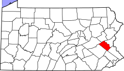 | |
| Boroughs | ||
| Townships | ||
| CDPs | ||
| Unincorporated communities |
| |
| Footnotes | ‡This populated place also has portions in an adjacent county or counties | |