Slantsy, Leningrad Oblast
| Slantsy (English) Сланцы (Russian) | |
|---|---|
| - Town[1] - | |
 Lenina Square in Slantsy | |
.svg.png) Location of Leningrad Oblast in Russia | |
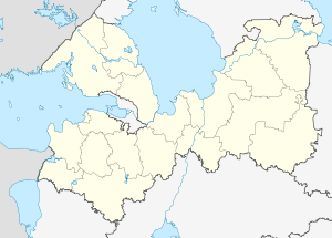 Slantsy | |
|
| |
.png) |
|
|
| |
| Administrative status (as of June 2013) | |
| Country | Russia |
| Federal subject | Leningrad Oblast[1] |
| Administrative district | Slantsevsky District[1] |
| Settlement municipal formation | Slantsevskoye Settlement Municipal Formation[1] |
| Administrative center of | Slantsevsky District,[1] Slantsevskoye Settlement Municipal Formation[1] |
| Municipal status (as of May 2010) | |
| Municipal district | Slantsevsky Municipal District[2] |
| Urban settlement | Slantsevskoye Urban Settlement[2] |
| Administrative center of | Slantsevsky Municipal District,[2] Slantsevskoye Urban Settlement[2] |
| Statistics | |
| Population (2010 Census) | 33,485 inhabitants[3] |
| Time zone | MSK (UTC+03:00)[4] |
| Founded | December 20, 1934[5] |
| Town status since | April 5, 1949[6] |
| Postal code(s)[7] | 188560, 188561, 188563–188565 |
|
| |
| Slantsy on Wikimedia Commons | |
Slantsy (Russian: Сла́нцы) is a town and the administrative center of Slantsevsky District in Leningrad Oblast, Russia, located on the Plyussa River, 192 kilometers (119 mi) west of St. Petersburg. Population: 33,485 (2010 Census);[3] 37,371 (2002 Census);[8] 43,087 (1989 Census).[9].
History

The creation of the settlement was proposed in 1930 by Sergey Kirov, when a large oil shale deposit was discovered in the region. The construction began in 1932. The main street was named after Kirov. On December 20, 1934, rural localities of Nikolskoye and Gavrilovskoye, then a part of Polsky Selsoviet of Gdovsky District of Leningrad Oblast, were merged to form the urban-type settlement of Slantsy.[5]
On March 11, 1941, Slantsevsky District was split from Gdovsky District and Slantsy became the district administrative center.[5] Between August 1941 and February 1944, Slantsy was occupied by German troops.[6] On April 5, 1949, Slantsy was granted town status.[6] On January 1, 1963, Slantsevsky District was abolished and split between Kingiseppsky and Luzhsky Districts.[6] On November 3, 1965 it was re-established.[6]
Administrative and municipal status
Within the framework of administrative divisions, Slantsy serves as the administrative center of Slantsevsky District.[1] As an administrative division, it is, together with eight rural localities, incorporated within Slantsevsky District as Slantsevskoye Settlement Municipal Formation.[1] As a municipal division, Slantsevskoye Settlement Municipal Formation is incorporated within Slantsevsky Municipal District as Slantsevskoye Urban Settlement.[2]
Economy
Industry
The town's name is the Russian word for shale. The town was largely sustained by oil shale mining by Leningradslanets mining company, as depicted on its coat of arms, and shale oil production by Zavod Slantsy. The mines are now largely closed due to decrease in local demand and disagreements over contracts with nearby Estonia. This has resulted in large-scale local unemployment. Furthermore, the disused mines present a serious ecological threat to water supplies in the region.
Additionally, there are construction industry (including cement plants), chemical industry, and food industry enterprises.[10]
Transportation

A railway connects Slantsy with Gdov in the south and with Veymarn in the north. Originally, the railway connected Pskov with Veymarn. It was destroyed during World War II and the stretch between Gdov and Pskov was never rebuilt.
Slantsy is connected by roads with Pskov via Gdov and with Kingisepp. There are also local roads, with bus traffic originating from Slantsy.
Culture and recreation
Slantsy contains four objects classified as cultural and historical heritage of local significance.[11] Three of those commemorate events related to World War II, while the fourth one is the building of the first shale mine open in Slantsy.
The Slantsy Museum of History and Culture, focusing on the history of Slantsy, is the only state museum in Slantsevsky District.[12]
Notable people
- Larisa Peleshenko (born 1964), shot putter
- Aleksey Dmitrik (born 1984), high jumper
References
Notes
- 1 2 3 4 5 6 7 8 Oblast Law #32-oz
- 1 2 3 4 5 Law #47-oz
- 1 2 Russian Federal State Statistics Service (2011). "Всероссийская перепись населения 2010 года. Том 1" [2010 All-Russian Population Census, vol. 1]. Всероссийская перепись населения 2010 года (2010 All-Russia Population Census) (in Russian). Federal State Statistics Service. Retrieved June 29, 2012.
- ↑ Правительство Российской Федерации. Федеральный закон №107-ФЗ от 3 июня 2011 г. «Об исчислении времени», в ред. Федерального закона №271-ФЗ от 03 июля 2016 г. «О внесении изменений в Федеральный закон "Об исчислении времени"». Вступил в силу по истечении шестидесяти дней после дня официального опубликования (6 августа 2011 г.). Опубликован: "Российская газета", №120, 6 июня 2011 г. (Government of the Russian Federation. Federal Law #107-FZ of June 31, 2011 On Calculating Time, as amended by the Federal Law #271-FZ of July 03, 2016 On Amending Federal Law "On Calculating Time". Effective as of after sixty days following the day of the official publication.).
- 1 2 3 Гдовский район (август 1927 г. - август 1944 г.) (in Russian). Справочник истории административно-территориального деления Ленинградской области. Retrieved March 12, 2014.
- 1 2 3 4 5 Сланцевский район (март 1941 г. - февраль 1963 г., ноябрь 1965 г.) (in Russian). Система классификаторов исполнительных органов государственной власти Санкт-Петербурга. Retrieved March 12, 2014.
- ↑ Почта России. Информационно-вычислительный центр ОАСУ РПО. (Russian Post). Поиск объектов почтовой связи (Postal Objects Search) (Russian)
- ↑ Russian Federal State Statistics Service (May 21, 2004). "Численность населения России, субъектов Российской Федерации в составе федеральных округов, районов, городских поселений, сельских населённых пунктов – районных центров и сельских населённых пунктов с населением 3 тысячи и более человек" [Population of Russia, Its Federal Districts, Federal Subjects, Districts, Urban Localities, Rural Localities—Administrative Centers, and Rural Localities with Population of Over 3,000] (XLS). Всероссийская перепись населения 2002 года [All-Russia Population Census of 2002] (in Russian). Retrieved August 9, 2014.
- ↑ Demoscope Weekly (1989). "Всесоюзная перепись населения 1989 г. Численность наличного населения союзных и автономных республик, автономных областей и округов, краёв, областей, районов, городских поселений и сёл-райцентров" [All Union Population Census of 1989: Present Population of Union and Autonomous Republics, Autonomous Oblasts and Okrugs, Krais, Oblasts, Districts, Urban Settlements, and Villages Serving as District Administrative Centers]. Всесоюзная перепись населения 1989 года [All-Union Population Census of 1989] (in Russian). Институт демографии Национального исследовательского университета: Высшая школа экономики [Institute of Demography at the National Research University: Higher School of Economics]. Retrieved August 9, 2014.
- ↑ Экономика (in Russian). Администрация Сланцевского муниципального района. Retrieved March 6, 2013.
- ↑ Памятники истории и культуры народов Российской Федерации (in Russian). Russian Ministry of Culture. Retrieved 2 June 2016.
- ↑ Сланцевский историко-краеведческий музей (in Russian). Российская сеть культурного наследия. Retrieved March 12, 2013.
Sources
- Законодательное собрание Ленинградской области. Областной закон №32-оз от 15 июня 2010 г. «Об административно-территориальном устройстве Ленинградской области и порядке его изменения», в ред. Областного закона №23-оз от 8 мая 2014 г. «Об объединении муниципальных образований "Приморское городское поселение" Выборгского района Ленинградской области и "Глебычевское сельское поселение" Выборгского района Ленинградской области и о внесении изменений в отдельные Областные законы». Вступил в силу со дня официального опубликования. Опубликован: "Вести", №112, 23 июня 2010 г. (Legislative Assembly of Leningrad Oblast. Oblast Law #32-oz of June 15, 2010 On the Administrative-Territorial Structure of Leningrad Oblast and on the Procedures for Its Change, as amended by the Oblast Law #23-oz of May 8, 2014 On Merging the Municipal Formations of "Primorskoye Urban Settlement" in Vyborgsky District of Leningrad Oblast and "Glebychevskoye Rural Settlement" in Vyborgsky District of Leningrad Oblast and on Amending Various Oblast Laws. Effective as of the day of the official publication.).
- Законодательное собрание Ленинградской области. Областной закон №47-оз от 1 сентября 2004 г. «Об установлении границ и наделении соответствующим статусом муниципального образования Сланцевский муниципальный район и муниципальных образований в его составе», в ред. Областного закона №17-оз от 6 мая 2010 г «О внесении изменений в некоторые областные законы в связи с принятием федерального закона "О внесении изменений в отдельные законодательные акты Российской Федерации в связи с совершенствованием организации местного самоуправления"». Вступил в силу через 10 дней со дня официального опубликования (24 сентября 2004 г.). Опубликован: "Вестник Правительства Ленинградской области", №27, 14 сентября 2004 г. (Legislative Assembly of Leningrad Oblast. Oblast Law #47-oz of September 1, 2004 On Establishing the Borders of and Granting an Appropriate Status to the Municipal Formation of Slantsevsky Municipal District and to the Municipal Formations Comprised By It, as amended by the Oblast Law #17-oz of May 6, 2010 On Amending Various Oblast Laws Due to the Adoption of the Federal Law "On Amending Various Legislative Acts of the Russian Federation Due to the Improvement of the Organization of the Local Self-Government". Effective as of after 10 days from the day of the official publication (September 24 2004).).
Administrative center: none | |||
| Cities and towns |
| ||
| Districts | |||