Skogerøya
| Native name: <span class="nickname" ">Sállan | |
|---|---|
 Location off the Varangerfjord | |
 Skogerøya | |
| Geography | |
| Location | Finnmark, Norway |
| Coordinates | 69°53′23″N 29°50′41″E / 69.8898°N 29.8447°ECoordinates: 69°53′23″N 29°50′41″E / 69.8898°N 29.8447°E |
| Area | 129 km2 (50 sq mi) |
| Length | 18.5 km (11.5 mi) |
| Width | 12 km (7.5 mi) |
| Highest elevation | 445 m (1,460 ft) |
| Highest point | Skogerøytoppen |
| Administration | |
|
Norway | |
| County | Finnmark |
| Municipality | Sør-Varanger |
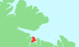
Skogerøya (Northern Sami: Sállan) is an uninhabited island in Sør-Varanger municipality in Finnmark county, Norway. The 129-square-kilometre (50 sq mi) partially forested island lies south of the Varangerfjorden, west of the Bøkfjorden, north of the Korsfjorden, and east of the Kjøfjorden. The highest point on the island is the 445-metre (1,460 ft) tall Skogerøytoppen. The island lies about 10 kilometres (6.2 mi) northwest of the town of Kirkenes. It is used as a summer and autumn grazing area for reindeer.[1]
See also
References
- ↑ Store norske leksikon. "Skogerøya" (in Norwegian). Retrieved 2013-03-10.
This article is issued from Wikipedia - version of the 11/18/2016. The text is available under the Creative Commons Attribution/Share Alike but additional terms may apply for the media files.