Skirpenbeck
| Skirpenbeck | |
 St Mary's Church at Skirpenbeck |
|
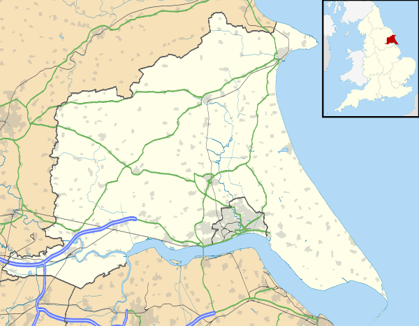 Skirpenbeck |
|
| Population | 192 (2011 census)[1] |
|---|---|
| OS grid reference | SE746570 |
| Civil parish | Skirpenbeck |
| Unitary authority | East Riding of Yorkshire |
| Ceremonial county | East Riding of Yorkshire |
| Region | Yorkshire and the Humber |
| Country | England |
| Sovereign state | United Kingdom |
| Post town | YORK |
| Postcode district | YO41 |
| Dialling code | 01759 |
| Police | Humberside |
| Fire | Humberside |
| Ambulance | Yorkshire |
| EU Parliament | Yorkshire and the Humber |
| UK Parliament | East Yorkshire |
Coordinates: 54°00′13″N 0°51′44″W / 54.003636°N 0.862110°W
Skirpenbeck is a village and civil parish in the East Riding of Yorkshire, England. It is situated 2 miles (3.2 km) north-west of Stamford Bridge just north of the A166 road.
According to the 2011 UK census, Skirpenbeck parish had a population of 192,[1] an increase on the 2001 UK census figure of 142.[2]
Skirpenbeck is near Stamford Bridge, over the River Derwent, near where King Harold of England defeated Harald Hardrada King of Norway in 1066. Its first baron was Sir William de Chauncy, son of Chauncy de Chauncy.
There are a number of working farms in the village. The number having reduced by four all of which have been subject to property development.
The parish church of St Mary's is a Grade II* listed building.[3]
There are markings on the church building (near the bell tower) that appear to be Saxon runes.
Alick Walker the palaeontologist was born in Skirpenbeck.[4]
References
- 1 2 "Key Figures for 2011 Census: Key Statistics: Area: Skirpenbeck CP (Parish)". Neighbourhood Statistics. Office for National Statistics. Retrieved 7 February 2013.
- ↑ "2001 Census: Key Statistics: Parish Headcounts: Area: Skirpenbeck CP (Parish)". Neighbourhood Statistics. Office for National Statistics. Retrieved 20 May 2008.
- ↑ Historic England. "Church of St Mary (1161856)". National Heritage List for England. Retrieved 7 February 2013.
- ↑ Benton, Michael J; Walker, David J (2002). "Alick D. Walker 1925–1999: an appreciation" (PDF). Zoological Journal of the Linnean Society. 136: p. 1. doi:10.1046/j.1096-3642.1999.00022.x. Retrieved 4 June 2010.
- Gazetteer — A–Z of Towns Villages and Hamlets. East Riding of Yorkshire Council. 2006. p. 10.
External links
| Wikimedia Commons has media related to Skirpenbeck. |