Skidmore, Missouri
| Skidmore, Missouri | |
|---|---|
| City | |
 Location within Nodaway County and Missouri | |
| Coordinates: 40°17′19″N 95°4′44″W / 40.28861°N 95.07889°WCoordinates: 40°17′19″N 95°4′44″W / 40.28861°N 95.07889°W | |
| Country | United States |
| State | Missouri |
| County | Nodaway |
| Area[1] | |
| • Total | 0.33 sq mi (0.85 km2) |
| • Land | 0.33 sq mi (0.85 km2) |
| • Water | 0 sq mi (0 km2) |
| Elevation | 945 ft (288 m) |
| Population (2010)[2] | |
| • Total | 284 |
| • Estimate (2012[3]) | 276 |
| • Density | 860/sq mi (330/km2) |
| Time zone | Central (CST) (UTC-6) |
| • Summer (DST) | CDT (UTC-5) |
| ZIP code | 64487 |
| Area code(s) | 660 |
| FIPS code | 29-68132 [4] |
| GNIS feature ID | 0726506 [5] |
Skidmore is a city in Nodaway County, Missouri, United States. The population was 284 at the 2010 Census. The small farming community has a yearly "Punkin' Show".
History
The Skidmore area was first settled in 1840 by William Bunton shortly after the Platte Purchase opened the area to settlement. Skidmore itself was platted in 1880 when M. Skidmore donated 20 acres (81,000 m2) to the Nodaway Valley Railroad Company (the agent for the Kansas City, St. Joseph and Council Bluffs Railroad which was eventually taken over by the Burlington Northern Railroad).[6] The railroad no longer operates.
On July 10, 1981, Ken McElroy was shot to death, by at least two different guns, while sitting in his truck in front of the pool hall in town. Though dozens of people saw the event, all denied seeing anything that would help identify the shooters.[7] McElroy had a reputation as the "town bully," and he had fended off over 20 charges for acts of theft, rape, and other violence (often by means of witness intimidation, allegedly). In the months before his death, he was appealing a light sentence for shooting a 70-year-old grocer in the neck. Town residents had been upset over the inability of the courts to deal with him. Author Harry N. MacLean recounted the incident and its background in a bestselling and award-winning book, In Broad Daylight.[8] In 1991 the incident was portrayed in a made-for-TV movie starring Brian Dennehy and Cloris Leachman (although filmed in Texas).[9] The Ken McElroy shooting was also the focus of the A&E Network program City Confidential, season two, episode twenty-two entitled, "Skidmore: Frontier Justice".
On April 11, 2001, Branson Kayne Perry, twenty years old at the time, mysteriously disappeared from near his home in Skidmore. Branson was last seen by his friend on April 11 at approximately 3:00 p.m. They were cleaning house for his father before he came home from the hospital. He told his friend he was putting jumper cables in the shed and would be right back. He has not been seen since. He left behind his van and personal belongings. The jumper cables weren't in the shed, but a few days later, they were placed there by an unknown person. The family is currently offering a reward of up to $20,000 for information leading to the whereabouts of Branson Perry and/or the arrest and conviction of the person and/or persons responsible for his disappearance, and Castle Records[10] is offering a $25,000 recording contract for any information in regards to Branson Perry's disappearance.[11][12]
On December 16, 2004, Skidmore was once again the focus of national attention when Bobbie Jo Stinnett was murdered and had her unborn baby cut from her womb.[13] The baby, Victoria Jo Stinnett, was found alive two days later in Topeka, Kansas. The killer, Lisa M. Montgomery, received a federal death sentence.
The St. Oswald's Protestant Episcopal Church was listed on the National Register of Historic Places in 1992.[14]
Geography
Skidmore is located at 40°17′19″N 95°04′44″W / 40.288488°N 95.078955°W.[15] According to the United States Census Bureau, the city has a total area of 0.33 square miles (0.85 km2), all land.[1]
Demographics
| Historical population | |||
|---|---|---|---|
| Census | Pop. | %± | |
| 1900 | 561 | — | |
| 1910 | 562 | 0.2% | |
| 1920 | 528 | −6.0% | |
| 1930 | 538 | 1.9% | |
| 1940 | 498 | −7.4% | |
| 1950 | 485 | −2.6% | |
| 1960 | 425 | −12.4% | |
| 1970 | 440 | 3.5% | |
| 1980 | 437 | −0.7% | |
| 1990 | 404 | −7.6% | |
| 2000 | 342 | −15.3% | |
| 2010 | 284 | −17.0% | |
| Est. 2015 | 272 | [16] | −4.2% |
2010 census
As of the census[2] of 2010, there were 284 people, 122 households, and 81 families residing in the city. The population density was 860.6 inhabitants per square mile (332.3/km2). There were 172 housing units at an average density of 521.2 per square mile (201.2/km2). The racial makeup of the city was 99.3% White, 0.4% Native American, and 0.4% from two or more races.
There were 122 households of which 29.5% had children under the age of 18 living with them, 52.5% were married couples living together, 8.2% had a female householder with no husband present, 5.7% had a male householder with no wife present, and 33.6% were non-families. 27.9% of all households were made up of individuals and 13.9% had someone living alone who was 65 years of age or older. The average household size was 2.33 and the average family size was 2.80.
The median age in the city was 45.4 years. 21.8% of residents were under the age of 18; 5.6% were between the ages of 18 and 24; 21.7% were from 25 to 44; 32.1% were from 45 to 64; and 18.7% were 65 years of age or older. The gender makeup of the city was 52.8% male and 47.2% female.
2000 census
As of the census[4] of 2000, there were 342 people, 148 households, and 96 families residing in the city. The population density was 1,058.8 people per square mile (412.6/km²). There were 173 housing units at an average density of 535.6 per square mile (208.7/km²). The racial makeup of the city was 99.42% White, 0.29% African American, and 0.29% from two or more races.
There were 148 households out of which 29.7% had children under the age of 18 living with them, 52.0% were married couples living together, 7.4% had a female householder with no husband present, and 35.1% were non-families. 31.8% of all households were made up of individuals and 12.8% had someone living alone who was 65 years of age or older. The average household size was 2.31 and the average family size was 2.89.
In the city the population was spread out with 23.7% under the age of 18, 7.9% from 18 to 24, 26.9% from 25 to 44, 25.7% from 45 to 64, and 15.8% who were 65 years of age or older. The median age was 40 years. For every 100 females there were 102.4 males. For every 100 females age 18 and over, there were 94.8 males.
The median income for a household in the city was $30,500, and the median income for a family was $36,250. Males had a median income of $27,500 versus $20,156 for females. The per capita income for the city was $13,881. About 14.7% of families and 22.1% of the population were below the poverty line, including 36.8% of those under age 18 and 10.9% of those age 65 or over.
References
- 1 2 "US Gazetteer files 2010". United States Census Bureau. Retrieved 2012-07-08.
- 1 2 "American FactFinder". United States Census Bureau. Retrieved 2012-07-08.
- ↑ "Population Estimates". United States Census Bureau. Retrieved 2013-05-30.
- 1 2 "American FactFinder". United States Census Bureau. Retrieved 2008-01-31.
- ↑ "US Board on Geographic Names". United States Geological Survey. 2007-10-25. Retrieved 2008-01-31.
- ↑ "Past and Present of Nodaway County Missouri – B.F. Owen & Co. – 1910". Digital.library.umsystem.edu. Retrieved 2012-04-08.
- ↑ "Ken McElroy Murderer, rapist and consummate intimidator — Keep an Eye on Him — Crime Library on truTV.com". Crimelibrary.com. 1981-07-10. Retrieved 2012-04-08.
- ↑ Harry N. MacLean, In Broad Daylight: A Murder in Skidmore, Missouri. New York: Harper & Row, 1988.
- ↑ In Broad Daylight at the Internet Movie Database
- ↑ "Castle Records Index". Castlerecords.com. Retrieved 2012-04-08.
- ↑ Branson Perry article on Crime Library
- ↑ Branson Perry story on America's Most Wanted
- ↑ "Women Who Kill, Part Two — Obsessed with Babies — Crime Library on truTV.com". Crimelibrary.com. 2004-12-16. Retrieved 2012-04-08.
- ↑ National Park Service (2010-07-09). "National Register Information System". National Register of Historic Places. National Park Service.
- ↑ "US Gazetteer files: 2010, 2000, and 1990". United States Census Bureau. 2011-02-12. Retrieved 2011-04-23.
- ↑ "Annual Estimates of the Resident Population for Incorporated Places: April 1, 2010 to July 1, 2015". Retrieved July 2, 2016.
- ↑ "Census of Population and Housing". Census.gov. Retrieved June 4, 2015.
External links
- Historic maps of Skidmore in the Sanborn Maps of Missouri Collection at the University of Missouri
Municipalities and communities of Nodaway County, Missouri, United States | ||
|---|---|---|
| Cities | 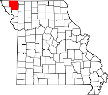 | |
| Villages | ||
| Townships | ||
| CDPs | ||
| Unincorporated communities | ||
| Ghost town | ||