Skidby
Coordinates: 53°47′22″N 0°27′41″W / 53.7894°N 0.46134°W
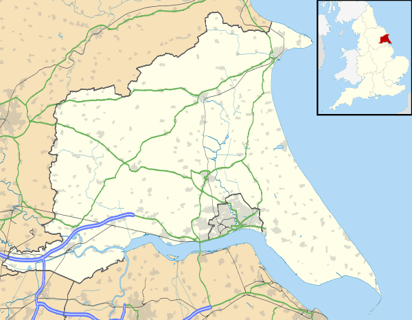
Skidby is a small village and civil parish in Yorkshire Wolds of the East Riding of Yorkshire, England. It is situated about 6 miles (10 kilometres) north-west of Hull city centre and 5 mi (8 km) south of Beverley.
The civil parish contains mainly agricultural land, both in the hills of the wolds and the low-lying land. The civil parish also includes the hamlets of Eppleworth and Raywell.
The village is the site of Skidby Windmill, a Grade II* listed building.[2]
Geography
The modern civil parish includes the village of Skidby and the hamlet of Eppleworth,[map 1] and Raywell.[map 2] Most of the parish lies west-south-west of the village in the Yorkshire Wolds, rising from about 50 m above sea level at Skidby to about 100 m on the western fringes. The A164 road forms part of the south-eastern boundary of the parish, on the edge of the Wolds.[3]

Part of the parish is to the east of the village and A164 beyond the Wolds, and north of Cottingham, extending as far as the Hull to Bridlington railway line at its easternmost extent, the land height drops to the east reaching a low of less than 10m near the railway line.[3] The part of the parish east of the A164 includes a golf course 'Skidby Lakes Golf course' and associated leisure club,[4][5][map 3] as well as a major (400/275 kV AC) electricity substation "Creyke Beck",[6][map 4][note 1] The remainder of the low-lying area is agricultural.
Most of the parish area is west of the A164, within the wolds: Hessle Golf Club is north of the Eppleworth to Raywell road (Westfield road),[7][map 5] There is a traveller's site at a former chalk quarry near Eppleworth;[8][map 6] and a waste composting facility near the former Albion Mill on the route of the former Hull and Barnsley line,[9][map 7] expanded to include an in-vessel composting facility in 2015, used to process organic waste from East Riding of Yorkshire Council and Hull City Council.[10] The remainder of the area is in agricultural use.
In the 2011 UK census, Skidby parish had a population of 1,284,[1] a fall from the 2001 UK census figure of 1,369.[11]
Skidby village
Skidby has a single main street, Main Street, running roughly east-west: the eastern end leads to Cottingham, making a crossroads with the former Hessle to Beverley turnpike before a roundabout junction with the A164 road. At the western end of the village Little Weighton Road leads roughly towards Little Weighton; to the south is Riplingham Road, also leading westward, currently (2006) a farm track and footpath.[3][12]
History

The village's name is thought mean dwelling (-bý) of a person called Skítr, ("Skyti's farm") the words are of Scandinavian origin.[13] An alternative origin meaning 'firewood place' (from skið and by), an origin from the person's name skiði has also been suggested.[14] Other alternatives are 'dirty place', from the old English scite.[13]
The village name 'Skidby' is first recorded by Oswald, Archbishop of York in the 10th century, as Scyteby: the bishop Oscytel was recorded as having acquired it for £20.[15] In the Doomsday Book it is referred to as Schitebi - at the time of the survey it was recorded together with 'Burtone' (near Bishop Burton): the land belonged to the manor of Beverley (in the hands of the church), with over 20 villains and 3 knights.[16]
The forms Skipbie,[13][17] and Skitby were in use in the 16th century,[18] in the 19th century 'Skitby' was a common form,[14][19] as was the current form Skidby.[20][21][note 2]
The church of St Michael dates to 1777, with a tower built in 1827.[21] The church was designated a Grade II* listed building in 1968.[23] Weslyan and Baptist chapels were built in the early 1800s, and a school and teacher's house built in 1849.[21] A cornmill, Skidby Mill was constructed in 1821, raised in the 1870s and listed in 1952.[24]
By the 1850s the village population had reached 306;[21] in 1857 the ecclesiastical parish of Skidby became fully separated from Cottingham and received a resident clergyman.[20]
Around 1885 the Hull and Barnsley Railway was constructed (section closed 1960s), running north-east through the parish: no stations were constructed on the section near Skidby; at the point the railway crossed the Eppleworth valley a five arched brick viaduct was constructed, known locally as 'five arches', or as 'Eppleworth viaduct'.[25][map 8] [note 3] Northwest of the viaduct the line required a 83 ft (25 m) cutting, known as the Little Weighton Cutting.[note 3]
In 1972 120 acres (49 ha) of land north of the Eppleworth to Raywell road was acquired for the Hessle Golf Club, which was relocating due to the construction of the Humber Bridge; the nine-hole course was opened in 1975.[29][map 5]
A traveller's site was established on Westfield Road in a disused chalk pit in the 1980s.[8][map 6]
Notes
- ↑ Creyke Beck is usually associated by address with Cottingham, not Skidby, being much closer and being accessible via Cottingham not Skidby
- ↑ The name of the town has also been confused with archaic forms of Skeeby, a place in Richmondshire, North Yorkshire.[22]
- 1 2 The viaduct was completed in 1881,[26] demolished in the 1970s.[27] The Little Weighton cutting and adjacent quarries were used for landfill between 1970 and 2000s.[28] See main article Hull and Barnsley Railway for details.
References
- 1 2 "Key Figures for 2011 Census: Key Statistics: Area: Skidby CP (Parish)". Neighbourhood Statistics. Office for National Statistics. Retrieved 2 February 2013.
- ↑ Historic England. "Skidby Mill and Attached Mill Buildings (1103339)". National Heritage List for England. Retrieved 15 August 2013.
- 1 2 3 Ordnance survey. 1:25000. 2006
- ↑ "Cottingham Parks, golf and leisure club, East Yorkshire, UK". www.cottinghamparks.co.uk. Retrieved 17 June 2012.
- ↑ "Skidby Lakes Golf Club". www.skidbylakes.co.uk. Retrieved 2 February 2013.
- ↑ Hiorns, Andrew (7 December 2010). "Infrastructure for, and integration of, renewable energy into electricity networks" (PDF). www.supergen-networks.org.uk. National Grid. pp. 5, 6; see map diagrams.
- ↑ "Hessle Golf Club : Superb Golf Course in East Yorkshire". Hessle Golf Club. Contact / Visitors:How to find us. Retrieved 20 June 2012.
- 1 2 Sources:
- "Gypsy and traveller sites". East Riding of Yorkshire Council. Retrieved 20 June 2012.
- "Eppleworth Road (Cottingham) Gypsy And Traveller Site". Cottingham Times. Retrieved 2 February 2013.
- ↑ Sources:
- "Composting". Wastewise. Retrieved 20 June 2012.
- Brook, D.F. (21 March 2007). "Environmental Protection Act 1990 : Waste Management Licence Working Plan. Biowaste Composting Facility. Albion Lane, Willerby, East Yorkshire. Biowaste Recycling Limited." (PDF). Wastewise. p.3, 1.1.2., "The site is centred on grid reference TA 014314".
- ↑ "Lord Haskins opens new In-Vessel Composting facility". Yorkshire Business Daily. 1 July 2015. Retrieved 15 July 2015.
- ↑ "2001 Census: Key Statistics: Parish Headcounts: Area: Skidby CP (Parish)". Neighbourhood Statistics. Office for National Statistics. Retrieved 20 May 2008.
- ↑ Ordnance Survey. 1:10560. 1856
- 1 2 3 Sources:
- Mills, Anthony David (2003). A Dictionary of British Place-Names. Oxford University Press. "Skidby". ISBN 0-19-852-758-6.
- English Place-Name Society. 14. 1937. p. 209.
- 1 2 Holderness, Thomas (1881). Some place-names of the east riding of Yorkshire, a paper read before the Hull Literary Club, March 28th 1881. p. 15.
I believe that, locally the village is still caled Skitby
- ↑ "LIV. Statement given by Oswald, Archbishop of York, regarding church lands in Northumbria". anglo-saxon charters. CUP Archive. pp. 112–3.
æt Scyteby he gebohte mid .XX pundun
- ↑ Poulson, George (1829). Beverlac; or, The antiquities and history of the town of Beverley in the county of York, and of the provostry and collegiate establishment of St. John's .. 2. p. 515.
- ↑ "The Yorkshire Archaeological Journal". Yorkshire Archaeological Society. 1917: 71.
- ↑ "III. The Fight Against Ignorance; 3. Returns of the Examination of Clergy by the Archbishop's Chaplains". Tudor Parish Documents of the Diocese of York. CUP Archive. p. 114.
Examinatio ecclesiasticorum quorundam habita in Beverlaco 2 die Junii 1575 per me Henricum Wright [..] Robt. Browne diaconus curatus de Skitby parcella de Cottingham..
- ↑ Sources:
- Frost, Charles (1827). Notices relative to the early history of the town and port of Hull. J.B. Nichols. pp. 64, 124.
- Evans, William; Evans, Thomas, eds. (1847). "Some account of the life and religious exercises of Mary Neale, formerly Mary Peisley". The Friends' library: comprising journals, doctrinal treatises, and other writings of members of the religious Society of Friends. 11. p. 82.
- 1 2 Overton, Charles (1861). The history of Cottingham. J.W. Leng. p. 108.
- 1 2 3 4 Sheahan, James Joseph; Whellan, T (1856). History and topography of the city of York; the Ainsty wapentake; and the East riding of Yorkshire; embracing a general review of the early history of Great Britain, and a general history and description of the county of York. 2. p. 552.
- ↑ White, William (1900). Notes and queries. 102. p. 195.
Peacock's blunder in confounding Skidby with Skeeby, he still persists in speaking of " Skeeby or Skidby," as if they were one place
- ↑ Historic England. "Church of Saint Michael (1103341)". National Heritage List for England. Retrieved 16 August 2013.
- ↑ Historic England. "Skidby Mill and attached mill buildings (1103339)". National Heritage List for England. Retrieved 6 February 2013.
- ↑ "Collections - Search Results: "Black and white photograph depicting the Eppleworth Viaduct, with trucks passing across the top"". Hull museums collection. Hull City Council. Retrieved 2 February 2013.
- ↑ "July 15, 1881; "Chips"; p.81". Building News and Engineering Journal. 41. July–December 1881.
A temporary line of railway from Hull to Eppleworth, near Willerby, was opened with public ceremony by the sheriff of Hull on Thursday week. It forms the first section of the Hull and Barnsley Railway, and includes an embankment two miles long, and several permanent bridges and a viaduct at Eppleworth. Messrs. Lucas and Aird, of London, are the contractors; Messrs. Shelford and Bohn, of Hull, the engineers, and Mr. J. Abernethy, F.E.S., the consulting engineer.
- ↑ "Timeline of the Hull & Barnsley Railway". LNER Encyclopedia www.lner.info. Retrieved 2 February 2013.
1977. Eppleworth Viaduct or "Five Arches" as it was known, is demolished
- ↑ "Company History". Wastewise. Retrieved 13 November 2012.
- ↑ "Hessle Golf Club : Superb Golf Course in East Yorkshire". Hessle Golf Club. History. Retrieved 20 June 2012.
Sources
- Gazetteer — A–Z of Towns Villages and Hamlets. East Riding of Yorkshire Council. 2006. p. 10.
Map locations
- ↑ 53°46′28″N 0°27′48″W / 53.774335°N 0.463215°W, Eppleworth
- ↑ 53°45′50″N 0°29′51″W / 53.763945°N 0.497373°W, Raywell House
- ↑ 53°47′43″N 0°26′38″W / 53.79533°N 0.44391°W, Skidby Lakes golf club
- ↑ 53°48′03″N 0°24′55″W / 53.800828°N 0.415159°W, Creyke Beck electricity substation
- 1 2 53°46′18″N 0°29′11″W / 53.7718°N 0.4863°W, Hessle Golf Club course
- 1 2 53°46′40″N 0°27′08″W / 53.777866°N 0.452133°W, Traveller site, former Chalk pit, Westfield Road.
- ↑ 53°46′06″N 0°27′58″W / 53.768277°N 0.466180°W, Waste management site (composting)
- ↑ 53°46′15″N 0°28′16″W / 53.770926°N 0.471056°W, Eppleworth viaduct (demolished)
External links
| Wikimedia Commons has media related to Skidby. |