Skåde
| Skåde | |
|---|---|
| Neighborhood | |
 | |
 Skåde | |
| Coordinates: DK 56°06′00″N 10°12′04″E / 56.100036°N 10.201211°E | |
| Country | Kingdom of Denmark |
| Regions of Denmark | Central Denmark Region |
| Municipality | Aarhus Municipality |
| District | Højbjerg |
| Postal code | 8270 |
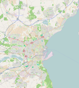
Skåde is a neighbourhood of Højbjerg, a southern district of Aarhus in Denmark. It is located 6 km south from the city centre.
Skåde is the highest lying area in Aarhus municipality, with hills like Jelshøj (128 metres) and Søsterhøj (112 metres).
Description
The built up area of Skåde is almost exclusively residential, but the neighbourhood also comprise a larger part of the Marselisborg Forests, known as Skåde Skov. Skåde Skov includes the park like area of Hørhaven. The Moesgård estate is also situated in Skåde and comprise the Moesgård Manor, Moesgård Museum, the forest area of Moesgård Skov, and Moesgård beach.
Notable points of interest in Skåde includes:
- Skåde Bakker
Larger affluent residential area with large mansions. - Handelsfagskolen Kursuscenter
Course center near Søsterhøj with vocational courses and training in the fields of trade and commerce.[1]
Notable brutalist architecture designed by Friis & Moltke in 1969.[2] - Aarhus Efterskole
An efterskole since 1978.[3] - Diakonhøjskolen (Deaconal Folk High School)
- Skattecenter Aarhus
Municipal tax centre. - Søsterhøj
A hilltop with a landmark radio and tv antenna. - Jelshøj
The highest hill in the municipality. - Skåde Skov
Part of the Marselisborg Forests. - Hørhaven
A park like area of Skåde Skov. - Moesgård Museum
- Moesgård Manor
- Moesgård Forest Mill
- Moesgård beach
Popular destination in the summer.
History
Skåde was originally a small village in the Aarhus countryside, but has now merged with the city. The administrative division of Skåde has been enlarged several times since the late 1800s.[4]
Gallery
 The Telecommunication Tower Aarhus at Søsterhøj can be seen from all over Aarhus.
 Aarhus Efterskole.
 Hørhaven
 Scene from Skåde Skov.
 View from the Moesgård Museum across the Moesgård estate.
 Jelshøj is the highest hill in Aarhus Municipality.
References
- ↑ "Konferencested" (in Danish). Handelsfagskolen. Retrieved 30 January 2016.
- ↑ "Scanticon (nu Handelsfagskolen), Højbjerg". ArkArk.dk (in Danish). Retrieved 30 January 2016.
- ↑ "Aarhus Efterskole" (in Danish). Aarhus Efterskole. Retrieved 30 January 2016.
- ↑ Local history archive
Sources
- Højbjerg Holme Lokalhistoriske Arkiv Archive on local history (Danish)
External links
| Wikimedia Commons has media related to Skåde. |
Coordinates: 56°06′00″N 10°12′04″E / 56.100036°N 10.201211°E