Sistema Sac Actun
| Sistema Sac Actun | |
|---|---|
|
Gran Cenote | |
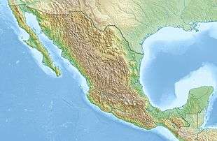 Sistema Sac Actun Location in Mexico | |
| Location | Tulum Municipality, Quintana Roo, Mexico |
| Coordinates | 20°14′47.6″N 87°27′50.8″W / 20.246556°N 87.464111°WCoordinates: 20°14′47.6″N 87°27′50.8″W / 20.246556°N 87.464111°W |
| Depth | 101.2 meters (332 ft)[1] |
| Length |
underwater: 230.775 kilometers (143.397 mi)[1] total: 319.021 kilometers (198.230 mi)[2] |
| Discovery | November 26, 1987 |
| Geology | Limestone |
| Entrances | 170 Cenotes[1] |
| Difficulty | Advanced cave diving |

Sistema Sac Actun (from Spanish and Yucatec Maya meaning "White Cave System") is an underwater cave system situated along the Caribbean coast of the Yucatán Peninsula with passages to the north and west of the village of Tulum. Exploration started from Gran Cenote 5 kilometers (3.1 mi) west of Tulum. The whole of the explored cave system lies within the Municipality of Tulum (state of Quintana Roo).
In early 2007, the underwater cave Sistema Nohoch Nah Chich was connected into and subsumed into Sac Actun making it the longest surveyed underwater cave system in the world.[3] 'Sistema Naranjal' cave complex is also related.
Sac Actun measures 230.8 kilometers (143.4 mi) (after connecting Sistema Aktun Hu with 34 kilometers (21 mi) in January 2011) and is only surpassed by Sistema Ox Bel Ha at 256.7 kilometers (159.5 mi).[1] Since early 2007, these two caves frequently exchanged the title of the longest Quintana Roo Speleological Survey underwater cave system in the world.[4] Including connected dry caves and Sistema Dos Ojos makes Sistema Sac Actun with 319 kilometers (198 mi) the longest cave in Mexico[2] and the second longest worldwide.[5]
Upper Paleolithic remains
In March 2008, three members of the Proyecto Espeleológico de Tulum and Global Underwater Explorers dive team, Alex Alvarez, Franco Attolini, and Alberto Nava, explored a section of Sistema Aktun Hu known as the pit Hoyo Negro.[6][7] At a depth of 57 meters (187 ft) the divers located the remains of a mastodon as well as at 43 meters (141 ft) a human skull that might be the oldest evidence of human habitation in this area to date. [7]Additional bones were located and the skeleton was later identified as that of a teenaged female now referred to as Naia.[8]
See also
 Underwater diving portal
- Eve of Naharon
- List of caves in Mexico
- List of sinkholes of Mexico
- Paleo-Indians
- Settlement of the Americas
References
- 1 2 3 4 "List of Long Underwater Caves in Quintana Roo Mexico". Quintana Roo Speleological Survey. National Speleological Society (NSS). January 1, 2014. Retrieved January 7, 2014.
- 1 2 "Dry Caves and Sumps of Quintana Roo Mexico". Quintana Roo Speleological Survey. National Speleological Society. January 1, 2014. Retrieved January 7, 2014.
- ↑ John Roach (March 5, 2007). "World's Longest Underground River Discovered in Mexico". National Geographic News. National Geographic. Retrieved January 14, 2011.
- ↑ Michael Poucher, Bob Gulden (November 30, 2013). "World longest underwater caves". Geo2 Committee on Long and Deep Caves. NSS. Retrieved January 7, 2014.
- ↑ Bob Gulden (November 18, 2013). "Worlds longest caves". Geo2 Committee on Long and Deep Caves. NSS. Retrieved January 7, 2014.
- 1 2 Fabio Esteban Amador (February 18, 2011). "Skull in Underwater Cave May Be Earliest Trace of First Americans". NatGeo News Watch. National Geographic. Retrieved February 19, 2011.
- ↑ Hodges, Glen (2014-05-14). "Most Complete Ice Age Skeleton Helps Solve Mystery of First Americans". National Geographic.
- Steve Gerrard (2000). The Cenotes of the Riviera Maya. ISBN 0-9677412-0-3. online Version. Retrieved January 14, 2011.
