Sironcha
| Sironcha | |
|---|---|
| city | |
 Sironcha Location in Maharashtra, India | |
| Coordinates: 18°50′50″N 79°58′06″E / 18.847244°N 79.968195°ECoordinates: 18°50′50″N 79°58′06″E / 18.847244°N 79.968195°E | |
| Country |
|
| State | Maharashtra |
| District | Gadchiroli |
| Elevation | 323 m (1,060 ft) |
| Population (2001) | |
| • Total | 88,670 |
| Languages | |
| • Official | Marathi |
| Time zone | IST (UTC+5:30) |
Sironcha is a town and the administrative headquarters of Sironcha tehsil in Gadchiroli district of Maharashtra state in central India.
Geography
Sironcha is located at 18°50′N 79°58′E / 18.83°N 79.96°E.[1] It has an average elevation of 118 metres (390 feet).
There is a planned National highway No 16 between Karimnagar in Telangana State and Jagdalpur in Chhattisgarh State, Maharashtra and Telangana states. The construction of this National highway includes building bridges over the Pranhita and Indravati rivers.
Historical background
Historically Sironcha was a key location for the East India Company from Nizam perspective,it was the Southern tehsil of Chanda District, Central Provinces. however it is not clear why Sironcha, a remote place, was selected ?. In 1901, Sironcha tehsil area was 2,810 square kilometres (1,085 sq mi), and its population was 51,148. The transfer of the taluks of Nugur, Albaka, and Cherla of the Sironcha tehsil, covering an area of 1,540 square kilometres (593 sq mi) and containing 142 villages with 20,218 persons, to the Madras Presidency has been sanctioned, but further details of administration are still being con- sidered. In 1905 an area of 6,740 square kilometres (2,603 sq mi) of the Chanda tahsil, of which 2,600 were in the Ahiri zamindari estate, was transferred to Sironcha. The revised totals of area and population of the Sironcha tahsil are 8,020 square kilometres (3,095 sq mi) and 55,465 persons. The population in 1891 of the area now constituting the tahsil was 51,732. The density is only 6.9 inhabitants per square kilometre (18/sq mi), and the tahsil contains 421 inhabited villages. Its headquarters are at Sironcha, a village of 2,813 inhabitants, 210 kilometres (130 mi) from Chanda town by road. The area of Government forest in the new tahsil is 1,200 square kilometres (480 sq mi), while 5,840 square kilometres (2,254 sq mi) of the Ahiri zamindari are covered by tree forest, scrub jungle, or grass. The northern portion of the tehsil comprised in the Ahiri zamindari is one of the most densely wooded and sparsely populated areas in the Province; to the south of this Sironcha extends in a long narrow strip to the east of the Godavari, and consists of a belt of rich alluvial soil along the banks of the river and its affluents, with forests and hills in the background. The population is wholly Telugu. The land revenue demand of the tahsil was approximately Rs. 17,000, before the revision of settlement now in progress. [2] Sironcha has the look of an English village.
Transport
Sironcha is connected by the State Road Transport services to Gadchiroli, Aheri, Chandrapur, Nagpur and Wardha. Sironcha is also connected to the Telangana State capital Hyderabad and some popular Cities/Towns like Warangal, Karimnagar, Godavarikhani and Mancherial.
References
- ↑ Falling Rain Genomics, Inc - Sironcha
- ↑ "Full text of "The Imperial gazetteer of India" - Internet Archive".
 |
Aheri | | ||
| Pranahita River, Kaghaznagar, Telangana State | |
Indravati River, BhopalpatnamChhattisgarh State | ||
| ||||
| | ||||
| Godavari River, Warangal Telangana State |
Gadchiroli district topics | ||
|---|---|---|
| History | 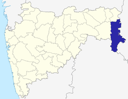 | |
| Geography | ||
| Cities and towns | ||
| Transport | ||
| Culture | ||
| Lok Sabha constituencies | ||
| Vidhan Sabha constituencies | ||