Siliguri
| Siliguri শিলিগুড়ি | ||||||
|---|---|---|---|---|---|---|
| Metropolis | ||||||
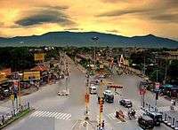
Clockwise from the top : Old view of Siliguri Durgapuja in Siliguri, City Centre Cosmos Mall, Lions Clock Tower | ||||||
| Nickname(s): Gateway City to Northeast India, City of Tea and Wood, Gateway City to Nepal, Bhutan, China, Bangladesh, Sikkim | ||||||
 Siliguri  Siliguri Location of Siliguri in West Bengal | ||||||
| Coordinates: 26°43′N 88°26′E / 26.71°N 88.43°ECoordinates: 26°43′N 88°26′E / 26.71°N 88.43°E | ||||||
| Country |
| |||||
| State | West Bengal | |||||
| District | Darjeeling (62%), Jalpaiguri (38%) | |||||
| Named for | Largest city of North Bengal and Gateway city of Northeast India | |||||
| Government | ||||||
| • Type | Municipal Corporation | |||||
| • Body | Siliguri Municipal Corporation | |||||
| • Mayor | Ashok Bhattacharya(CPI(M)) | |||||
| • Police commissioner | C.S. Lepcha (IPS) | |||||
| • ADM / SDO | Rajanvir Singh Kapur (IAS) | |||||
| Area | ||||||
| • Metropolis | 260 km2 (100 sq mi) | |||||
| • Metro | 2,327.12 km2 (898.51 sq mi) | |||||
| Area rank | 2nd in West Bengal, 1st in Northeast India | |||||
| Highest elevation | 140 m (460 ft) | |||||
| Lowest elevation | 114 m (374 ft) | |||||
| Population (2011 census)[1] | ||||||
| • Metropolis | 705,579 | |||||
| • Rank | 3rd in West Bengal, 1st in Northeast India | |||||
| • Density | 2,700/km2 (7,000/sq mi) | |||||
| • Metro[2] | 2.01 million | |||||
| Demonym(s) | Siligurians, Siliguribashi | |||||
| Languages | ||||||
| • Official | Bengali, Nepali, Hindi, English | |||||
| Time zone | IST (UTC+5:30) | |||||
| PIN | 734 001-734 015 (city limits), 734 401-734 436, 735 133-735 135(suburbs) | |||||
| Telephone code | 0353, 0354, 03561 | |||||
| Vehicle registration | WB 71/72/73/74/76/772 | |||||
| Lok Sabha constituency | Darjeeling, Jalpaiguri | |||||
| Vidhan Sabha constituency | Siliguri, Dabgram-Phulbari, Matigara-Naxalbari, Phansidewa, Rajganj | |||||
| Website |
www | |||||
|
1The coordinates given here are in metric system and based upon the Microsoft Encarta Reference Library Map Center 2005 2 The Vehicle Code given here based upon the Siliguri Sub Divisional Court, Darjeeling District Court and Jalpaiguri District Court documentations. | ||||||


Siliguri (![]() pronunciation ) is a city which spans across the Darjeeling and Jalpaiguri districts in the Indian state of West Bengal. The city is located on the banks of the Mahananda River and the foothills of the Himalayas.
pronunciation ) is a city which spans across the Darjeeling and Jalpaiguri districts in the Indian state of West Bengal. The city is located on the banks of the Mahananda River and the foothills of the Himalayas.
Climate
| Climate data for Silguri | |||||||||||||
|---|---|---|---|---|---|---|---|---|---|---|---|---|---|
| Month | Jan | Feb | Mar | Apr | May | Jun | Jul | Aug | Sep | Oct | Nov | Dec | Year |
| Average high °C (°F) | 20 (68) |
22 (72) |
25 (77) |
30 (86) |
32 (90) |
33 (91) |
33 (91) |
31 (88) |
28 (82) |
26 (79) |
24 (75) |
21 (70) |
27.1 (80.8) |
| Average low °C (°F) | 2 (36) |
10 (50) |
13 (55) |
21 (70) |
24 (75) |
25 (77) |
26 (79) |
25 (77) |
23 (73) |
16 (61) |
10 (50) |
4 (39) |
16.6 (61.8) |
| Average precipitation mm (inches) | 8 (0.31) |
18 (0.71) |
33 (1.3) |
94 (3.7) |
300 (11.81) |
658 (25.91) |
818 (32.2) |
643 (25.31) |
538 (21.18) |
142 (5.59) |
13 (0.51) |
5 (0.2) |
3,266 (128.58) |
| Source: Siliguri Weather | |||||||||||||
Demographics
Based on Census data of 2011, the city had a population of 705,579, while the population of Siliguri UA/Metropolitan is 1,057,438.[2][1] Males constitute 51% of the population and females 49%. In Siliguri, 10% of the population is under six years of age.
People from Bihar, Jharkhand, North Bengal, North-East and other parts of India have also come to the city in search of livelihood.[3]
Transport
Siliguri Junction railway station
Bagdogra Airport is about 16 km (9.9 mi) west of Siliguri
References
- 1 2 "Siliguri City Population Census 2011 - West Bengal". census2011.co.in. Retrieved 25 July 2016.
- 1 2 "Siliguri Metropolitan Urban Region Population 2011 Census". census2011.co.in. Retrieved 25 July 2016.
- ↑ "Bangla immigrants to be pushed back". The Times Of India. 5 November 2001.
External links
- Siliguri Municipal Corporation
- Siliguri Jalpaiguri Development Authority
- Information on Siliguri at West Bengal Government website
Cities, towns and locations in Darjeeling District | |||||||||||||||
|---|---|---|---|---|---|---|---|---|---|---|---|---|---|---|---|
| Cities, municipal and census towns |
| ||||||||||||||
| Locations other than cities and towns | |||||||||||||||
| See also |
| ||||||||||||||
Cities, towns and locations in Jalpaiguri district | |||||||||||
|---|---|---|---|---|---|---|---|---|---|---|---|
| Cities, municipal and census towns |
| ||||||||||
| Locations other than cities and towns | |||||||||||
| Related Topics |
| ||||||||||