Sierra de Enguera
| Sierra de Enguera | |
|---|---|
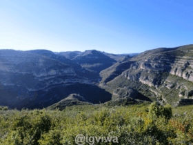 Landscape in Sierra de Enguera | |
| Highest point | |
| Elevation | 1,056 m (3,465 ft) |
| Coordinates | 38°56′40″N 0°57′34″W / 38.94444°N 0.95944°WCoordinates: 38°56′40″N 0°57′34″W / 38.94444°N 0.95944°W |
| Geography | |
 Sierra de Enguera Spain | |
| Location |
Canal de Navarrés and Valle de Cofrentes, Valencian Community |
| Parent range | Prebaetic System, eastern end |
| Geology | |
| Mountain type | Karstic |
| Climbing | |
| Easiest route | Drive from Énguera, Ayora or Almansa, then hike |
Sierra de Enguera[1] (Valencian: Serra d'Énguera) is a 16.45 km (10 mi) long mountain range in the Canal de Navarrés and Valle de Cofrentes comarcas, Valencian Community, Spain. Its highest point is Altos de Salomón (1,056 m.) in the Caroig Massif. Other important peaks are Palmera (880 m.), Cova Negra (862 m.) and Marc (830 m.).
This mountain chain is named after the town of Énguera, located to the east of the range.[2]
See also
References
- ↑ Vicenç M. Rosselló i Verger, Toponímia, geografia i cartografia
- ↑ La Canal de Navarrés
External links
This article is issued from Wikipedia - version of the 3/18/2015. The text is available under the Creative Commons Attribution/Share Alike but additional terms may apply for the media files.