Sidhuwal
| Sidhuwal | |
|---|---|
| Village | |
| Country | India |
| State | Punjab |
| District | Patiala district |
Sidhuwal is a Jat Sikh village on the road Patiala Bhadson - approximately six kilometres from Patiala in Patiala tehsil in the Patiala district of the state of Punjab in northwest India.It is located 6 km towards North from District headquarters Patiala and 66 km from State capital Chandigarh It is one of 365 villages in Patiala Block. The village is located at the banks of Bhakra Main Line Canal. The total geographical area of village is 644 hectares. Jasso Wal ( 1 km ), Prem Nagar ( 2 km ), Ranjit Nagar ( 2 km ), Ucha Gaon ( 2 km ), Anand Nagar ( 2 km ) are the nearby Villages to Sidhuwal. Sidhuwal is surrounded by Sanour Tehsil towards East, Nabha Tehsil towards west, Bhuner Heri Tehsil towards South, Ghanaur Tehsil towards East . Patiala, Sirhind Fatehgarh Sahib, Gobindgarh, Nabha are the nearby Cities to Sidhuwal.
The pin code of Sidhuwal is 147001 [1]and the address of the post office is "Postmaster, Post Office SIDHUWAL (BRANCH OFFICE), PATIALA, PUNJAB (PB), India (IN). Nearby railway station of Sidhuwal is Patiala. STD code is 0175.
History
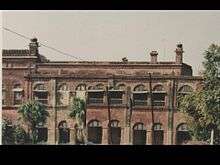
Origin of the name of the village is not known, probably it got its name from the family of Bhaikas which had lot of property in the village. In fact till around 2003–04 the village also had an old fort, which has since been demolished.

As per the locals, the last king of Sidhuwal state was Bhai Fateh Jang Singh who was from Bhaika family of Kaithal state. It can also be assumed that the village must have come up in the vicinity of the fort which probably was built in nineteenth century.
Demographics
Though the name of the village suggests that it may be predominantly of Sidhu gotra, but majority of the population of the village consists of farmers with Khroud gotra. Punjabi language is spoken by all in the village. As per 2011 census, the village has total population of 2290[2] with 478 households of which 56% are males (1289) and 44% are females (1001) means sex ratio in the village is skewed as with 777 females per 1000 males. Though residents have now started sending their daughters to schools, still only 53.2% of females are educated as compared to 67.4% of males. Overall literacy rate of the village is 61.2%.
Religion
Though village has a strong secular culture, majority population follows Sikhism. Some population also follows Hinduism and Islam. Beside a common Gurudwara, there are large number of religious places of various religions in the village and they are visited by all.

Education
Due to its proximity to Patiala city, it does not have many independent facilities like education. However, Rajiv Gandhi National University of Law (RGNUL) has been established in the village by the Punjab Government, which will not only give boost to infrastructure in the village but also to the education of the students from the village. In addition there is a Govt Senior Secondary Co-educational School in the village. Colleges near Sidhuwal are as given below:-
- Govt Medical College, Patiala
- Surya School of Pharmacy (SSP), Rajpura (Patiala)
- Gian Sagar College of Physiotherapy, VPO Banur; Distt. Patiala
- Sri Sukhmani Institute of Nursing, Dera Bassi; Distt. Patiala
- Divya Shiksha Gurukul College of Education For Women, Vill - Gholu Majra; Derabassi—lalru Highway;distt - Patiala
Occupation
Residents of the village are mostly farmers with very few in other jobs including government jobs. Main source of irrigation is ground water through pumps, canal water and rainfall. Earlier farmers used to grow wheat, sugarcane, cotton, pulses, peanuts etc. Now, with availability of machinery and knowledge, farmers normally stick to wheat and rice cultivation. Other products grown earlier are minuscule. This has led to large scale use of ground water. Now the level of ground water has reduced to 50–70 metres.
References
- ↑ Technology, India Post, Ministry of Communication &. "Find Pin Code". www.indiapost.gov.in. Retrieved 2016-11-11.
- ↑ ORGI. "Census of India : List of Towns and Villages". www.censusindia.gov.in. Retrieved 2016-11-11.
Coordinates: 30°22′44″N 76°20′49″E / 30.379°N 76.347°E