Sibun River
| Sibun River | |
|---|---|
|
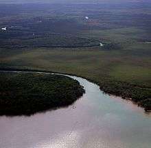
Aerial view showing the characteristic meanders of the lower reaches of the Xibun or Sibun River before it flows into the Caribbean Sea. | |
| Country | Belize |
| Basin | |
| Main source |
Maya Mountains 600 m (2,000 ft) 17°04′N 88°44′W / 17.067°N 88.733°W |
| River mouth |
Caribbean Sea 10 km south-west of Belize City 0 m (0 ft) 17°25′N 88°15′W / 17.417°N 88.250°WCoordinates: 17°25′N 88°15′W / 17.417°N 88.250°W |
| Basin size | Caribbean Sea |
The Sibun River is a river in Belize which drains a large central portion of the country.[1] Xibun is an alternate Mayan spelling of Sibun that appears on some Spanish colonial-period maps of the region and is sometimes used to refer to the ancient Maya people who inhabited the region.

The headwaters of the Sibun River are located within the Maya Mountains, at approximately 800 meters above sea level, where it is known as the Caves Branch River. The river then flows through a gorge until it reaches an alluvial floodplain, where citrus and cacao plantations exist. Here the river valley is flanked by Karst topography featuring Maya cave sites.[2] Before the river reaches the village of Freetown Sibun, river figs and spiny bamboo (Guadua longifolia) are common along its banks; along the stretch of river between the coast and the village, mangroves are predominant. It empties into the Caribbean Sea, south of Belize City.
The Sibun River Watershed features several vegetation types, including tropical evergreen seasonal mixed needle forest, broadleaf forest, mangroves, and agriculture.[3]
The Sibun Watershed Association is a local organization focused on environmental issues within the watershed.
Since 1999 Guatemala has claimed all Belizean land south of the Sibun River, although the claim is not internationally recognized.[4] The current internationally accepted southern Belizean–Guatemalan border is the Sarstoon River. The claim is central to the ongoing Belizean–Guatemalan territorial dispute.
The lower reaches of the river are prominent in scenes from the 1986 film The Mosquito Coast.
References
- ↑ Boles, Ed (1999). The Sibun River Watershed Atlas. Sibun Watershed Association and The Government Printer, Belmopan, Belize.
- ↑ McAnany, Patricia A., and Ben S. Thomas, editors (2002). Sacred Landscape and Settlement in the Sibun River Valley, Institute for Mesoamerican Studies Occasional Publication 8. Institute for Mesoamerican Studies at the State University of New York, Albany.
- ↑ Monacci, Natalie M.; Meier-Grünhagen, Ursula; Finney, Bruce P.; Behling, Hermann; Wooller, Matthew J. (2011-09-01). "Paleoecology of mangroves along the Sibun River, Belize". Quaternary Research. 76 (2): 220–228. doi:10.1016/j.yqres.2011.06.001.
- ↑ Lauterpacht, Elihu; Stephen Schwebel; Shabtai Rosenne; Francisco Orrego Vicuña (November 2001). "Legal Opinion on Guatemala's Territorial Claim to Belize" (PDF). p. 7. Retrieved 10 November 2012.
| Wikimedia Commons has media related to Sibun River. |