Shungnak, Alaska
| Shungnak Isiŋnaq , Nuurviuraq | |
|---|---|
| City | |
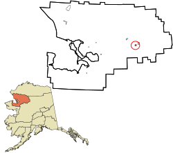 Location in Northwest Arctic Borough and the state of Alaska. | |
| Coordinates: 66°53′9″N 157°8′15″W / 66.88583°N 157.13750°WCoordinates: 66°53′9″N 157°8′15″W / 66.88583°N 157.13750°W | |
| Country | United States |
| State | Alaska |
| Borough | Northwest Arctic |
| Incorporated | May 4, 1967[1] |
| Government | |
| • Mayor | Melvin Lee[2] |
| • State senator | Donald Olson (D) |
| • State rep. | Benjamin Nageak (D) |
| Area | |
| • Total | 9.6 sq mi (24.9 km2) |
| • Land | 8.4 sq mi (21.7 km2) |
| • Water | 1.3 sq mi (3.3 km2) |
| Elevation | 144 ft (44 m) |
| Population (2010)[3] | |
| • Total | 262 |
| • Density | 30.6/sq mi (11.8/km2) |
| Time zone | Alaska (AKST) (UTC-9) |
| • Summer (DST) | AKDT (UTC-8) |
| ZIP code | 99773 |
| Area code | 907 |
| FIPS code | 02-70100 |
Shungnak (Isiŋnaq or Nuurviuraq in Iñupiaq) is a city in Northwest Arctic Borough, Alaska, United States. At the 2010 census the population was 262.
History
The village of Kochuk, later renamed Shungnak, was settled in the 1920s. The original village of Kobuk, settled in 1899 and situated about 10 miles upstream, was largely abandoned due to flooding. A few residents remain at Kobuk. The name "Shungnak" is derived from the Eskimo term "issingnak," which means jade, a stone found in the surrounding area.[4]
The first postmaster at Shungnak was Martin F. Moran, appointed September 24, 1903.[5]
Geography
Shungnak is located at 66°53′09″N 157°08′15″W / 66.885846°N 157.137458°W [6]
According to the United States Census Bureau, the city has a total area of 9.6 square miles (25 km2), of which 8.4 square miles (22 km2) is land and 1.3 square miles (3.4 km2) of it (13.10%) is water.
The town is located about 150 miles east of Kotzebue.[7]
Demographics
| Historical population | |||
|---|---|---|---|
| Census | Pop. | %± | |
| 1910 | 210 | — | |
| 1920 | 95 | −54.8% | |
| 1930 | 145 | 52.6% | |
| 1940 | 193 | 33.1% | |
| 1950 | 141 | −26.9% | |
| 1960 | 135 | −4.3% | |
| 1970 | 165 | 22.2% | |
| 1980 | 202 | 22.4% | |
| 1990 | 223 | 10.4% | |
| 2000 | 256 | 14.8% | |
| 2010 | 262 | 2.3% | |
| Est. 2015 | 273 | [8] | 4.2% |
As of the census [10] of 2000, there were 256 people, 56 households, and 51 families residing in the city. The population density was 30.6 people per square mile (11.8/km²). There were 64 housing units at an average density of 7.7 per square mile (3.0/km²). The racial makeup of the city was 5.47% White and 94.53% Alaska Native.
Of those 56 households, 66.1% had children under the age of 18 living with them, 53.6% were married couples living together, 16.1% had a female householder with no husband present, and 8.9% were non-families. In addition, 7.1% of all households were made up of individuals and 1.8% had someone living alone who was 65 years of age or older. The average household size was 4.57 and the average family size was 4.53.
In the city the age distribution of the population shows 48.4% under the age of 18; 8.6% from 18 to 24; 23.8% from 25 to 44; 12.9% from 45 to 64; and 6.3% who were 65 years of age or older. The median age was 19 years. For every 100 females age 18 and over, there were 103.1 males.
The median income for a household in the city was $44,375, and the median income for a family was $41,000. Males had a median income of $25,750 versus $33,750 for females. The per capita income for the city was $10,377. About 21.7% of families and 35.8% of the population were below the poverty line, including 46.2% of those under the age of eighteen and none of those 65 or over.
Facilities
There is one school with 76 students.
The source of municipal water is from a reservoir intermittently filled from the Kobuk River. Previously, there was a water infiltration gallery that was destroyed by ice. Groundwater wells have proven unsuccessful.[7]
The town has a 3,400-ft gravel runway owned by the state of Alaska.[11] In the summer of 2006, only part of a fuel shipment was able to be delivered by barge and the remainder of the town's fuel needs had to be supplied by air. This resulted in the price of gasoline rising to $8.10 per gallon at the town's only filling station in 2006-07.
References
- ↑ 1996 Alaska Municipal Officials Directory. Juneau: Alaska Municipal League/Alaska Department of Community and Regional Affairs. January 1996. p. 143.
- ↑ 2015 Alaska Municipal Officials Directory. Juneau: Alaska Municipal League. 2015. p. 148.
- ↑ "2010 City Population and Housing Occupancy Status". U.S. Census Bureau. Archived from the original on July 21, 2011. Retrieved May 14, 2012.
- ↑ NWArctic
- ↑ Dickerson, Ora B. (1989) 120 Years of Alaska Postmasters, 1867-1987, p. 63. Scotts, Michigan: Carl J. Cammarata. A photograph of George Cleveland (postmaster 1949-77), outside the Co-op Store/Post Office, appears on the cover of the book.
- ↑ "US Gazetteer files: 2010, 2000, and 1990". United States Census Bureau. 2011-02-12. Retrieved 2011-04-23.
- 1 2 http://www.beringsea.com/communities/index.php?community=336
- ↑ "Annual Estimates of the Resident Population for Incorporated Places: April 1, 2010 to July 1, 2015". Retrieved July 2, 2016.
- ↑ "Census of Population and Housing". Census.gov. Archived from the original on May 11, 2015. Retrieved June 4, 2015.
- ↑ "American FactFinder". United States Census Bureau. Retrieved 2008-01-31.
- ↑ Maniilaq Association | Shungnak
External links
- Subsistence wildlife harvests in five northwest Alaska communities, 2001-2003: results of a household survey / by Kawerak, Inc., Maniilaq Association, and the Alaska Department of Fish and Game; by Susan Georgette et al. Hosted by Alaska State Publications Program.
Municipalities and communities of Northwest Arctic Borough, Alaska, United States | ||
|---|---|---|
| Cities | 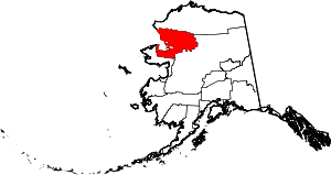 | |
| CDPs | ||
| Unincorporated communities | ||
| Ghost towns | ||