Shrewsbury Township, New Jersey
- For other places with similar names, see Shrewsbury, New Jersey (disambiguation).
| Shrewsbury Township, New Jersey | |
|---|---|
| Township | |
| Township of Shrewsbury | |
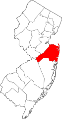
 Map of Shrewsbury Township in Monmouth County. Inset: Location of Monmouth County highlighted in the State of New Jersey. | |
 Census Bureau map of Shrewsbury Township, New Jersey | |
| Coordinates: 40°18′48″N 74°04′18″W / 40.313433°N 74.071686°WCoordinates: 40°18′48″N 74°04′18″W / 40.313433°N 74.071686°W[1][2] | |
| Country |
|
| State |
|
| County | Monmouth |
| Formed | October 31, 1693 |
| Incorporated | February 21, 1798 |
| Named for | Shrewsbury, England |
| Government[3] | |
| • Type | Township |
| • Body | Township Committee |
| • Mayor | Alfred Melillo (R, term ends December 31, 2016)[4][5] |
| • Clerk | Jan Delonardo[6] |
| Area[1] | |
| • Total | 0.105 sq mi (0.272 km2) |
| • Land | 0.105 sq mi (0.272 km2) |
| • Water | 0.000 sq mi (0.000 km2) 0.00% |
| Area rank |
566th of 566 in state 53rd of 53 in county[1] |
| Elevation[7] | 39 ft (12 m) |
| Population (2010 Census)[8][9][10] | |
| • Total | 1,141 |
| • Estimate (2015)[11] | 1,122 |
| • Rank |
529th of 566 in state 48th of 53 in county[12] |
| • Density | 10,877.7/sq mi (4,199.9/km2) |
| • Density rank |
27th of 566 in state 2nd of 53 in county[12] |
| Time zone | Eastern (EST) (UTC-5) |
| • Summer (DST) | Eastern (EDT) (UTC-4) |
| ZIP code | 07724[13][14] |
| Area code(s) | 732[15] |
| FIPS code | 3402567365[1][16][17] |
| GNIS feature ID | 0882603[1][18] |
| Website |
www |
Shrewsbury Township is a township in Monmouth County, New Jersey, United States. As of the 2010 United States Census, the township's population was 1,141,[8][9][10] reflecting an increase of 43 (+3.9%) from the 1,098 counted in the 2000 Census, which was unchanged from the 1,098 counted in the 1990 Census.[19]
History
Shrewsbury was part of the Navesink Patent or Monmouth Tract granted soon after the creation of East Jersey in 1665.[20]
When it was formed in 1693, Shrewsbury Township covered an area of almost 1,000 square miles (2,600 km2), extending to the north to the Navesink River, south to include all of present-day Ocean County, east to the Atlantic Ocean and west to the present-day border of Monmouth County. It retained its size and scope until 1750, when Stafford Township was formed, taking away most of present-day Ocean County.[21] The Parker Homestead, one of the oldest buildings in state, was built by early settlers to the region.
What is now Shrewsbury Township was originally formed on October 31, 1693, and was created as a township by the Township Act of 1798 of the New Jersey Legislature on February 21, 1798.
Creation of New Towns
Over the centuries, portions of the township have been taken to form Stafford Township (March 3, 1750), Dover Township (March 1, 1768, now Toms River Township), Howell Township (February 23, 1801), Ocean Township (February 24, 1849), Atlantic Township (February 18, 1847, now Colts Neck), Red Bank (March 17, 1870), Eatontown (April 4, 1873), Rumson (May 15, 1907),[22] Fair Haven (March 28, 1912), Little Silver (March 19, 1923), Shrewsbury borough (March 22, 1926) and New Shrewsbury (April 15, 1950, now Tinton Falls). The township was named for Shrewsbury, England.[23]
The remaining land was formerly owned by the Government and called Camp Vail, a housing complex for families of Fort Monmouth employees. After World War II the government planned to close the site but the established families, with no where else to go, purchased the land from the Army with the help of Ann Switek who arranged to maintain the Original Township Charter which had been abandoned. Ann Switek was then elected Town Clerk of Shrewsbury Township and maintained that post for close to 50 years. Camp Vail became Alfred Vail Mutual Association, one of New Jersey's first cooperative housing entities. Along with AVMA, Shrewsbury Township also contains Shrewsbury Arms apartments, a single convenience store/liquor store/deli called The Hideaway, and more recently, Shrewsbury Woods Townhouses.[24]
Geography
According to the United States Census Bureau, Shrewsbury Township had a total area of 0.105 square miles (0.272 km2), all of which was land.[1][2]
The borough borders the Monmouth County municipalities of Shrewsbury and Tinton Falls.[25]
Demographics
| Historical population | |||
|---|---|---|---|
| Census | Pop. | %± | |
| 1790 | 4,673 | — | |
| 1810 | 3,773 | * | — |
| 1820 | 4,824 | 27.9% | |
| 1830 | 4,700 | −2.6% | |
| 1840 | 5,917 | 25.9% | |
| 1850 | 3,182 | * | −46.2% |
| 1860 | 4,132 | 29.9% | |
| 1870 | 3,354 | * | −18.8% |
| 1880 | 3,842 | * | 14.5% |
| 1890 | 4,222 | 9.9% | |
| 1900 | 3,842 | * | −9.0% |
| 1910 | 3,238 | * | −15.7% |
| 1920 | 1,944 | −40.0% | |
| 1930 | 1,052 | * | −45.9% |
| 1940 | 1,347 | 28.0% | |
| 1950 | 1,388 | 3.0% | |
| 1960 | 1,204 | * | −13.3% |
| 1970 | 1,164 | −3.3% | |
| 1980 | 995 | −14.5% | |
| 1990 | 1,098 | 10.4% | |
| 2000 | 1,098 | 0.0% | |
| 2010 | 1,141 | 3.9% | |
| Est. 2015 | 1,122 | [11][26] | −1.7% |
| Population sources: 1790-1920[27] 1840[28] 1850-1870[29] 1850[30] 1870[31] 1880-1890[32] 1890-1910[33] 1910-1930[34] 1930-1990[35] 2000[36][37] 2010[8][9][10] * = Lost territory in previous decade.[24] | |||
Census 2010
The 2010 United States Census counted 1,141 people, 583 households, and 265.8 families residing in the township. The population density was 10,877.7 per square mile (4,199.9/km2). The township contained 648 housing units at an average density of 6,177.7 per square mile (2,385.2/km2). The racial makeup of the township was 72.13% (823) White, 14.29% (163) Black or African American, 0.09% (1) Native American, 6.57% (75) Asian, 0.00% (0) Pacific Islander, 2.98% (34) from other races, and 3.94% (45) from two or more races. Hispanics or Latinos of any race were 14.11% (161) of the population.[8]
Out of a total of 583 households, 22.1% had children under the age of 18 living with them, 25.4% were married couples living together, 15.6% had a female householder with no husband present, and 54.4% were non-families. 47.5% of all households were made up of individuals, and 22.5% had someone living alone who was 65 years of age or older. The average household size was 1.96 and the average family size was 2.79.[8]
In the township, 18.8% of the population were under the age of 18, 6.5% from 18 to 24, 30.0% from 25 to 44, 26.8% from 45 to 64, and 18.0% who were 65 years of age or older. The median age was 41.9 years. For every 100 females the census counted 82.6 males, but for 100 females at least 18 years old, it was 76.2 males.[8]
The Census Bureau's 2006-2010 American Community Survey showed that (in 2010 inflation-adjusted dollars) median household income was $51,548 (with a margin of error of +/- $8,211) and the median family income was $55,625 (+/- $11,553). Males had a median income of $44,844 (+/- $7,203) versus $36,136 (+/- $6,032) for females. The per capita income for the borough was $28,891 (+/- $3,658). About 3.1% of families and 7.8% of the population were below the poverty line, including 6.7% of those under age 18 and 11.0% of those age 65 or over.[38]
Census 2000
As of the 2000 United States Census[16] there were 1,098 people, 521 households, and 254 families residing in the township. The population density was 11,624.7 people per square mile (4,710.4/km²). There were 546 housing units at an average density of 5,780.6 per square mile (2,342.4/km²). The racial makeup of the township was 66.76% White, 16.67% African American, 10.02% Asian, 2.82% from other races, and 3.73% from two or more races. Hispanic or Latino of any race were 6.65% of the population.[36][37]
There were 521 households out of which 24.6% had children under the age of 18 living with them, 28.6% were married couples living together, 16.3% had a female householder with no husband present, and 51.1% were non-families. 39.5% of all households were made up of individuals and 11.7% had someone living alone who was 65 years of age or older. The average household size was 2.10 and the average family size was 2.89.[36][37]
In the township the population was spread out with 20.6% under the age of 18, 9.3% from 18 to 24, 37.8% from 25 to 44, 21.5% from 45 to 64, and 10.8% who were 65 years of age or older. The median age was 35 years. For every 100 females there were 93.3 males. For every 100 females age 18 and over, there were 90.0 males.[36][37]
The median income for a household in the township was $36,875, and the median income for a family was $42,500. Males had a median income of $32,813 versus $30,598 for females. The per capita income for the township was $23,574. About 6.9% of families and 8.8% of the population were below the poverty line, including 12.7% of those under age 18 and 11.8% of those age 65 or over.[36][37]
Government
Local government
Shrewsbury Township is governed under the Township form of government. The governing body is a three-member Township Committee, whose members are elected directly by the voters in partisan elections to serve three-year terms of office on a staggered basis, with one seat coming up for election each year as part of the November general election in a three-year cycle.[3][39] At an annual reorganization meeting, the Township Committee selects one of its members to serve as Mayor.
As of 2016, members of the Shrewsbury Township Committee are Mayor Alfred Melillo (R, term on committee and as mayor ends December 31, 2016), Deputy Mayor Maryellen McNama-Bailly (R, term on committee ends 2017; term as deputy mayor ends 2016) and Edward P. Nolan (D, 2018).[4][40][41][42][43][44]
With Maryellen McNama-Bailly taking office in January 2015, control of the council shifted to the Republican Party.[45]
Federal, state and county representation
Shrewsbury Township is located in the 4th Congressional District[46] and is part of New Jersey's 11th state legislative district.[9][47][48] Prior to the 2011 reapportionment following the 2010 Census, Shrewsbury Township had been in the 12th state legislative district.[49] Prior to the 2010 Census, Shrewsbury Township had been part of the 12th Congressional District, a change made by the New Jersey Redistricting Commission that took effect in January 2013, based on the results of the November 2012 general elections.[49]
New Jersey's Fourth Congressional District is represented by Christopher Smith (R).[50] New Jersey is represented in the United States Senate by Cory Booker (D, Newark, term ends 2021)[51] and Bob Menendez (D, Paramus, 2019).[52][53]
For the 2016–2017 session (Senate, General Assembly), the 11th Legislative District of the New Jersey Legislature is represented in the State Senate by Jennifer Beck (R, Red Bank) and in the General Assembly by Joann Downey (D, Freehold Township) and Eric Houghtaling (D, Neptune Township).[54] The Governor of New Jersey is Chris Christie (R, Mendham Township).[55] The Lieutenant Governor of New Jersey is Kim Guadagno (R, Monmouth Beach).[56]
Monmouth County is governed by a Board of Chosen Freeholders consisting of five members who are elected at-large to serve three year terms of office on a staggered basis, with either one or two seats up for election each year as part of the November general election. At an annual reorganization meeting held in the beginning of January, the board selects one of its members to serve as Director and another as Deputy Director.[57] As of 2014, Monmouth County's Freeholders are Freeholder Director Lillian G. Burry (R, Colts Neck Township; term ends December 31, 2014),[58] Freeholder Deputy Director Gary J. Rich, Sr. (R, Spring Lake; 2014),[59] Thomas A. Arnone (R, Neptune City; 2016),[60] John P. Curley (R, Middletown Township; 2015)[61] and Serena DiMaso (R, Holmdel Township; 2016).[62][63] Constitutional officers elected on a countywide basis are County Clerk M. Claire French (Wall Township),[64] Sheriff Shaun Golden (Farmingdale)[65] and Surrogate Rosemarie D. Peters (Middletown Township).[66]
Politics
As of March 23, 2011, there were a total of 638 registered voters in Shrewsbury Township, of which 229 (35.9%) were registered as Democrats, 114 (17.9%) were registered as Republicans and 294 (46.1%) were registered as Unaffiliated. There was one voter registered to another party.[67]
In the 2012 presidential election, Democrat Barack Obama received 66.1% of the vote (286 cast), ahead of Republican Mitt Romney with 29.8% (129 votes), and other candidates with 4.2% (18 votes), among the 438 ballots cast by the township's 655 registered voters (5 ballots were spoiled), for a turnout of 66.9%.[68][69] In the 2008 presidential election, Democrat Barack Obama received 62.1% of the vote (300 cast), ahead of Republican John McCain with 34.8% (168 votes) and other candidates with 2.5% (12 votes), among the 483 ballots cast by the township's 679 registered voters, for a turnout of 71.1%.[70] In the 2004 presidential election, Democrat John Kerry received 57.8% of the vote (263 ballots cast), outpolling Republican George W. Bush with 40.7% (185 votes) and other candidates with 0.8% (5 votes), among the 455 ballots cast by the borough's 640 registered voters, for a turnout percentage of 71.1.[71]
In the 2013 gubernatorial election, Republican Chris Christie received 62.2% of the vote (166 cast), ahead of Democrat Barbara Buono with 35.2% (94 votes), and other candidates with 2.6% (7 votes), among the 271 ballots cast by the township's 651 registered voters (4 ballots were spoiled), for a turnout of 41.6%.[72][73] In the 2009 gubernatorial election, Democrat Jon Corzine received 44.1% of the vote (135 ballots cast), ahead of Republican Chris Christie with 44.1% (135 votes), Independent Chris Daggett with 7.5% (23 votes) and other candidates with 2.6% (8 votes), among the 306 ballots cast by the township's 643 registered voters, yielding a 47.6% turnout.[74]
Education
Public school students in Kindergarten through eighth grade attend the three schools in the Tinton Falls School District, a regional district that also serves students from the neighboring community of Tinton Falls and the dependent children of military families based at Naval Weapons Station Earle.[75] All three of the district's schools are located in Tinton Falls. Shrewsbury Township is represented with one seat out of nine on the district's board of education.[76] Schools in the district (with 2010-11 enrollment data from the National Center for Education Statistics[77]) are Mahala F. Atchison Elementary School[78] (Grades K-3, 669 students), Swimming River Elementary School[79] (Grades 4-5, 384 students) and Tinton Falls Middle School[80] (Grades 6-8, 512 students).[81]
Students in public school for ninth through twelfth grades attend Monmouth Regional High School, located in Tinton Falls. The school serves students from Eatontown, Shrewsbury Township, Tinton Falls, and Naval Weapons Station Earle.[82] As of the 2012-13 school year, the school served 1,025 students.[83] Students may also apply to attend one of the magnet schools in the Monmouth County Vocational School District — Marine Academy of Science and Technology, Academy of Allied Health & Science, High Technology High School, Biotechnology High School, and Communications High School.[84]
Transportation
As of May 2010, the township had a total of 1.49 miles (2.40 km) of roadways all of which were maintained by the municipality.[85]
Nearby major roads that are accessible from the township include CR 520, CR 537, Route 18, Route 35, Route 36, Route 71, and the Garden State Parkway.
Notable people
People who were born in, residents of, or otherwise closely associated with Shrewsbury Township include:
- John M. Corlies (1868–1926), politician who served on the Monmouth County, New Jersey Board of Chosen Freeholders, the Shrewsbury Township Committee, and as mayor of Rumson.[86]
References
- 1 2 3 4 5 6 2010 Census Gazetteer Files: New Jersey County Subdivisions, United States Census Bureau. Accessed May 21, 2015.
- 1 2 US Gazetteer files: 2010, 2000, and 1990, United States Census Bureau. Accessed September 4, 2014.
- 1 2 2012 New Jersey Legislative District Data Book, Rutgers University Edward J. Bloustein School of Planning and Public Policy, March 2013, p. 63.
- 1 2 Home page, Township of Shrewsbury. Accessed July 18, 2016.
- ↑ 2016 New Jersey Mayors Directory, New Jersey Department of Community Affairs. Accessed June 14, 2016.
- ↑ Clerk, Township of Shrewsbury. Accessed July 18, 2016.
- ↑ U.S. Geological Survey Geographic Names Information System: Borough of Shrewsbury, Geographic Names Information System. Accessed March 14, 2013.
- 1 2 3 4 5 6 DP-1 - Profile of General Population and Housing Characteristics: 2010 for Shrewsbury township, Monmouth County, New Jersey, United States Census Bureau. Accessed August 1, 2012.
- 1 2 3 4 Municipalities Grouped by 2011-2020 Legislative Districts, New Jersey Department of State, p. 6. Accessed January 6, 2013.
- 1 2 3 Profile of General Demographic Characteristics: 2010 for Shrewsbury township, New Jersey Department of Labor and Workforce Development. Accessed August 1, 2012.
- 1 2 PEPANNRES - Annual Estimates of the Resident Population: April 1, 2010 to July 1, 2015 - 2015 Population Estimates for New Jersey municipalities, United States Census Bureau. Accessed May 22, 2016.
- 1 2 GCT-PH1 Population, Housing Units, Area, and Density: 2010 - State -- County Subdivision from the 2010 Census Summary File 1 for New Jersey, United States Census Bureau. Accessed December 7, 2012.
- ↑ Look Up a ZIP Code for Shrewsbury, NJ, United States Postal Service. Accessed August 1, 2012.
- ↑ Zip Codes, State of New Jersey. Accessed October 23, 2013.
- ↑ Area Code Lookup - NPA NXX for Shrewsbury, NJ, Area-Codes.com. Accessed October 23, 2013.
- 1 2 American FactFinder, United States Census Bureau. Accessed September 4, 2014.
- ↑ A Cure for the Common Codes: New Jersey, Missouri Census Data Center. Accessed August 1, 2012.
- ↑ US Board on Geographic Names, United States Geological Survey. Accessed September 4, 2014.
- ↑ Table 7. Population for the Counties and Municipalities in New Jersey: 1990, 2000 and 2010, New Jersey Department of Labor and Workforce Development, February 2011. Accessed August 1, 2012.
- ↑ "Middletown and Shrewsbury" (PDF). Using the Records of East and West Jersey Proprietors. www.nj.gov/state/darm. Retrieved 2012-03-01.
Middletown & Shrewsbury, 1665 (a.k.a. Navesink or Monmouth Patent) – In April 1665, twelve men, principally from Long Island, obtained a triangular tract from Governor Nicolls extending from Sandy Hook to the mouth of the Raritan River, up the river approximately twenty-five miles, then southwest to Barnegat Bay. The area was first known as Navesink, then Middletown and Shrewsbury County, and finally in 1683 as Monmouth County. Founders were mostly Baptists and Quakers. Purchasers at Middletown and Shrewsbury subscribed £3 or £4, which entitled them to 120 acres with additional increments for wives and children, and 60 acres for each servant. As many as eighty families arrived from Long Island, Rhode Island and Massachusetts during the first years. Quaker meetings were established by 1670. Settlers understood their patent to have endowed them with a right of government.
- ↑ Karcher, Alan J. "New Jersey's Multiple Municipal Madness", via Google Books, p. 34 ff. Rutgers University Press, 1998. ISBN 0-8135-2566-7. Accessed November 16, 2008.
- ↑ Honeyman, Abraham Van Doren. Index-analysis of the Statutes of New Jersey, 1896-1909: Together with References to All Acts, and Parts of Acts, in the 'General Statutes' and Pamphlet Laws Expressly Repealed: and the Statutory Crimes of New Jersey During the Same Period, p. 257. New Jersey Law Journal Publishing Company, 1910. Accessed October 3, 2015.
- ↑ Hutchinson, Viola L. The Origin of New Jersey Place Names, New Jersey Public Library Commission, May 1945. Accessed October 3, 2015.
- 1 2 Snyder, John P. The Story of New Jersey's Civil Boundaries: 1606-1968, Bureau of Geology and Topography; Trenton, New Jersey; 1969. p. 185. Accessed October 23, 2012.
- ↑ Areas touching Shrewsbury Township, MapIt. Accessed July 23, 2015.
- ↑ Census Estimates for New Jersey April 1, 2010 to July 1, 2015, United States Census Bureau. Accessed May 22, 2016.
- ↑ Compendium of censuses 1726-1905: together with the tabulated returns of 1905, New Jersey Department of State, 1906. Accessed July 20, 2013.
- ↑ Bowen, Francis. American Almanac and Repository of Useful Knowledge for the Year 1843, p. 231, David H. Williams, 1842. Accessed July 20, 2013.
- ↑ Raum, John O. The History of New Jersey: From Its Earliest Settlement to the Present Time, Volume 1, p. 252, J. E. Potter and company, 1877. Accessed July 20, 2013. "Shrewsbury township is level the southern part being sandy the soil is fertile and contains excellent farming land. It was settled by emigrants from Connecticut in 1664. Lewis Morris of Barbadoes, the uncle of Lewis Morris, Governor of New Jersey, carried on iron works here. The village of Red Bank is pleasantly situated on the Navesink river two miles from Shrewsbury and five from the ocean. In 1830 it contained but two houses but is now one of the most thriving villages in the state. It has an extensive trade with New York in vegetables, wood, and oysters. Population in 1870, 2,086." Data listed covers only Red Bank, not Shrewsbury Township.
- ↑ Debow, James Dunwoody Brownson. The Seventh Census of the United States: 1850, p. 140. R. Armstrong, 1853. Accessed December 7, 2012.
- ↑ Staff. A compendium of the ninth census, 1870, p. 260. United States Census Bureau, 1872. Accessed December 7, 2012. Population for Shrewsbury Township of 5,440 included the population of 2,086 for Red Bank, with the population for Shrewsbury Township alone calculated via subtraction.
- ↑ Porter, Robert Percival. Preliminary Results as Contained in the Eleventh Census Bulletins: Volume III - 51 to 75, p. 99. United States Census Bureau, 1890. Accessed August 1, 2012. Population is listed for Shrewsbury Township including Red Bank town as 6,526 in 1880 and 8,367 in 1890, while population for Red Bank town is listed as 2,684 in 1880 and 4,145 in 1890, with results for the two years calculated by subtracting the Red Bank town only total from the combined total.
- ↑ Thirteenth Census of the United States, 1910: Population by Counties and Minor Civil Divisions, 1910, 1900, 1890, United States Census Bureau, p. 338. Accessed July 30, 2012.
- ↑ Fifteenth Census of the United States : 1930 - Population Volume I, United States Census Bureau, p. 717. Accessed July 30, 2012.
- ↑ Table 6. New Jersey Resident Population by Municipality: 1930 - 1990, New Jersey Department of Labor and Workforce Development. Accessed June 28, 2015.
- 1 2 3 4 5 Census 2000 Profiles of Demographic / Social / Economic / Housing Characteristics for Shrewsbury township, Monmouth County, New Jersey, United States Census Bureau. Accessed August 1, 2012.
- 1 2 3 4 5 DP-1: Profile of General Demographic Characteristics: 2000 - Census 2000 Summary File 1 (SF 1) 100-Percent Data for Shrewsbury township, Monmouth County, New Jersey, United States Census Bureau. Accessed August 1, 2012.
- ↑ DP03: Selected Economic Characteristics from the 2006-2010 American Community Survey 5-Year Estimates for Shrewsbury township, Monmouth County, New Jersey, United States Census Bureau. Accessed August 1, 2012.
- ↑ "Forms of Municipal Government in New Jersey", p. 7. Rutgers University Center for Government Studies. Accessed June 3, 2015.
- ↑ 2016 Municipal User Friendly Budget, Township of Shrewsbury. Accessed July 18, 2016.
- ↑ Monmouth County Directory 2016, Monmouth County, New Jersey. Accessed July 14, 2016.
- ↑ November 3, 2015 General Election Official Results, Monmouth County, New Jersey, updated January 27, 2016. Accessed July 14, 2016.
- ↑ November 4, 2014 General Election Official Results, Monmouth County, New Jersey, updated November 24, 2014. Accessed July 14, 2016.
- ↑ Official Election Results - General Election November 5, 2013, Monmouth County, New Jersey Accessed July 14, 2016.
- ↑ Galioto, Catherine. "Appointments left unfilled at Shrewsbury organization meeting", Asbury Park Press, January 2, 2015. Accessed January 12, 2015. "The change in committee control from Democrat to Republican in the 0.1 square-mile Township of Shrewsbury left several annual appointments unfilled at Thursday's organization meeting, including township attorney, engineer and auditor. Republican Maryellen McNama-Bailly was sworn in to her first term on the committee by Lt. Gov. Kim Guadagno, and will serve as deputy mayor on the three-person committee. Republican Alfred Melillo was nominated as chairman of the township committee, also the role as mayor."
- ↑ Plan Components Report, New Jersey Redistricting Commission, December 23, 2011. Accessed January 6, 2013.
- ↑ 2016 New Jersey Citizen's Guide to Government, p. 64, New Jersey League of Women Voters. Accessed July 20, 2016.
- ↑ Districts by Number for 2011-2020, New Jersey Legislature. Accessed January 6, 2013.
- 1 2 2011 New Jersey Citizen's Guide to Government, p. 64, New Jersey League of Women Voters. Accessed May 22, 2015.
- ↑ Directory of Representatives: New Jersey, United States House of Representatives. Accessed January 5, 2012.
- ↑ About Cory Booker, United States Senate. Accessed January 26, 2015. "He now owns a home and lives in Newark's Central Ward community."
- ↑ Biography of Bob Menendez, United States Senate, January 26, 2015. "He currently lives in Paramus and has two children, Alicia and Robert."
- ↑ Senators of the 114th Congress from New Jersey. United States Senate. Accessed January 26, 2015. "Booker, Cory A. - (D - NJ) Class II; Menendez, Robert - (D - NJ) Class I"
- ↑ Legislative Roster 2016-2017 Session, New Jersey Legislature. Accessed January 17, 2016.
- ↑ "About the Governor". State of New Jersey. Retrieved 2010-01-21.
- ↑ "About the Lieutenant Governor". State of New Jersey. Retrieved 2010-01-21.
- ↑ Monmouth County Government, Monmouth County, New Jersey. Accessed February 4, 2014.
- ↑ Freeholder Lillian G. Burry, Monmouth County, New Jersey. Accessed February 4, 2014.
- ↑ Freeholder Gary J. Rich Sr., Monmouth County, New Jersey. Accessed February 4, 2014.
- ↑ Freeholder Director Thomas A. Arnone, Monmouth County, New Jersey. Accessed February 4, 2014.
- ↑ Freeholder John P. Curley, Monmouth County, New Jersey. Accessed February 4, 2014.
- ↑ Freeholder Deputy Director Serena DiMaso, Monmouth County, New Jersey. Accessed February 4, 2014.
- ↑ Freeholder Gary J. Rich Sr., Monmouth County, New Jersey. Accessed February 4, 2014.
- ↑ About the County Clerk, M. Claire French, Monmouth County, New Jersey. Accessed February 4, 2014.
- ↑ Sheriff Shaun Golden, Monmouth County Sheriff's Office. Accessed February 4, 2014.
- ↑ Monmouth County Surrogate, Monmouth County, New Jersey. Accessed February 4, 2014.
- ↑ Voter Registration Summary - Monmouth, New Jersey Department of State Division of Elections, March 23, 2011. Accessed December 7, 2012.
- ↑ "Presidential General Election Results - November 6, 2012 - Monmouth County" (PDF). New Jersey Department of Elections. March 15, 2013. Retrieved December 24, 2014.
- ↑ "Number of Registered Voters and Ballots Cast - November 6, 2012 - General Election Results - Monmouth County" (PDF). New Jersey Department of Elections. March 15, 2013. Retrieved December 24, 2014.
- ↑ 2008 Presidential General Election Results: Monmouth County, New Jersey Department of State Division of Elections, December 23, 2008. Accessed December 7, 2012.
- ↑ 2004 Presidential Election: Monmouth County, New Jersey Department of State Division of Elections, December 13, 2004. Accessed December 7, 2012.
- ↑ "Governor - Monmouth County" (PDF). New Jersey Department of Elections. January 29, 2014. Retrieved December 24, 2014.
- ↑ "Number of Registered Voters and Ballots Cast - November 5, 2013 - General Election Results - Monmouth County" (PDF). New Jersey Department of Elections. January 29, 2014. Retrieved December 24, 2014.
- ↑ 2009 Governor: Monmouth County, New Jersey Department of State Division of Elections, December 31, 2009. Accessed December 7, 2012.
- ↑ DeNicola, Linda. "Boro grapples with issue of educating military kidsSchool district says agreement was for Navy dependents only", Atlanticville, February 15, 2007. Accessed October 28, 2013. "Whether or not the Tinton Falls School District is obligated to educate all children living at Naval Weapons Station Earle in Colts Neck, is expected to be an issue with ramifications for taxpayers in the borough school district.... The resolution states that the education of non-Navy dependent children who will remain at NWS Earle for several more years, as well as additional non-Navy dependent children who will reside at NWS Earle in the future, was never contemplated in the 1988 agreement and is an unfair tax burden to the taxpayers of the Borough of Tinton Falls and the Township of Shrewsbury."
- ↑ Home page, Shrewsbury Township. Accessed October 28, 2013. "Public school students in grades K through 8 attend the three schools in the Tinton Falls School District. The district is a regional district that also serves students from the neighboring community of Tinton Falls. Shrewsbury Township is represented with one seat out of nine on the district's board of education."
- ↑ School Data for the Tinton Falls School District, National Center for Education Statistics. Accessed December 11, 2012.
- ↑ Mahala F. Atchison Elementary School, Tinton Falls School District. Accessed October 28, 2013.
- ↑ Swimming River Elementary School, Tinton Falls School District. Accessed October 28, 2013.
- ↑ Tinton Falls Middle School, Tinton Falls School District. Accessed October 28, 2013.
- ↑ New Jersey School Directory for the Tinton Falls School District, New Jersey Department of Education. Accessed October 28, 2013.
- ↑ Monmouth Regional High School 2013 Report Card Narrative, New Jersey Department of Education. Accessed July 18, 2016. "Monmouth Regional is a comprehensive high school serving a culturally diverse student population of approximately 1050 students. Pupils attending reside in the Monmouth County communities of Eatontown, Shrewsbury Township, and Tinton Falls. In addition, some students come from the military facility of Earle Naval Weapons Station."
- ↑ School Data for Monmouth Regional High School, National Center for Education Statistics. Accessed March 8, 2015.
- ↑ Career Academy Admissions, Monmouth County Vocational School District. Accessed October 28, 2013.
- ↑ Monmouth County Mileage by Municipality and Jurisdiction, New Jersey Department of Transportation, May 2010. Accessed July 18, 2014.
- ↑ Gabrielan, Randall. Rumson: Shaping a Superlative Suburb, p. 35. Arcadia Publishing, 2003. ISBN 0-7385-2398-4. Accessed October 3, 2015. "Opponents cried 'political revenge', observing that Shrewsbury Township had just elected its first Democratic majority in about two decades, one which would be destroyed by taking from office Oceanic's John M. Corlies."
External links
- Township website
- Tinton Falls Public Schools
- Tinton Falls School District's 2014–15 School Report Card from the New Jersey Department of Education
- School Data for the Tinton Falls School District, National Center for Education Statistics
- Monmouth Regional High School District