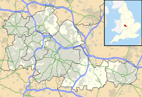
Shirley, West Midlands
| Shirley | |
 St. James the Great Church, Stratford Road, Shirley |
|
 Shirley |
|
| Population | 35,689 (2011.Wards) |
|---|---|
| OS grid reference | SP120790 |
| Metropolitan borough | Solihull |
| Metropolitan county | West Midlands |
| Region | West Midlands |
| Country | England |
| Sovereign state | United Kingdom |
| Post town | Solihull |
| Postcode district | B90 |
| Police | West Midlands |
| Fire | West Midlands |
| Ambulance | West Midlands |
| EU Parliament | West Midlands |
|
|
Coordinates: 52°24′32″N 1°49′23″W / 52.409°N 1.823°W
Shirley is a district of the Metropolitan Borough of Solihull, in the county of West Midlands, England. It is a residential and shopping neighbourhood, and a suburb of Solihull.
History
The earliest known settlement in the area was at Berry Mound in Solihull Lodge, part of West Shirley, which was the site of an Iron Age Hill Fort, a fortified village protected by earth banks, dating back to the first century BC and which covered approximately 11 acres (4.5 ha).[1] The earth works can still be seen from the North Worcestershire Path which commences in Aqueduct Road, Majors Green.
Shirley was part of the Manor of Ulverlei (now Olton) until the establishment of Solihull in the 12th or 13th centuries[2] after which it became part of the parish of Solihull. Shirley developed slowly as a small village on Stratford Road, called Shirley Street through the settlement.[3] Between 1725 and 1872 Stratford Road was a turnpike road, and the ease of travel along this from Birmingham, and Shirley's remoteness attracted sporting activity in the form of bull baiting cockfighting (reputedly at the Plume of Feathers pub) and pugilism. These activities encouraged the church authorities to start building St James Church in 1831, subsequently enlarged in 1882. Finally, in 1893, Shirley became its own ecclesiastical parish.[4] Shirley School which was in School Road until the 1970s was built in 1833.
Shirley grew rapidly in the late 19th century and early 20th century, as people moved out of Birmingham, helped by the opening of the railway in 1908 as a Great Western route from Snow Hill station to Stratford upon Avon and on to Cheltenham. For a hundred years from the mid-19th century, Shirley had a racecourse, and this was supplemented by a public lido in Sansome Road, the Odeon Cinema on Stratford Road, and the public library in Church Road, all in the 1930s.
The expansion of Shirley resumed after the Second World War and has continued apace in the recent time
Shirley also had its own council and council house. However, with the rise of Solihull, it became managed underneath the Solihull Council, becoming two district wards: Shirley, and Shirley South; the council house has since been demolished.
Retail

There are many shops and businesses in the area, many along the Stratford Road. Shirley has a high proportion of independent retailers and charity stores. "Chinese Wilson", the notable plant collector and writer, was brought up in Shirley where his parents ran a floristry business.[5]
Along the Stratford Road there are many restaurants and other eateries, including Cafe Shirley (German and English food) and Nandos. Pedestrianisation of the high street encouraged the local eateries to have outside dining.
There are also many well-known supermarkets that are accessible down the Stratford Road which include Sainsbury's, Morrisons, Iceland and a large Tesco superstore.
Currently, the 'New Heart for Shirley' plan to develop 1.43 acres (4%) of Shirley Park,[6] to build a new shopping complex, with twenty new shops including an Asda supermarket as its flagship store, residential apartments, cafes, restaurants and new public areas. This plan came under much local criticism, but has now been given the go ahead by the local authority.
The 'New Heart for Shirley' was opened in May 2015. Building work on further residential properties are still continuing.
To the south of the high street (Stratford Road, A34) there are two retail parks; one of which is listed as 'Solihull Gate Retail Park', which has shops including retail outlets Argos, Boots and Toys R Us; DIY stores B & Q and Homebase; and electrical store Currys. Cranmore Retail/Business Park is mainly DIY (Such as ScrewFix) and tool hire.
Along the A34 there are many car dealerships such as Renault, Ford, Jaguar, BMW, Audi and Land Rover as well as a combined Ferrari and Maserati dealership. A new Peugeot car dealership is currently being considered on the same stretch of road.
There are also plans to develop a large industrial estate on the Blackford Road side of Dog Kennel Lane, occupying the TRW site.
Education
The only secondary school physically in Shirley is Light Hall School. However Tudor Grange Academy, Alderbrook School, St Peter's School in Solihull and Langley School in Olton have catchment areas that cover parts of Shirley. Tudor Grange became an academy in 2011 and now has a Sixth Form, joining St Peter's Sixth Form. Additionally, the Sixth Form College, Solihull and Solihull College are also major local centres for further education as well as Stratford-upon-Avon College via rail links.
Shirley Heath, Hasluck's Green, Peterbrook, Sharman's Cross, Woodlands, Streetsbrook, Blossomfield, Burman, Tudor Grange Primary Academy (Previously named St James's C:E) and Our Lady of the Wayside R.C. are all local primary and infant schools that serve pupils in the Shirley area.
Leisure

Shirley has a public library and park, and some small patches of woodland at Bills Wood and Palmers Rough. There is also the nearby Stratford-upon-Avon Canal which provides a walking route into the Warwickshire countryside. There are several pubs in the area, the most prominent being the Saracens Head and the Plume of Feathers, in the centre of Shirley. Others close by include the Colebrook, the Red Lion and the Woodmans Rest.
Solihull town centre is a 15-minute bus ride away.
Religion
Our Lady of the Wayside RC church contains one of Elisabeth Frink's Risen Christ sculptures[7] as well as art by Walter Ritchie.
St James Church is the CE parish church and it is from here that church bells can be heard on Sundays.
Also on Stratford Road (A34) are Shirley Baptist and Shirley Methodist Churches.
Transport
There are train services to Birmingham Moor Street station, Birmingham Snow Hill station and on to Stourbridge Junction in one direction and to Henley in Arden and Stratford Upon Avon in the other direction from Shirley railway station[8] which is located in Haslucks Green Road.[9]
The North Warwickshire Line from Shirley railway station currently only runs as far as Stratford upon Avon railway station, however the line was a mainline continuing via Honeybourne railway station (which is on the Cotswold Line) as the Honeybourne Line to Cheltenham.
The Stratford-upon-Avon Canal skirts the western edge of Shirley, and it is possible to walk along this to Kings Norton 4 miles (6.4 km) away, or Stratford upon Avon, further in the other direction.
Shirley is also served by several bus routes, including the 5, 6, 31, 49, and 76, all operated by National Express West Midlands which all stop on the Stratford Road in the town centre. Other services that operate in Shirley include the 3, S4, S7, and X20.
Notable people
Mandy Rice-Davies lived in Blenheim Road, Shirley, and attended Sharman's Cross Junior School, during the 1950s before moving to London prior to the Profumo Affair.
Martin Johnson England RFU Manager, Captain and member of the 2003 Rugby Union World Cup, Solihull Road and attended Sharman's Cross Junior School.
Richard Hammond BBC Top Gear and TV presenter / journalist, attended Streetsbrook Infants School.
Ossie Wheatley, cricketer (Glamorgan and England), lived in Shirley in the 1950s while attending first Shirley College, a small private boys preparatory school at the end of Bills Lane Shirley, and then King Edward's School, Birmingham.
References
- ↑ "Berry Mound". Pastscape – National Monuments Record. English Heritage. Retrieved 14 August 2009.
- ↑ "Solihull on-line history". Retrieved 18 September 2009.
- ↑ Plea Rolls of the Court of Common Pleas; CP 40/629, in 1418;http://aalt.law.uh.edu/H5/CP40no629/bCP40no629dorses/IMG_1583.htm; 5th entry; the second defendant comes from 'Shirleystrete' in the county of Warwickshire.
- ↑ 'Parishes: Solihull', A History of the County of Warwick: Volume 4: Hemlingford Hundred (1947), pp. 214–229; URL: http://www.british-history.ac.uk/report.aspx?compid=42685&strquery=shirley warwick shelley ; date accessed: 23 February 2012.
- ↑ D. J. Mabberley, 'Wilson, Ernest Henry (1876–1930)', Oxford Dictionary of National Biography, Oxford University Press, 2004
- ↑ Shirley Advance
- ↑ Domesday Reloaded: A Solihull Parish Priest (2)
- ↑ National Rail timetable for Shirley
- ↑ National Rail information for Shirley