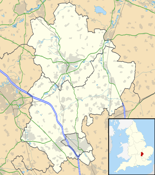
Shillington, Bedfordshire
| Shillington | |
 Church Street |
|
 Shillington |
|
| Area | 1.79 km2 (0.69 sq mi) |
|---|---|
| Population | 1,842 (2011 census)[1] |
| – density | 1,029/km2 (2,670/sq mi) |
| OS grid reference | TL127340 |
| Civil parish | Shillington |
| Unitary authority | Central Bedfordshire |
| Ceremonial county | Bedfordshire |
| Region | East |
| Country | England |
| Sovereign state | United Kingdom |
| Post town | HITCHIN |
| Postcode district | SG5 |
| Dialling code | 01462 |
| Police | Bedfordshire |
| Fire | Bedfordshire and Luton |
| Ambulance | East of England |
| EU Parliament | East of England |
| UK Parliament | Mid Bedfordshire |
|
|
Coordinates: 51°59′02″N 0°21′54″W / 51.984°N 0.365°W
Shillington is a village and civil parish in Bedfordshire, England. In the south of the parish the hamlet of Pegsdon is in the Barton Hills National Nature Reserve and a salient of the county into Hertfordshire. Since 1985 its administration has included the village of Higham Gobion, south-west on the minor road leading to the main north-south road in the district, the A6.[2] It has a population of 1,831 and is centred midway between stopping services railway stations on the Midland Main Line and East Coast Main Line 6 miles (9.7 km) away. Farmland and hedgerows forms 95% of the land use and to the south and north of the boundaries is intermittent woodland.
History
Etymology
The first recorded name of the village (1060) is Scytlingedune, literally translating to 'hill of the people of Scyttle'. Scyttle being a Saxon. This name gradually evolved into an unfortunate Shytlington in official returns and letters of the 17th and 18th centuries[3] so was later bowdlerised.
Early history
Miscellaneous Roman artefacts have been found.[3]
Shillington is mentioned in the Domesday Book. The entry is headed: "Sethlindone: [overlord] St Benedict's of Ramsey. a broken mill, 2 others". It contained 34 households, of which four were slaves, however 27 were villagers or villeins, and five were homes of more independent smallholders. Per year it rendered a large £12, assessed by the Book's compilers to be the same at the conquest twenty years before, had 14 ploughlands and woodland for 100 pigs per year.[4]
The chief hamlets were: Lower Stondon in the north-east, Pegsdon on high ground south of the village on the hills which form the Hertfordshire border, Aspley — with Aspley Bury manor — to the south, Little Holwell, to the east, and Woodmer End and Bury End close to the village on the north.[3]
World War II (1939 - 1945)

In 1940 a Luftwaffe Dornier 17 was attacked over Great Offley (to the south of Pegsdon), the bomber crashed killing the pilot alongside the road at Pegsdon.[5]
On 21 February 1944 Lancaster LL729 (A4 B)[6][7] belonging to 115 Squadron RAF left its base at RAF Witchford for a raid on Stuttgart, several hours later the plane crashed killing its crew near Pegsdon whilst trying to return to its base.
Manors
- Shillington of Shillington Bury
Until the Dissolution of the Monasteries the powerful Ramsey Abbey held this, with its noble arms of three rams heads with golden horns on a blue band, set on a gold (or yellow backdrop), i.e. "or a bend azure".[3]
Including much of Pegsbury as well as the hub of the village, at the Dissolution it was valued at £88 2s. 10d per year and formed part of the (royal) honour of Ampthill, conferred on Princess Elizabeth, remaining in the Royal Family until after James I (or VI of Scotland).[3]
Its mesne lords (intermediate landlords) included George Rotherham (21 years), Sir Henry Hobart (99 years) for Anthony Chester (assumed title three years later), Dr. Peter Barwick, Roger Gillingham, John Borrett and finally the 1764 will of John Briscoe bequeathing Shillington Bury to Henry Earl of Essex for life, remainder to the daughters of the late chivalric Bath King of Arms, Grey Longueville. As such, it settled in 1800 on Grey Arnold and cousin Bridget Frances Anne. Little is known of the mid-19th century except for a sale by a Miss Profit to the father of William Hanscombe, the 1908 lord of the manor.[3]
- Shillington or Apsley Bury (Tudor to Georgian subdivision)
This secondary manor was sold in 1760 to Joseph Musgrave, and henceforward it follows the same descent as Aspley Bury manor below.[3]
In 1476, when Thomas Lawley first transferred this so-called manor held of the Abbey to Thomas Rotherham Archbishop of York who left it at his death in 1500 to Thomas Rotherham, son of his brother John. His grandson Thomas and his wife Alice, for their lives were later heirs, then George, their son, who held the manor from 1561 to 1599. Then came his son John, having succeeded him, who appears to have alienated (sold or lost) this manor, as in the case of Luton to Sir Robert Napier, who held manorial court here in 1651 and like Luton it remained in this family to the death of Sir John Napier in 1714. In 1748 the manorial court was held by Sir Conyers D'Arcy, and in 1759 by his kinsman, the former Ambassador at Venice (to Italy), and at the Hague (to the Netherlands) Robert Darcy, 4th Earl of Holderness.[3]
- Apsley or Apsley Bury
Owners in succession from 1504, for this is a later manor, have been only four families: Lane, Eton, Sir John Franklin's and his grandson-in-law's, that of Sir Christopher Musgrave (with subsequent Musgraves until 1908).[3]
Charities
Charity of Edward Pilsworth produced in 1908 a sum of £12 14s "received annually from the Clothworkers Company, London", applied as follows: £10 8s. in money generally among fifty parishioners, £1 to the vicar, 16s. (80% of that amount) for repair of church, and 10s. to the churchwardens who assisted in its administration.[3]
In 1796 Samuel Whitbread, esq., by will, left £10 10s a year, charged on the manor of Cardington, for providing clothing for the inmates (occupants) of the four almshouses situated in the churchyard. In 1897 this annuity was redeemed making an India stock transfer.[3]
Demography and topography
A local adage is that 'all roads lead away from Shillington' — somewhat true as more efficient routes avoid the village altogether. Shillington is though not demographically, physically agricultural — mostly green-buffered strings of homes and working farms with farmhouses across a broad area. In all 1.69;km² of its 1.78–km² is 'greenspace' leaving the remainder largely domestic gardens, roads, buildings and watercourses.[8] The number of residents increased by a net total of 11 (0.5%) in the ten years to 2011.[1]
Localities
Its much interlinked road layout and modest population, is because, originally, it was made up of several 'Ends', as is not uncommon in rural Bedfordshire. These Ends gradually grew and merged into the Shillington that exists today. Many parts of the village are still referred to by their original names, by villagers and to a lesser extent officially. The elder generation of villagers have developed a colloquial geography of the village, based on the figure of speech 'odds and ends'. By this the old groups of homes suffixed 'End' in some instances have a newer equivalent 'Odd'.
Apsley End
51°59′35″N 0°22′05″W / 51.993°N 0.3680°W
Historically Aspley End (see manors above),[3] this small gently sloping hamlet unusually has three moated sites in a line from north to south, all scheduled ancient monuments, two with ponds, one of which was a fishpond. The other, Pirton Grange has a settling pond, moat remains and enclosure.[9]
Sixteen houses or farmhouses are listed here for architecture, fifteen at Grade II.
- Pirton Grange
At Grade II*, this is the highest listed secular building of the parish and has 15th and 16th century parts, a c. 1690 hall roof and mostly timber-framed construction, however Victorian chimneys and fireplaces.[10]
Other localities (clusters of homes)
- Handscome End
- Upton End
- Bury End
- Hillfoot End
- Greenfields Odd
- Bryant's Odd
- Marquis Odd
- Scytles Odd
The village is home to Shillington Lower School and has pubs:
- Noah's Ark
- The Crown and
- The Musgrave Arms.
The village has a rich history of public houses, and at one time was home to seventeen simultaneously, the former Five Bells being architecturally grade II listed.[11]
All Saints Church
Shillington's church, All Saints Church, is mostly 14th century, with an 18th-century tower and is grade I listed, the highest category.
It has been referred to as the "cathedral of the Chilterns", on an outcrop hill, a contender for the most easterly in the triangular chalk belt enclosing most of South-East England all of East Anglia.[n 1] The building was originally a Saxon monastery, which grew richer and more influential through the mining and selling of coprolite, fossilised dinosaur dung, once used as a fuel and also a fertilizer. The church also has a secret underground passageway, leading to the basement of a local and equally antiquated house. It is believed that there used to be more secret passages, possibly leading all the way out of the village, but they have never been found.
Notes and references
- References
- 1 2 Key Statistics: Population. (2011 census Output Area: E00150093) Retrieved 2015-02-27.
- ↑ BLARS, Guide to Bedfordshire Parishes
- 1 2 3 4 5 6 7 8 9 10 11 12 William Page (editor) (1908). "Parishes: Shillington with Lower Stondon and Little Holwell". A History of the County of Bedford: Volume 2. Institute of Historical Research. Retrieved 3 July 2013.
- ↑ Domesday map website
- ↑ BBC People's War - Brian Limbrick’s Wartime Childhood 1938 to 1941. website accessed 20/07/10
- ↑ Lost Bombers (website accessed: 22/07/10)
- ↑ Alex Tooley, recollection. BBC Peoples War website accessed: 20 July 2010)
- ↑ Office for National Statistics: Parish: Shillington: Physical Environment: Key Statistics Retrieved 19 September 2015
- ↑ Scheduled Ancient Monument, north of Apsley End Historic England. "Details from listed building database (1009586)". National Heritage List for England.
Scheduled Ancient Monument (2), Apsley End Historic England. "Details from listed building database (1010927)". National Heritage List for England.
Scheduled Ancient Monument (3) Apsley End Historic England. "Details from listed building database (1012348)". National Heritage List for England. - ↑ Historic England. "Details from listed building database (1175572)". National Heritage List for England.
- ↑ Historic England. "Details from listed building database (1312534)". National Heritage List for England.
- Notes
- ↑ The parish is mainly on the north terraces of the Chilterns' flatter north-eastern section, a chalk escarpment of informal starting point at the Barton Hills - as noted by geologist William Smith, its newer strata remains intact all the way to a broad culmination at the North Sea coast alongside The Wash and north-west Norfolk.
External links
| Wikimedia Commons has media related to Shillington, Bedfordshire. |
- Parish council website
- Village website, which includes a parish magazine
- Shillington History Society village history society