Shahabad Markanda
| Shahabad Markanda शाहाबाद मारकंडा | |
|---|---|
| Town | |
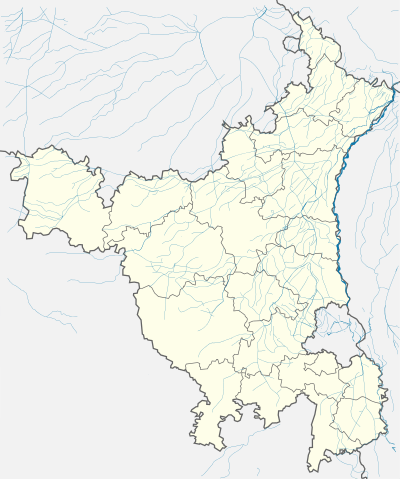 Shahabad Markanda  Shahabad Markanda Location in Haryana, India | |
| Coordinates: 30°10′N 76°52′E / 30.16°N 76.87°ECoordinates: 30°10′N 76°52′E / 30.16°N 76.87°E | |
| Country |
|
| State | Haryana |
| District | Kurukshetra |
| Named for | Rishi Markandeya |
| Government | |
| • Type | Democratic |
| • Body | Municipal Committee |
| • President of MC | Sudarshan Kakkar |
| • Member of Legislative Assembly | Krishan Kumar Bedi (Bhartiya Janta Party) |
| Population (2011) | |
| • Total | 42,607 |
| Languages | |
| • Official | Hindi |
| Time zone | IST (UTC+5:30) |
| PIN | 136135 |
| Telephone code | 01744 |
| Vehicle registration | HR |
| Website |
haryana |
Shahabad Markanda (Hindi: शाहाबाद मारकंडा) also Shahabad (Hindi: शाहाबाद), a town and a Municipal Committee in Kurukshetra district in the Indian state of Haryana. It is situated on the left bank of the Markanda River, 20 km south of Ambala Cantonment and 22 km from the historical city Kurukshetra.
It has a historic gurdwara of those times and many temples including ‘Shri Markandeshwar Mahadev Shiv Mandir’, ‘Balasundri Mandir’, ‘Durga Mandir’.
History
The town was founded after the Battle of Tarain (Taraori) in 1192 by a general of Shahab-ud-din Muhammad Gauri. Historically it was a Muslim majority town. References were made to a fort during Mughal times. The fort was raided and sacked by Banda Singh Bahadur. It was pillaged by Babur for having assisted Ibrahim Lodhi. After partition most of the Muslims left, while Punjabis, Sikhs and Hindus from Pakistan were resettled there.
After the victory over Prithviraj Chauhan, Muhammad Gauri donated 52000 Bigha of land to his commander Qutb-ud-din Aibak. Mughal emperors Babur & Humayun also stayed there for some time. During the medieval period it had a fortified Sarai used by imperial officers and troops moving between Delhi and the Northern Provinces. It also had a resident garrison to guard the highway.
In 1710 Sikh warrior Banda Singh Bahadur captured Shahabad. On 22 May 1791 Baghel Singh and 'Karam Singh Nirmala' of Nishanwalia Misal recaptured the town by killing Kiledaar Khalil Khan along with 700 Mughal soldiers. The Sikhs also captured two cannons.
In 1757, the town was sacked and captured by the forces of the Hindu Maratha Empire.[1] The Sikhs started occupying territory. Nishananvali misl, under Dasaundha Singh and Sangat Singh, took possession of a long, narrow stretch of land south of the Sutlej, extending from Singhanvala in Firozpore district to Shahabad with Ambala as the headquarters. The territory of Shahabad and Ismailabad fell to Sardar Mehar Singh. Several attempts were made by the Afghans to dislodge the Sikhs, but they were repulsed every time.[2]
During the period between 1770 and 1780, a magnificent old mosque, said to have been built by Mughal Emperor Shah Jahan in 1630, was converted into a gurdwara. The only major change was the demolition of its minarets. The gurdwara was named Mastgarh, a designation commonly used for such conversions. Bhai Prem Singh of Hazur Sahib was appointed the first granthi.
Shahabad was divided by the Sikhs into 7 patlis. The Sardars of Shahabad exercised administrative powers in the earlier days of the British regime but were deprived of these powers by the British in 1850.
Commissioner of Karnal Major C. R. Buck in 1854 allotted shops to the traders. The market was named as Larkingunj. Later it became known as Gurmandi.
A market known as Kahan Chand Mandi was constructed in 1923 on the outskirts of the town. It later converted into a residential colony. A new market known as Partap Mandi was constructed in the 1960s.
Shri Markandeshwar Mahadev Shiv Mandir commonly known as “Shivji Mandir/Pracheen Shivala” is a registered body under Society Registration Act 1860 and it has also received revised certificate under Haryana Registration and regulations Act 2012.. This society is first society in Haryana to be fully accountable to public. Shahabad has received Sub Divisional Status on 9 May 2011.
Shahabad was famous for manufacturing scissors and musical instruments.
The municipal committee of Shahabad was formed in 1885.
The Railway Station and Railway Bridge were built in 1930. The name of Shahabad railway station was Khrindwa station.
ruled in Shahabad.
Geography
Shahabad lies 21 Kilometres south of Ambala on the Ambala - Delhi section of the historical Grand Trunk Road. It is some 22 kilometres north or Kurukshetra. Shahabad is on national highway NH-1 and has a railway station on the Delhi - Ambala line. It lies on the banks of the River/stream Markanda, a tributary of the Ghaggar, supposed to be a part of the ancient Vedic Saraswati River basin system.
Another road travels from Panchkula, via Ramgarh and Dosarka, that comes out near Shahabad. Direct roads lead to Ladwa and Radaur as well as Yamunanagar from Shahabad. Pipli, near Kurukshetra, Nilokheri and Karnal are the other nearby towns south of Shahabad.
Economy
The town is a market for agricultural products. The market yard in Shahabad is a major market or Mandi.
The area is fertile and is used for paddy as well as wheat and vegetables. Poultry farming also contributes to its economy. Agriculture productivity is high, and the belt till Karnal hosts rice mills to process the grain. Shahabad also has a government sugar mill.
Administration
Shahabad city is divided into 17 wards that hold elections every 5 years.
The SMC is authorized to build roads within Municipal Committee limits and impose taxes on properties coming under its jurisdiction. It supplies basic amenities including water and sewerage.
Demographics
The Shahabad Municipal Committee has population of 42,607 of which 22,913 are males while 19,694 are females as per report released by Census[3] India 2011. It hosts 9,222 houses.
The city is home to 4,349 children 0-6, 10.21% of the total. The female sex ratio is 860 against state average of 879. The child sex ratio is around 771 compared to the state average of 834. The literacy rate is 83.77%, higher than state average of 75.55%. Male literacy is around 87.11% while female literacy rate is 79.93%.
Education
A government school was established in 1897 Others include ‘Arya Putri Gurukul’ (1909), ‘D.A.V School’ (1916). ‘Islamiya School’ was converted to ‘Khanewal Khalsa School’.
After partition some private schools were established. ‘Ramdutt Ka School’, ‘Prince Coaching College’ popularly known as ‘Sardaar Ka School’ (1950-2000), ‘National School of Guruji’. ‘Master Teerath Singh Ka School’ played notable role in the field of education there.
In higher education ‘Markanda National College’ and ‘Arya Kanya Mahavidyalya’ are important to note. Contributions of Lala Sita Ram Ji Rahees, Krishan Gopal Chadha, Lala Bhal Singh Gupta and Lala Kesho Ram helped provide higher education for women and established ‘Arya Kanya Mahavidyalya’.
‘Vishwas School’, ‘Satluj Senior Secondary School’ and ‘Chanan Singh Ghumman Memorial College of Education’ are there. ‘Mata Rukmani Rai Arya Senior Secondary School’, ‘D.A.V Centenary School’, and ‘SGNP School’ are in the area.
Sports
In the field of hockey, Shahabad produced many hockey players, both men and women, including 12 members on the National Women's Hockey Team. Other prominent sports include climbers who summited Everest and cycling.
Religion
A large temple on the banks of the river, which is called Markandeya Mandir, after the name of the famous Maharishi Markandeya.
An ancient Shiva Temple is situated in the city. It is said that the idea for a Shiv temple originally came to a military guard who was guarding the railway bridge adjacent to the present temple.
Sights
Gurdwara Mastgarh is on a high ground in the northeastern part of the town. The original prayer hall, under a high dome is used as the divan hall. The “Guru Granth Sahib” is seated in the centre in front of the mihrab. Bullet marks on the exterior surface of the domes and the walls document turbulence in the eighteenth century. The gurdwara is affiliated to the Shiromani Gurdwara Parbandhak Committee which administers it through a local committee.
Amenities
The town has several hospitals, restaurants, schools and colleges. There is also a municipal library in the town having some Hindi and English books and newspapers. Any resident of the town can become member of the library to avail its facility.
Notables
- Justice Pravesh Kumar Bhasin, Judge, Delhi High Court [4]
- S. Joginder Singh received the Baba Farid Award from Haryana Punjabi Sahitya academy in 2006 for his contribution to Punjabi literature. He has four books in prose to his name: Adhi Vaat Da Saath (1979), Je Tu Akal Latif (2003), Manobal Atamvishvas Ate Jitt (2006) in Punjabi and Teer-o-Nashtar (1998) in Urdu. Two of his Punjabi books and Teer-Nashtar were selected in the category of Best Book Awards by Punjabi and Urdu Sahitya academy respectively.
- Mitul Kansal, great grandson of Lala Sita Ram Ji Rahees, is a radio hobbyist and the founder of “International Radio Listeners’ Friendship & Fraternity Club”[5] who was recognized in Russia, Sri Lanka and Indonesia and other countries.[6][7][8][9][10] His essay on rescue operations when 'Markanda River' flooded in 2010 was selected by Radio France Internationale for its weekly show "The Sound Kitchen’.[11] He is an active writer and has written two books and many articles. He is the author of Moonless Nights (English Poems), which is widely available on Amazon, Flipkart and many other websites. His e-book AFTER DICKENS - A collection of writings from the Dickens 2012 project was jointly published by British Council, Penguin Group and CinnamonTeal Publishing.[12]
- Sardar Shingara Singh Hanjra sacrificed his life during partition. He was imprisoned with Mahatma Gandhi
- Jagdish Kalra sacrificed his life during the Indo-Pak war in 1965. A park is named in his honor and a statue of him is installed there.
- Khusdev Singh, Gurpreet Kaur and Gurdeep Singh sacrificed their lives fighting terrorists on 9 April 1988 who had attacked the residence of then M.L.A Dr. Harnam Singh.
- Five Shaurya Chakra were awarded by President Of India to the family of Dr.Harnam Singh.
- Squadron Leader Tej Parkash Singh Gill- Vir Chakra
- Hockey Coach Baldev Singh- Dronacharya Award Sandeep kaur- Hanjra Bheem Award
- Suman Bala Saini ( hockey)- {[ Arjuna Award]}
- Surinder Kaur (Hockey) - Arjuna Award
- Jasjeet Handa - Arjuna Award
- Sandeep Singh Ex-captain Indian Hockey Team - Arjuna Award
- Principal Joginder Singh- Haryana Punjabi Gaurav Puraskar 2008, Baba Sheikh Farid Award 2006
- Dr. R.S. Ghumman- Shiksha Ratan, Shiksha Bharti Avantika and Kartavya Murti Award
- Bhupinder Kaur, Sanjeev Dang Olympian, Sandeep Kaur- Bhim Award
- Kulwant Singh Virk- Krishi Ratan Award
- Banu Ram Gupta- Haryana Ratan
- Freedom Fighters- Jagir Singh Virk, Narsingh Das Arora, Lala Banu Ram Gupta,Vaidya Shukdev Muni Nagar, Ghanshyam Das, Ajit Singh,
- Late professor R. P. Shokh was an Urdu Shaayar who wrote two books, Gamja-B-Gamja (Glance by Glance) and Munnkash-Khandhar-Jabie (Engraved Ruined Forehead) in Urdu.
- Surinder Bansal translated Shokh’s poetic work into Hindi : Jindgi Ke Sheeshe Mein (2001). He translated Anupam Mishar’s Hindi book Aaj Bhi Khere Hain Taalab into Punjabi as Aaj Vee Khere Han Taalab (2006).
- Dr. Desraj Sapra was an Urdu scholar of the town who two books in Urdu: Haryana Ka Urdu Adab (1985) and Urdu Mein Islahe Jubaan Ki Tehreerein (1994).
- Surinder Pal Singh wrote Meri Ikkees Kavitayein (2006).
- Dr. Narender Pal Singh published Lokyaan:Sidhant Te Mulyankan about the impacts of folklore of Punjab and Haryana on each other.
- Kulwant Chawla Rafique was recognized by Punjabi Sahitya Academy for his poetic work Cheekh Khamoshi Di.
- Jaswant Singh Nalva published three books: Ithas Ke Paripeksh Mein Kurukshetra, Kamboj Kaum Kaam Kurbaaniyo Ka and Atamkatha.
- Narender Singh Rafique published Kiste-A-Khyaal.
- Dr.Gurmukh Singh Naaz authored Sadhran-Da-Sarmaaya (Heritage of desires).
- Darshan Singh published a story book, Lakeerein (2010).
- Dr. R. S. Ghumman wrote Concept of Man and God in Sikhism (2010).
- Rani Rampal is Indian Field Hockey player and former captain of International Indian Hockey Team.
References
- ↑ Mehta, Jaswant Lal (1 January 2005). Advanced Study in the History of Modern India 1707-1813. Sterling Publishers Pvt. Ltd. pp. 234–. ISBN 978-1-932705-54-6.
- ↑ Gian Singh, Giani, Twarikh Guru Khalsa, [Reprint]. PATIALA, 1970
- ↑ "Census of India 2001: Data from the 2001 Census, including cities, villages and towns (Provisional)". Census Commission of India. Archived from the original on 2004-06-16. Retrieved 2008-11-01.
- ↑ http://www.indlii.org/ContentPages/Justice%20P%20K%20Bhasin.htm. Retrieved June 23, 2014. Missing or empty
|title=(help) - ↑ MITUL KANSAL. "International Radio Listeners' Friendship & Fraternity Club".
- ↑ "2011 प्रतियोगिता के विजेता".
- ↑ "विजेताओं के नाम - china radio international".
- ↑ "Winners of the Knowledge Contest".
- ↑ https://web.archive.org/web/20120824041518/http://www.rri.ro/art.shtml?lang=1&sec=16&art=280942. Archived from the original on August 24, 2012. Retrieved October 14, 2015. Missing or empty
|title=(help) - ↑
- ↑ Susan Owensby (8 January 2012). "Listener's essay - A life of service and dedication". RFI.
- ↑ "Download" (PDF).