Shady Lea Historic District
|
Shady Lea Historic District | |
|
Mill workers' housing | |
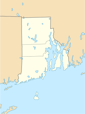  | |
| Location | North Kingstown, Rhode Island |
|---|---|
| Coordinates | 41°32′7″N 71°27′56″W / 41.53528°N 71.46556°WCoordinates: 41°32′7″N 71°27′56″W / 41.53528°N 71.46556°W |
| Area | 18 acres (7.3 ha) |
| Built | 1870 |
| Architect | Multiple |
| Architectural style | Gothic, Federal |
| MPS | North Kingstown MRA |
| NRHP Reference # | 85001644 [1] |
| Added to NRHP | July 19, 1985 |
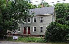
The Shady Lea Historic District is a historic district on Shady Lea and Tower Hill Roads in North Kingstown, Rhode Island. It encompasses a predominantly residential linear district extending along Shady Lea Road southward from Tower Hill Road. Most of the houses along Shady Lea Road are mill worker housing built in the 19th century for workers at the mill complex which stands at the edge of the Shady Lea Mill Pond, at the southern end of the district. This area is a well-preserved example of the numerous rural mill complexes which dotted the Rhode Island countryside in the 19th century.[2]
The district was listed on the National Register of Historic Places in 1985.[1]
See also
References
- 1 2 National Park Service (2007-01-23). "National Register Information System". National Register of Historic Places. National Park Service.
- ↑ "Historic Resources of North Kingstown (PDF pages 33-37)" (PDF). Rhode Island Preservation. Retrieved 2014-11-11.
| Topics | |
|---|---|
| Lists by states |
|
| Lists by insular areas | |
| Lists by associated states | |
| Other areas | |
| |
This article is issued from Wikipedia - version of the 11/26/2016. The text is available under the Creative Commons Attribution/Share Alike but additional terms may apply for the media files.