Sevier County, Arkansas
| Sevier County, Arkansas | |
|---|---|
|
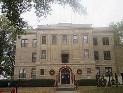
The Sevier County Courthouse is located in De Queen | |
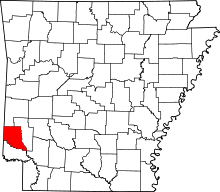 Location in the U.S. state of Arkansas | |
 Arkansas's location in the U.S. | |
| Founded | October 17, 1828 |
| Named for | Ambrose Hundley Sevier |
| Seat | De Queen |
| Largest city | De Queen |
| Area | |
| • Total | 581 sq mi (1,505 km2) |
| • Land | 565 sq mi (1,463 km2) |
| • Water | 16 sq mi (41 km2), 2.8 |
| Population (est.) | |
| • (2015) | 17,290 |
| • Density | 30/sq mi (12/km²) |
| Congressional district | 4th |
| Time zone | Central: UTC-6/-5 |
| Website |
seviercountyar |

Sevier County is a county located in the U.S. state of Arkansas. As of the 2010 census, the population was 17,058.[1] The county seat is De Queen.[2] Sevier County is Arkansas's sixteenth county, formed on October 17, 1828,[3] and named for Ambrose Sevier, U.S. Senator from Arkansas. It is an alcohol prohibition or dry county.
History
Sevier County was organized on October 17, 1828 under legislative authority. It was formed from Hempstead and Miller Counties. Five days later on October 22, 1818, the legislature expanded the county's border, incorporating more land south of the Red River.[4] Hempstead, Miller and Crawford Counties as well as the Choctaw Nation in Indian Territory bound Sevier County. The establishment of Sevier County became effective on November 1, 1828.[5]
The county seat has undergone several changes since Sevier County was organized. The first county seat was Paraclifta. In 1871, the Lockes donated 120 acres (0.49 km2) of land. As a result, the county seat was moved to Lockesburg. In 1905, the county seat was again moved to De Queen. Sevier County is known as “The Land of Lakes”, “The Land of Fruits and Flowers” and “The Home of Friendly People”. The county has five lakes within a 35-mile (56 km) radius, five rivers and mountain streams and forests.
Geography
According to the U.S. Census Bureau, the county has a total area of 581 square miles (1,500 km2), of which 565 square miles (1,460 km2) is land and 16 square miles (41 km2) (2.8%) is water.[6]
Major highways
- Future
_Metric.svg.png) Interstate 49
Interstate 49  U.S. Highway 59
 U.S. Highway 70
 U.S. Highway 71
 U.S. Highway 371
 Highway 24
 Highway 27
 Highway 41
Adjacent counties
- Polk County (north)
- Howard County (east)
- Hempstead County (southeast)
- Little River County (south)
- McCurtain County, Oklahoma (west)
National protected area
Demographics
| Historical population | |||
|---|---|---|---|
| Census | Pop. | %± | |
| 1830 | 634 | — | |
| 1840 | 2,810 | 343.2% | |
| 1850 | 4,240 | 50.9% | |
| 1860 | 10,516 | 148.0% | |
| 1870 | 4,492 | −57.3% | |
| 1880 | 6,192 | 37.8% | |
| 1890 | 10,072 | 62.7% | |
| 1900 | 16,339 | 62.2% | |
| 1910 | 16,616 | 1.7% | |
| 1920 | 18,301 | 10.1% | |
| 1930 | 16,364 | −10.6% | |
| 1940 | 15,248 | −6.8% | |
| 1950 | 12,293 | −19.4% | |
| 1960 | 10,156 | −17.4% | |
| 1970 | 11,272 | 11.0% | |
| 1980 | 14,060 | 24.7% | |
| 1990 | 13,637 | −3.0% | |
| 2000 | 15,757 | 15.5% | |
| 2010 | 17,058 | 8.3% | |
| Est. 2015 | 17,290 | [7] | 1.4% |
| U.S. Decennial Census[8] 1790–1960[9] 1900–1990[10] 1990–2000[11] 2010–2015[1] | |||

As of the 2000 United States Census,[13] there were 15,757 people, 5,708 households, and 4,223 families residing in the county. The population density was 28 people per square mile (11/km²). There were 6,434 housing units at an average density of 11 per square mile (4/km²). The racial makeup of the county was 79.61% White, 4.94% Black or African American, 1.82% Native American, 0.13% Asian, 0.06% Pacific Islander, 11.84% from other races, and 1.61% from two or more races. 19.72% of the population were Hispanic or Latino of any race. 17.32% reported speaking Spanish at home .
There were 5,708 households out of which 36.40% had children under the age of 18 living with them, 59.30% were married couples living together, 10.00% had a female householder with no husband present, and 26.00% were non-families. 22.80% of all households were made up of individuals and 11.00% had someone living alone who was 65 years of age or older. The average household size was 2.73 and the average family size was 3.19.
In the county the population was spread out with 28.20% under the age of 18, 9.50% from 18 to 24, 27.70% from 25 to 44, 21.30% from 45 to 64, and 13.20% who were 65 years of age or older. The median age was 34 years. For every 100 females there were 99.10 males. For every 100 females age 18 and over, there were 97.00 males.
The median income for a household in the county was $30,144, and the median income for a family was $34,560. Males had a median income of $25,709 versus $17,666 for females. The per capita income for the county was $14,122. About 14.40% of families and 19.20% of the population were below the poverty line, including 26.90% of those under age 18 and 14.20% of those age 65 or over.
Communities
Cities
- De Queen (county seat)
- Horatio
- Lockesburg
Towns
Townships
Townships in Arkansas are the divisions of a county. Each township includes unincorporated areas; some may have incorporated cities or towns within part of their boundaries. Arkansas townships have limited purposes in modern times. However, the United States Census does list Arkansas population based on townships (sometimes referred to as "county subdivisions" or "minor civil divisions"). Townships are also of value for historical purposes in terms of genealogical research. Each town or city is within one or more townships in an Arkansas county based on census maps and publications. The townships of Sevier County are listed below; listed in parentheses are the cities, towns, and/or census-designated places that are fully or partially inside the township. [14][15]
- Bear Creek (contains most of De Queen)
- Ben Lomond (contains Ben Lomond)
- Buckhorn
- Clear Creek (contains Horatio)
- Jefferson
- Mill Creek
- Mineral (contains Gillham)
- Monroe (contains small part of De Queen)
- Paraclifta
- Red Colony (contains Lockesburg)
- Saline
- Washington
Source:[16]
See also
References
- 1 2 "State & County QuickFacts". United States Census Bureau. Retrieved May 19, 2014.
- ↑ "Find a County". National Association of Counties. Retrieved 2011-06-07.
- ↑ Strickland, Rex W. (March 1941). "Miller County, Arkansas Territory: The Frontier That Men Forgot". Chronicles of Oklahoma. Oklahoma Historical Society. 19 (1): 43. Retrieved 2012-05-13. (footnote 17)
- ↑ Strickland, Rex W. (March 1941). "Miller County, Arkansas Territory: The Frontier That Men Forgot". Chronicles of Oklahoma. Oklahoma Historical Society. 19 (1): 43. Retrieved 2012-05-13.
- ↑ Kane, Joseph Nathan; Aiken, Charles Curry (2005). The American Counties: Origins of County Names, Dates of Creation, and Population Data, 1950-2000 (5th ed.). Oxford, England: Scarecrow Press. p. 274. ISBN 0810850362.
- ↑ "2010 Census Gazetteer Files". United States Census Bureau. August 22, 2012. Retrieved August 27, 2015.
- ↑ "County Totals Dataset: Population, Population Change and Estimated Components of Population Change: April 1, 2010 to July 1, 2015". Retrieved July 2, 2016.
- ↑ "U.S. Decennial Census". United States Census Bureau. Retrieved August 27, 2015.
- ↑ "Historical Census Browser". University of Virginia Library. Retrieved August 27, 2015.
- ↑ Forstall, Richard L., ed. (March 27, 1995). "Population of Counties by Decennial Census: 1900 to 1990". United States Census Bureau. Retrieved August 27, 2015.
- ↑ "Census 2000 PHC-T-4. Ranking Tables for Counties: 1990 and 2000" (PDF). United States Census Bureau. April 2, 2001. Retrieved August 27, 2015.
- ↑ Based on 2000 census data
- ↑ "American FactFinder". United States Census Bureau. Retrieved 2011-05-14.
- ↑ 2011 Boundary and Annexation Survey (BAS): Sevier County, AR (PDF) (Map). U. S. Census Bureau. Retrieved 2011-08-23.
- ↑ "Arkansas: 2010 Census Block Maps - County Subdivision". United States Census Bureau. Retrieved May 29, 2014.
- ↑ "Summary Population and Housing Characteristics, CPH-1-5, Arkansas" (PDF). 2010 Census of Population and Housing. United States Census Bureau. September 2012. Retrieved May 31, 2014. External link in
|work=(help)
 |
Polk County | | ||
| McCurtain County, Oklahoma | |
Howard County | ||
| ||||
| | ||||
| Little River County | Hempstead County |
Municipalities and communities of Sevier County, Arkansas, United States | ||
|---|---|---|
| Cities | | |
| Towns | ||
| Unincorporated community | ||

Coordinates: 34°0′N 94°15′W / 34.000°N 94.250°W