Scotts Peak Dam
| Scotts Peak Dam | |
|---|---|
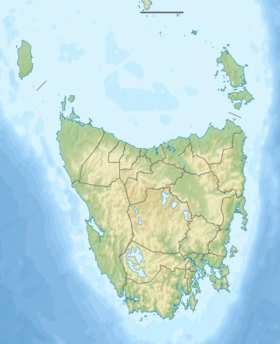 Location of the Edgar Dam in Tasmania | |
| Country | Australia |
| Location | South West Tasmania |
| Coordinates | 43°01′52″S 146°17′46″E / 43.03111°S 146.29611°ECoordinates: 43°01′52″S 146°17′46″E / 43.03111°S 146.29611°E |
| Purpose | Power |
| Status | Operational |
| Opening date | 1973 |
| Owner(s) | Hydro Tasmania |
| Dam and spillways | |
| Type of dam | Embankment dam |
| Impounds | Huon River |
| Height | 43 metres (141 ft) |
| Length | 1,067 metres (3,501 ft) |
| Dam volume | 584×103 m3 (20.6×10⁶ cu ft) |
| Spillways | 0 |
| Reservoir | |
| Creates | Lake Pedder |
| Total capacity | 2,937,930 ML (103,752×106 cu ft) |
| Catchment area | 734 km2 (283 sq mi) |
| Surface area | 242 km2 (93 sq mi) |
| Max. water depth | 43 m (141 ft) |
|
Website hydro | |
| [1] | |
The Scotts Peak Dam is an rockfill embankment dam with an asphalt face without a spillway across the Huon River, located in the South West region of Tasmania, Australia.
The impounded reservoir, also formed with the Edgar Dam and the Serpentine Dam, is called Lake Pedder which flooded Lake Edgar, a naturally forming fault scarp pond. The dam was constructed in 1973 by the Hydro Electric Corporation (TAS) as part of the Gordon River Power Development Scheme for the purpose of generating hydro-electric power via the conventional Gordon Power Station. Water from Lake Pedder is diverted to Lake Gordon (formed by the Gordon Dam) via the McPartlan Pass Canal.[2][3][4]
Location and features
The Scotts Peak Dam, together with the Edgar Dam and the Serpentine Dam, are three major dams that form the headwaters for the Gordon River Power Development Scheme. The dam is located near Lake Pedder's most easterly point[5] in the upper reaches of the Huon River where the river descends from the Marsden Range and descends into what is now known as the Huon Basin. Also at the southern end of the Lake Pedder, the Scotts Peak Dam impounds the upper reaches of the Huon River. At the northwestern end of the lake is impounded by the Serpentine Dam across the Serpentine River. The water in Lake Pedder provides around 40% of the water used in the Gordon Power Station. The water flows to Lake Gordon via McPartlan Canal.[2] Water from Lake Gordon then exits through the Gordon Dam.
Built on a foundation of rock and soil, the Scotts Peak Dam wall was constructed with 584 thousand cubic metres (20.6×10⁶ cu ft) of rockfill and faced with asphalt. The dam wall is 43 metres (141 ft) high and 1,067 metres (3,501 ft) long. At 100% capacity the dam wall holds back 2,937,930 megalitres (103,752×106 cu ft) of water. The surface area of Lake Pedder is 241,330 hectares (596,300 acres) and the catchment area is 734 square kilometres (283 sq mi). The dam wall does not have a spillway.[1]
This non-hydroelectric dam helps retain water in the new impoundment, which then flows to Lake Gordon via the McPartlans Pass Canal at 42°50′51″S 146°11′45″E / 42.84750°S 146.19583°E. In 2001 the dam was recorded as an Historic Engineering Marker along with twenty-four other dams by Engineers Australia.[3]
See also
References
- 1 2 "Register of Large Dams in Australia" (Excel (requires download)). Dams information. Australian National Committee on Large Dams. 2012. Retrieved 28 June 2015.
- 1 2 "Gordon - Pedder". Energy: Our power stations. Hydro Tasmania. Retrieved 21 June 2015.
- 1 2 "Scotts Peak Dam, Tasmania" (PDF). Submission for an Historic Engineering Marker. Engineers Australia. April 2000. Retrieved 1 July 2015.
- ↑ Reid, Vern (1976). "Sealing Scott's Peak Dam". Tasmanian Year Book (B&W photo). Tasmania: Australian Bureau of Statistics. p. 249. ISSN 0082-2116.
- ↑ "Edgar Dam camp ground". Community. Hydro Tasmania. 2015. Retrieved 29 June 2015.