Scio Township, Michigan
| Scio Township, Michigan | |
|---|---|
| Township | |
|
Township Hall, N. Zeeb Rd. | |
| Nickname(s): Township | |
 Scio Township, Michigan Location within the state of Michigan | |
| Coordinates: 42°18′12″N 83°50′10″W / 42.30333°N 83.83611°WCoordinates: 42°18′12″N 83°50′10″W / 42.30333°N 83.83611°W | |
| Country | United States |
| State | Michigan |
| County | Washtenaw |
| Area | |
| • Total | 34.2 sq mi (88.6 km2) |
| • Land | 33.7 sq mi (87.4 km2) |
| • Water | 0.5 sq mi (1.2 km2) |
| Elevation | 873 ft (266 m) |
| Population (2010) | |
| • Total | 20,081 |
| • Density | 590/sq mi (230/km2) |
| Time zone | Eastern (EST) (UTC-5) |
| • Summer (DST) | EDT (UTC-4) |
| ZIP code |
48103 (Ann Arbor), 48130 (Dexter) |
| Area code(s) | 734 |
| FIPS code | 26-71940[1] |
| GNIS feature ID | 1627050[2] |
| Website |
twp |


Scio Township is a civil township of Washtenaw County of the U.S. state of Michigan. As of the 2010 census, the township's population was 20,081.[3] The township is situated west of Ann Arbor.
Communities
- Delhi Mills is an unincorporated community in the northeast corner of the township on the Huron River.[4] It was platted with the name of Delhi in 1836.[5]
- Dexter is a city, formerly a village in the northwest corner of the township, also on the Huron River. The Dexter post office with ZIP code 48130 also serves northwest Scio Township.[6]
- Scio is the former site of an early community in the township on the Huron River about midway between Delhi Mills and Dexter[7] at the current location of the intersection of Zeeb Road and Huron River Drive.
- Sunward Cohousing was the first cohousing community to be established in Scio, followed by Great Oak Cohousing and Touchstone Cohousing.
- The city of Ann Arbor is to the southeast and has incorporated some land from the township. The Ann Arbor post office with ZIP code 48103 also serves much of southeastern Scio Township.[8]
History
Samuel W. Foster bought a mill site on the Huron River at what is now Scio in 1835. The community was platted by Dr. Cyril Nichols from Vermont. A post office was established in 1835. The office was moved to Delhi Mills and renamed in February 1871, though the Scio office was re-established in September 1871. The post office took its name from the township; however, early township records were destroyed by fire, and it is uncertain why "Scio" was chosen.[9] There are at least three origins suggested for the name. The first suggests it derives from the Greek island of Chios, and the second that it was named after Scio, New York, although that town was also named for Chios.[10] Thirdly, by coincidence scio also means "I know" in Latin, so following the American Civil War some people assumed this was the origin of the name.
Documents regarding the naming of townships in the State of Michigan archives indicate that Scio Township and its northern neighbor Webster Township were named on the same date, unlike other townships in Washtenaw County. This date followed the establishment by the United States of America of diplomatic relations with the modern nation of Greece, following the Greek War of Independence (1821–1830). U.S. Senator Daniel Webster had introduced a resolution, recorded in the Congressional Record, that is widely considered one of his better orations (printed in the Collected Works of Daniel Webster). He advocated that the USA be the first nation to diplomatically recognize Greece. Webster referred to the 1822 destruction of Scio, the then-current French translation of Chios (Greek: Χίος, pronounced /ˈçio̞s/), derived from the Genoese dialect. In Webster's era, French was the language of international diplomacy. Eugène Delacroix's 1824 painting The Massacre at Chios and numerous publications brought the Greek cause to the attention of Americans. Ypsilanti Township was named after the first leader of the secret organization that coordinated the beginning of the revolution, Alexander Ypsilanti (Greek: Αλέξανδρος Υψηλάντης). The City of Ypsilanti was named after the victor of the final battle of the revolution, Alexander's brother Demetrius.[11] The sister townships of Scio and Webster were named as a monument to the birth of the new Greek republic, the end of its citizen's subjection, and the first American senator to support their nation.
Delhi Mills was platted as "Michigan Village" by Jacob Doremus in 1836, but was renamed Delhi. In 1842, Norman C. Goodale, known as the founder of Delhi Mills, acquired all the unsold lots. The Scio post office was transferred here in 1871 and operated until 1903.[9]
Geography
According to the United States Census Bureau, the township has a total area of 34.2 square miles (88.6 km2), of which 33.7 square miles (87.4 km2) is land and 0.46 square miles (1.2 km2), or 1.39%, is water.[12]
Demographics
As of the census[1] of 2000, there were 15,759 people, 6,070 households, and 4,425 families residing in the township. The population density was 463.0 per square mile (178.8/km²). There were 6,338 housing units at an average density of 186.2 per square mile (71.9/km²). The racial makeup of the township was 89.53% White, 4.13% African American, 0.27% Native American, 3.70% Asian, 0.03% Pacific Islander, 0.40% from other races, and 1.94% from two or more races. Hispanic or Latino of any race were 1.53% of the population.
There were 6,070 households out of which 37.4% had children under the age of 18 living with them, 60.8% were married couples living together, 9.1% had a female householder with no husband present, and 27.1% were non-families. 20.7% of all households were made up of individuals and 5.0% had someone living alone who was 65 years of age or older. The average household size was 2.59 and the average family size was 3.03.
In the township the population was spread out with 27.2% under the age of 18, 6.9% from 18 to 24, 30.7% from 25 to 44, 26.9% from 45 to 64, and 8.4% who were 65 years of age or older. The median age was 37 years. For every 100 females there were 95.4 males. For every 100 females age 18 and over, there were 92.4 males.
The median income for a household in the township was $73,705, and the median income for a family was $87,498. Males had a median income of $60,313 versus $38,000 for females. The per capita income for the township was $36,837. About 1.8% of families and 2.9% of the population were below the poverty line, including 1.5% of those under age 18 and 4.6% of those age 65 or over.
References
- 1 2 "American FactFinder". United States Census Bureau. Retrieved 2008-01-31.
- ↑ U.S. Geological Survey Geographic Names Information System: Scio Township, Michigan
- ↑ "Profile of General Population and Housing Characteristics: 2010 Demographic Profile Data (DP-1): Scio township, Washtenaw County, Michigan". U.S. Census Bureau, American Factfinder. Retrieved July 10, 2012.
- ↑ U.S. Geological Survey Geographic Names Information System: Delhi Mills, Michigan
- ↑ Walter Romig, Michigan Place Names, p. 151
- ↑ 48130 5-Digit ZCTA, 481 3-Digit ZCTA - Reference Map - American FactFinder, U.S. Census Bureau, 2000 census
- ↑ U.S. Geological Survey Geographic Names Information System: Scio, Michigan
- ↑ 48103 5-Digit ZCTA, 481 3-Digit ZCTA - Reference Map - American FactFinder, U.S. Census Bureau, 2000 census
- 1 2 Romig, Walter (1986) [1973]. Michigan Place Names. Detroit, Michigan: Fag State University Press. ISBN 0-8143-1838-X.
- ↑ "History", About Scio Township, Scio Township, Michigan
- ↑ How Did Michigan Cities Get Their Names? Part 7, State of Michigan, 2012-03-09, retrieved 2013-01-31,
Like Pigeon, Ypsilanti wasn’t always known by the name is has today. The city was originally a trading post set up in 1809 and called Woodruff’s Grove after Major Thomas Woodruff. The name was later changed to Ypsilanti in 1829 in honor of Demetrius Ypsilanti. Ypsilanti was a hero in the Greek War of Independence from the Ottoman Empire.
- ↑ "Geographic Identifiers: 2010 Demographic Profile Data (G001): Scio township, Washtenaw County, Michigan". U.S. Census Bureau, American Factfinder. Retrieved July 10, 2012.
External links
| Wikimedia Commons has media related to Scio Township, Michigan. |
Municipalities and communities of Washtenaw County, Michigan, United States | ||
|---|---|---|
| Cities | 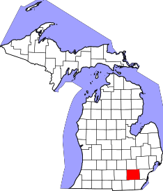 | |
| Villages | ||
| Charter townships | ||
| General law townships | ||
| CDPs | ||
| Unincorporated communities | ||
| Footnotes | ‡This populated place also has portions in an adjacent county or counties | |