Schaghticoke (town), New York
| Schaghticoke | |
|---|---|
| Town | |
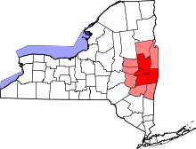
_highlighted.svg.png) Location in Rensselaer County and the state of New York. | |
| Coordinates: 42°52′50″N 73°36′35″W / 42.88056°N 73.60972°WCoordinates: 42°52′50″N 73°36′35″W / 42.88056°N 73.60972°W | |
| Country | United States |
| State | New York |
| County | Rensselaer |
| Settled | 1668 |
| Incorporated | 1788 |
| Government | |
| • Town Clerk | Janet Salisbury |
| Area | |
| • Total | 51.9 sq mi (134.3 km2) |
| • Land | 49.9 sq mi (129.3 km2) |
| • Water | 2.0 sq mi (5.1 km2) |
| Elevation | 377 ft (115 m) |
| Population (2010) | |
| • Total | 7,679 |
| • Density | 150/sq mi (57/km2) |
| Time zone | Eastern (EST) (UTC-5) |
| • Summer (DST) | EDT (UTC-4) |
| ZIP code | 12154 |
| Area code(s) | 518 |
| FIPS code | 36-65486 |
| GNIS feature ID | 0979467 |
| Website | Town of Schaghticoke, NY |
Schaghticoke /ˈskætᵻkoʊk/ SKAT-ə-kohk is a town in Rensselaer County, New York, United States. The population was 7,679 at the 2010 census.[1] It was named for the Schaghticoke, a Native American tribe formed in the seventeenth century from an amalgamation of remnant peoples of eastern New York and New England. The tribe has one of the oldest reservations in the United States, located in what is now Litchfield County, Connecticut. It has been recognized by the state of Connecticut but has not yet achieved federal recognition.
The town is on the northern border of the county, north of Troy. The town contains a village, also called Schaghticoke, and part of the village of Valley Falls.
History
This area was historically occupied by the Mohican tribe, and later by a mixed group of Mohicans, and remnants of numerous New England tribes who had migrated west seeking to escape European encroachment.
In 1675, Governor Andros, governor of the colony of New York, planted a tree of Welfare near the junction of the Hoosic River and Tomhannock Creek, and area already know as Schaghticoke, "the place where the waters mingle." This tree symbolized the friendship between the English and the Dutch, and the Schaghticoke Indians. The Indians were Mohican refugees from New England welcomed to Schaghticoke because they agreed to help protect the English from the French and the Iroquois. They stayed until 1754.
Until the Revolutionary War, Schaghticoke was part of the colony of New York with most of its citizens governed by the city of Albany, which owned the land they rented.
Originally, Schaghticoke was a dangerous place to live because they were frequently raided by the Indians and Tories. This led to the slow settlement of the Schaghticoke land. Once the land was fully settled it was apart of Albany County, until 1791 when Rensselaer County was formed.
After the revolution many immigrants came from England and Ireland to settle in Schaghticoke. The town flourished near the water powered mills created in the town on the Hoosic River. The town was mainly agricultural. There were many farmers residing in Schaghticoke who made crops for local industries.
The Knickerbocker Mansion was listed on the National Register of Historic Places in 1972.[2]
Today Schaghticoke still has a strong agriculture presence. However, it is becoming increasingly more residential, political and becoming plagued by economic issues.
Geography
According to the United States Census Bureau, the town has a total area of 51.9 square miles (134.3 km²), of which, 49.9 square miles (129.3 km²) of it is land and 2.0 square miles (5.1 km²) of it (3.76%) is water.
The north town line is the border of Washington County, and the west town line, defined by the Hudson River, is the border of Saratoga County.
The Hoosic River flows through the town to the Hudson River at the west town line.
Demographics
| Historical population | |||
|---|---|---|---|
| Census | Pop. | %± | |
| 1820 | 2,522 | — | |
| 1830 | 3,002 | 19.0% | |
| 1840 | 3,389 | 12.9% | |
| 1850 | 3,290 | −2.9% | |
| 1860 | 2,929 | −11.0% | |
| 1870 | 3,125 | 6.7% | |
| 1880 | 3,591 | 14.9% | |
| 1890 | 3,059 | −14.8% | |
| 1900 | 2,631 | −14.0% | |
| 1910 | 2,780 | 5.7% | |
| 1920 | 2,177 | −21.7% | |
| 1930 | 3,006 | 38.1% | |
| 1940 | 3,246 | 8.0% | |
| 1950 | 4,019 | 23.8% | |
| 1960 | 5,269 | 31.1% | |
| 1970 | 6,220 | 18.0% | |
| 1980 | 7,094 | 14.1% | |
| 1990 | 7,574 | 6.8% | |
| 2000 | 7,456 | −1.6% | |
| 2010 | 7,679 | 3.0% | |
| Est. 2014 | 7,658 | [3] | −0.3% |
As of the census[1] of 2000, there were 7,456 people, 2,714 households, and 2,103 families residing in the town. The population density was 149.4 people per square mile (57.7/km²). There were 2,823 housing units at an average density of 56.6 per square mile (21.8/km²). The racial makeup of the town was 97.57% White, 1.26% Black or African American, 0.17% Native American, 0.36% Asian, 0.13% from other races, and 0.50% from two or more races. Hispanic or Latino of any race were 0.66% of the population.
There were 2,714 households out of which 35.8% had children under the age of 18 living with them, 64.2% were married couples living together, 8.7% had a female householder with no husband present, and 22.5% were non-families. 17.7% of all households were made up of individuals and 8.1% had someone living alone who was 65 years of age or older. The average household size was 2.75 and the average family size was 3.12.
In the town the population was spread out with 26.3% under the age of 18, 6.5% from 18 to 24, 29.3% from 25 to 44, 25.5% from 45 to 64, and 12.5% who were 65 years of age or older. The median age was 38 years. For every 100 females there were 98.7 males. For every 100 females age 18 and over, there were 95.3 males.
The median income for a household in the town was $48,393, and the median income for a family was $57,423. Males had a median income of $40,574 versus $27,078 for females. The per capita income for the town was $20,673. About 3.4% of families and 4.7% of the population were below the poverty line, including 4.0% of those under age 18 and 8.3% of those age 65 or over.
Communities and locations in the town
- East Schaghticoke – A location south of Schaghticoke village.
- Grant Hollow – A hamlet northeast of Troy and Spiegletown on Route 40.
- Hemstreet Park – A location at the west town line at the Hudson River that is a suburb of Mechanicville.
- Melrose – A hamlet northeast of Grant Hollow on Route 40.
- Pleasantdale – A suburban community north of Troy.
- Reynolds – A hamlet in the western part of the town.
- Schaghticoke – A village.
- Schaghticoke Hill – A hamlet south of Schaghticoke village on Route 40.
- Speigletown – A hamlet northeast of Troy on Route 40.
- Valley Falls – A village, a small part of which is located in the town near Schaghticoke village.
References
- 1 2 "American FactFinder". United States Census Bureau. Retrieved 2008-01-31.
- ↑ National Park Service (2010-07-09). "National Register Information System". National Register of Historic Places. National Park Service.
- ↑ "Annual Estimates of the Resident Population for Incorporated Places: April 1, 2010 to July 1, 2014". Retrieved June 4, 2015.
- ↑ "Census of Population and Housing". Census.gov. Retrieved June 4, 2015.
Further reading
- Anderson, George Baker (1897). Landmarks of Rensselaer County New York. Syracuse, New York: D. Mason and Company. OCLC 1728151.
- Hayner, Rutherford (1925). Troy and Rensselaer County New York: A History. New York: Lewis Historical Publishing Company, Inc. OCLC 22524006.
- Sylvester, Nathaniel Bartlett (1880). History of Rensselaer Co., New York with Illustrations and Biographical Sketches of its Prominent Men and Pioneers. Philadelphia: Everts & Peck. OCLC 3496287.
- Weise, Arthur James (1880). History of the Seventeen Towns of Rensselaer County from the Colonization of the Manor of Rensselaerwyck to the Present Time. Troy, New York: J. M. Francis & Tucker. OCLC 6637788.
External links
| Wikimedia Commons has media related to Schaghticoke (town), New York. |
Municipalities and communities of Rensselaer County, New York, United States | ||
|---|---|---|
| Cities | 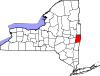 | |
| Towns | ||
| Villages | ||
| CDPs | ||
| Other hamlets | ||