Scalby, North Yorkshire
Coordinates: 54°18′00″N 0°26′54″W / 54.299947°N 0.448427°W
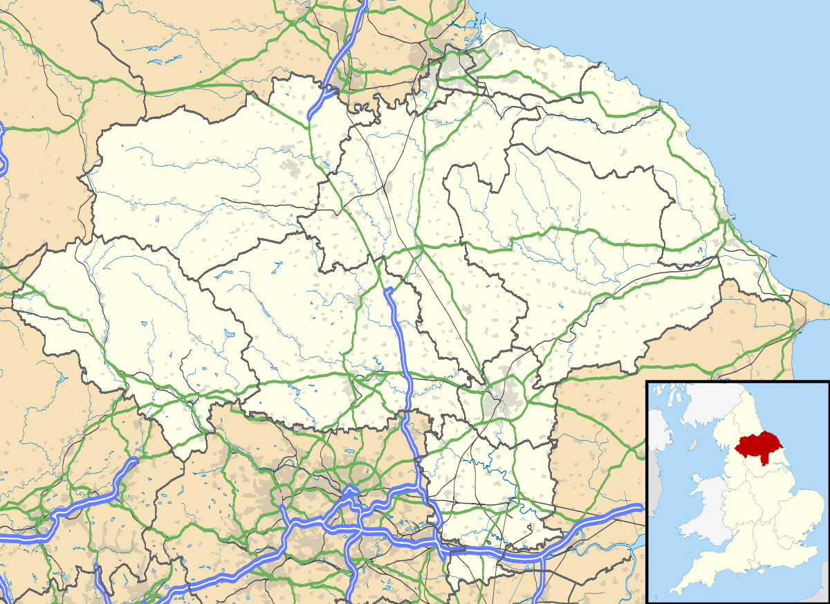
Scalby, a village on the north edge of Scarborough, North Yorkshire, England, is part of the civil parish of Newby and Scalby. From 1902 to 1974, Scalby was an urban district in the North Riding of Yorkshire.
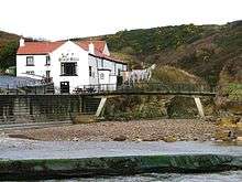
Scalby is 2.5 miles (4.0 km) north of Scarborough,[1] and is separated from the town's suburbs by the Scalby Beck, which flows to the North Sea at Scalby Mills. Scalby is a village which is bisected by the A171 Scarborough to Whitby road. The older part of the village is west of the main crossroads and is focussed around a small but busy High Street. There are two pubs, a newsagent (replaced by a beauty salon in October 2013), village store, two restaurants and a local hair salon. In addition there is Scalby Methodist Chapel and the Church Rooms.
History
The name Scalby derives from Scalli's Village, Scalli being and old Scandanavian name.[2]
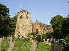
The parish church of Scalby is St Laurence's. The church is the oldest recorded building in the village. Records show its presentation in 1150 by Eustace Fitz John. The chancel arch and pillars are of that time and the first recorded priest, inducted in 1238, was Henry Devon. It is designated a Grade II* listed building.[3]
In modern times, as an artificial flood relief channel, much of the flow of the River Derwent (which drains a large area of the North York Moors into the Vale of Pickering) has been diverted, (about 6 miles (10 km) upstream of West Ayton and before it reaches the plain of the Vale of Pickering), into a new channel called the Sea Cut which runs east along a previously dry side valley (probably a glacial overflow channel) and into the existing Scalby Beck.
Transport
Scalby has two A roads running through it (the A165 and the A171); both go south to Scarborough and both meet up just north of Scalby at Burniston and continue as the A171 road to Whitby and Teesside.[1] The A165 is further east in the parish passing through the Scalby Mills area.
Scalby has one railway station at Scalby Mills on the narrow gauge North Bay Railway. Services leave to Peasholm Park in Scarborough's North Bay. The village used to have a station on the now closed Scarborough to Whitby Railway.[4] The station at Scalby closed in 1953, some 12 years before the other stations (and the line itself) closed down as a result of the Beeching Axe.[5]
There is a regular (half hourly) bus service to and from Scarborough with many going on to Cloughton, Ravenscar and Whitby. Another bus service operates a circular pattern that links the village with the Sea Life Centre and the railway station in Scarborough.[6]
Local government
Originally, Scalby had its own Urban District Council which was operational between 1902 and 1974 when Scalby came under Scarborough District Council. When the UDC was abolished, the Parish Council came into effect.[7] Scalby belongs to the ward of Scalby, Hackness and Staintondale, which the 2001 census records as having a population of 3,953 over an expanse of 10,186 hectares. Scalby has been twinned with the village of Pornic in north-west France, since 1989.[8]
Sport and leisure
The village is well served by sports facilities. Scalby Tennis Club is located to the east of the junction of the A171 and Station Road. The club has two floodlit courts and further use of two public courts adjacent to the private courts. Additionally there is the Scalby & Newby Lawn Bowling club which shares the site and the clubhouse. On a small hill behind the western limits of the village is the location of Scalby Cricket Club (Carr Lane playing fields which are held in trust by the Parish Council). During the winter months this doubles as a football pitch.
In January 2009, Scarborough Rugby club moved from their old grounds in Newby to a new purpose-built club on the northern edge of Scalby, adjacent to the A171.[9]
The village has a number of B&Bs and holiday cottages along with the prominent Wrea Head Country Hotel, built in 1881.[10]
The 48 miles (77 km) Tabular Hills Walk starts at Scalby Mills and goes westwards tracing the southern extent of the North York Moors park and finishes in Helmsley.[11]
Notable people
- Edward Charles Booth – Edwardian novelist whose books about the East Riding were compared to the Wessex novels by Thomas Hardy.[12]
References
- 1 2 "101" (Map). Scarborough & Bridlington (D2 ed.). 1:50,000. Landranger. Ordnance Survey. 2006. ISBN 9780319229057.
- ↑ Ayto, John; Crofton, Ian (2005). Brewer's Britain & Ireland. London: Wiedenfield & Nicholson. p. 974. ISBN 0-304-35385-X.
- ↑ Historic England. "Church of St Laurence (1148211)". National Heritage List for England. Retrieved 26 November 2013.
- ↑ "Scalby". Disused Stations. Retrieved 31 October 2016.
- ↑ Lidster, Robin (2011). Scarborough & Whitby Railway (2 ed.). Stroud: Amberley Publishing. p. 35. ISBN 978-1-84868-668-7.
- ↑ "Transport in North Yorkshire". North Yorks Travel. Retrieved 31 October 2016.
- ↑ "Home". Newby & Scalby Parish Council. Retrieved 31 October 2016.
- ↑ "Twenty-one years of happy twinning". The Scarborough News. 7 July 2010. Retrieved 30 October 2016.
- ↑ "Rugby club's move to be a limited company". The Scarborough News. 28 May 2010. Retrieved 31 October 2016.
- ↑ "Wrea Head Hall". Welcome to Wrea Head Hall. Retrieved 31 October 2016.
- ↑ "The Tabular Hills Walk". National Trails. Retrieved 31 October 2016.
- ↑ "Scalby Conservation Area" (PDF). North York Moors.org. Scarborough Borough Council. 7 January 2008. p. 23. Retrieved 29 October 2016.
External links
| Wikimedia Commons has media related to Scalby, North Yorkshire. |