Hazel Dell, Washington
| Hazel Dell, Washington | |
|---|---|
| Census-designated place | |
 Hazel Dell | |
| Coordinates: 45°40′17″N 122°39′46″W / 45.67139°N 122.66278°WCoordinates: 45°40′17″N 122°39′46″W / 45.67139°N 122.66278°W | |
| Country | United States |
| State | Washington |
| County | Clark |
| Area | |
| • Total | 4.85 sq mi (12.56 km2) |
| • Land | 4.84 sq mi (12.53 km2) |
| • Water | 0.01 sq mi (0.03 km2) |
| Elevation | 205 ft (62 m) |
| Population (2010) | |
| • Total | 19,435 |
| • Density | 4,017/sq mi (1,551.0/km2) |
| Time zone | Pacific (PST) (UTC-8) |
| • Summer (DST) | PDT (UTC-7) |
| FIPS code | 53-30305[1] |
| GNIS feature ID | 1512285[2] |
Hazel Dell is an unincorporated area and census-designated place (CDP) in Clark County, Washington, United States, located north and west of Vancouver. As of the 2010 census the population was 19,435.[1] Previous censuses divided the community into two areas, Hazel Dell North and Hazel Dell South.
Geography
The area runs parallel to and is bisected by Interstate 5, with access from exits 4 and 5. The community is bounded by the Vancouver city limits on the south in the vicinity of Burnt Bridge Creek, Lake Shore to the west, Salmon Creek to the north, I-205/Barberton to the northeast, and Walnut Grove to the east. Vancouver Lake is a short distance to the west of the area, and the community of Minnehaha is to the southeast. According to the United States Census Bureau, the Hazel Dell CDP has a total area of 4.9 square miles (12.6 km2), of which 0.01 square miles (0.03 km2), or 0.27%, is water.[1]
Much of Hazel Dell is occupied by businesses and working class homes, in well established neighborhoods. The main business portion follows NE Highway 99, just east of I-5, generally, from 63rd to 99th Street, with businesses east and west of Highway 99 on NE 78th and 99th streets. There are a few businesses and shopping centers on NE Hazel Dell Avenue, just west of I-5, scattered from 63rd to 99th Street. Hazel Dell's business and services include several retail, restaurant, and grocery chains, convenience stores, used car dealerships, auto parts stores, pawn shops, taverns, lounges and pubs, and motels, as well as many other franchise eateries, several banks and realty, medical and dental offices.
Municipal services
Law enforcement for the community of Hazel Dell is provided by the Clark County Sheriff's Office, and the local crime rate is typical for a neighborhood of its size and population density.[3] Fire Station 61 on Hazel Dell Avenue operates as part of Clark County Fire District 6 and provides fire-fighting services to Hazel Dell and neighboring communities.[4] Hazel Dell has its own sewer district as well.
Parks
Construction of Kate and Clarence LaLonde Neighborhood Park was to begin in early July 2010.[5]
Hazel Dell Community Park is located along NE 68th Street.
Schools
Hazel Dell Elementary School is a kindergarten through 5th grade elementary school located within the residential area of south Hazel Dell[6] and is part of the Vancouver School District. The school is home to the "Panthers". The current principal is Woody Howard.[7]
Sacajawea Elementary School is a kindergarten through 5th grade elementary school located within a residential area of northwest Hazel Dell, and is part of the Vancouver School District. The school is home to the "Skyhawks".[8]
Sarah J. Anderson Elementary School is a kindergarten through 5th grade elementary school located within a residential area of northeast Hazel Dell and is part of the Vancouver School District. The school is home to the "Pioneers".[9] The current principal is Lucy Estrada-Guzman.[10]
Toponymy and history
Oregon Country pioneers Reese and Sarah J. Anderson were Hazel Dell's first settlers. Sarah named the area after a stand of filberts on their land near what is today 78th Street and Highway 99. She also donated the land for the first school in Hazel Dell. The name "Bear Gulch" was briefly considered by the early Hazel Dell residents.[11]
Hazel Dell and Minnehaha were two of the first suburban areas to be developed after World War II and were followed by Lake Shore, Felida, and Salmon Creek. Much of the housing boom in this area has subsided due to the increase of homes being built to the east of Vancouver, between Interstate 205 and Camas and Washington State Route 500/Fourth Plain Boulevard and the Columbia River.
Until the late 1960s, it was not uncommon to see dairy cattle where there are now shopping centers, along I-5. Children during that time made money for school clothes and summer activities by picking raspberries, strawberries, beans and other vegetables. After the child labor laws went into effect, restricting children under 12 from working, most farm owners turned to "direct to customer" U-pick. There are now only a handful of small acreage farms left in Hazel Dell and no dairies at all.
Hazel Dell Parade of Bands
Every spring since 1964, Hazel Dell has hosted the "Parade of Bands". The parade route follows Hwy 99 North to 78th Street, west to Hazel Dell Avenue, south to 63rd Street and back to Highway 99. The parade was first organized and sponsored by Harvey Johnson and family who owned the Steakburger Drive-in restaurant on Highway 99.[12]
Hazel Dell citizens
Local business leaders once considered changing the name to "Basilville" in honor of enterprising merchant Basil Dhanens. With thanks, Dhanens declined the offer. He died in 1972.[13]
References
- 1 2 3 "Geographic Identifiers: 2010 Demographic Profile Data (G001): Hazel Dell CDP, Washington". U.S. Census Bureau, American Factfinder. Retrieved September 1, 2015.
- ↑ U.S. Geological Survey Geographic Names Information System: Hazel Dell, Washington
- ↑ "Clark County MapsOnline." Clark County GIS - Geographic Information System - Clark County Washington. Clark County, Washington, n.d. Web. 10 July 2010. <http://gis.clark.wa.gov/imfmol/imf.jsp?site=pub_crime>.
- ↑ "Service Area of Fire District 6." Clark County Fire District 6. N.p., n.d. Web. 10 July 2010. <http://ccfd6.org/servicearea.html>.
- ↑ "Vancouver-Clark Washington Parks & Recreation: Greater Clark Parks District." Vancouver-Clark Washington Parks & Recreation: Greater Clark Parks District. N.p., n.d. Web. 10 July 2010. <http://www.clarkparks.org/projects/lalonde.htm>.
- ↑ "VANCOUVER PUBLIC SCHOOLS • 2007-08 BOUNDARY GUIDE - Hazel Dell Elementary School." Welcome to VSD. Vancouver School District, n.d. Web. 10 July 2010. <portalsso.vansd.org/pls/portal/docs/PAGE/VSD_HOME_PUBLIC/ZSCHOOL_INFORMATION/ELEMENTARY_SCHOOL_INFO_A_L/HAZEL%20DELL__SCHOOL_INFO/HAZEL%20DELL.PDF>.
- ↑ "Hazel Dell Elementary School." Welcome to VSD. N.p., n.d. Web. 10 July 2010. <http://portalsso.vansd.org/portal/page?_pageid=193,1678516,193_1678521&_dad=portal&_schema=PORTAL>.
- ↑ "Sacajawea Elementary School." Welcome to VSD. N.p., n.d. Web. 10 July 2010. <http://portalsso.vansd.org/portal/page?_pageid=193,1678583,193_1678585:193_1697400&_dad=portal&_schema=PORTAL>.
- ↑ "Anderson Elementary School." Welcome to VSD. N.p., n.d. Web. 10 July 2010. <http://portalsso.vansd.org/portal/page?_pageid=193,974959,193_1648608:193_1648612&_dad=portal&_schema=PORTAL>.
- ↑ "Washington State Report Card." Washington State Report Card. N.p., n.d. Web. 10 July 2010. <http://reportcard.ospi.k12.wa.us/summary.aspx?schoolId=516&OrgType=4&reportLevel=School&year=2008-09>.
- ↑ Jollota, Pat. Naming Clark County. Vancouver: Fort Vancouver Historical Society Of Clark County, 1993. Print.
- ↑ "Parade Packet." The Hazel Dell/Salmon Creek Business Assoc. N.p., n.d. Web. 10 July 2010. <http://www.hdscba.org/packet.html>.
- ↑ Columbian Staff (1989). "Profiles: Basil Dhanens". The Columbian. Retrieved 10 April 2012.
Municipalities and communities of Clark County, Washington, United States | ||
|---|---|---|
| Cities | 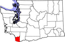 | |
| Town | ||
| CDPs | ||
| Other unincorporated communities | ||
| Footnotes | ‡This populated place also has portions in an adjacent county or counties | |