Santa Teresita, Batangas
| Santa Teresita | ||
|---|---|---|
| Municipality | ||
 | ||
| ||
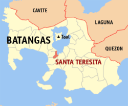 Map of Batangas showing the location of Santa Teresita | ||
.svg.png) Santa Teresita Location within the Philippines | ||
| Coordinates: 13°53′N 120°58′E / 13.88°N 120.97°ECoordinates: 13°53′N 120°58′E / 13.88°N 120.97°E | ||
| Country | Philippines | |
| Region | CALABARZON (Region IV-A) | |
| Province | Batangas | |
| District | 3rd District | |
| Founded | 1915 | |
| Barangays | 17 | |
| Government[1] | ||
| • Mayor | Aurea V. Segunial | |
| Area[2] | ||
| • Total | 16.3 km2 (6.3 sq mi) | |
| Population (2015 census)[3] | ||
| • Total | 21,127 | |
| • Density | 1,300/km2 (3,400/sq mi) | |
| Time zone | PST (UTC+8) | |
| ZIP code | 4206 | |
| Dialing code | +63 (0)43 | |
| Income class | 5th class | |

Santa Teresita (also spelled as Sta. Teresita) is a fourth class municipality in the province of Batangas, Philippines. According to the 2015 census, it has a population of 21,127 people.[3]
Sta. Teresita is situated along the southern lakeshore area of Taal Lake. Its boundaries are San Nicolas in the north, San Luis on the south, Taal on the west and Taal Lake on the northeast.
Barangays
Santa Teresita is politically subdivided into 17 barangays, three classified as urban and 14 as rural.[2]
| PSGC | Barangay | Population | ±% p.a. | ||
|---|---|---|---|---|---|
| 2015[3] | 2010[4] | ||||
| 041027001 | Antipolo | 3.6% | 768 | 696 | +1.89% |
| 041027002 | Bihis | 7.5% | 1,584 | 1,373 | +2.76% |
| 041027003 | Burol | 3.2% | 667 | 454 | +7.60% |
| 041027004 | Calayaan | 9.8% | 2,060 | 1,902 | +1.53% |
| 041027005 | Calumala | 6.4% | 1,346 | 1,289 | +0.83% |
| 041027006 | Cuta East | 5.6% | 1,185 | 991 | +3.46% |
| 041027007 | Cutang Cawayan | 3.5% | 733 | 510 | +7.15% |
| 041027008 | Irukan | 3.0% | 637 | 598 | +1.21% |
| 041027009 | Pacifico | 9.2% | 1,945 | 1,680 | +2.83% |
| 041027010 | Poblacion I | 7.9% | 1,662 | 1,483 | +2.19% |
| 041027012 | Saimsim | 12.9% | 2,730 | 1,910 | +7.04% |
| 041027013 | Sampa | 6.1% | 1,295 | 1,172 | +1.92% |
| 041027014 | Sinipian | 4.3% | 898 | 705 | +4.72% |
| 041027015 | Tambo Ibaba | 4.6% | 976 | 683 | +7.03% |
| 041027016 | Tambo Ilaya | 4.4% | 920 | 580 | +9.18% |
| 041027017 | Poblacion II | 5.6% | 1,180 | 986 | +3.48% |
| 041027018 | Poblacion III | 2.6% | 541 | 403 | +5.77% |
| Total | 21,127 | 17,415 | +3.75% | ||
Demographics
| Population census of Santa Teresita | ||
|---|---|---|
| Year | Pop. | ±% p.a. |
| 1990 | 12,005 | — |
| 1995 | 14,017 | +2.95% |
| 2000 | 14,074 | +0.09% |
| 2007 | 16,891 | +2.55% |
| 2010 | 17,415 | +1.12% |
| 2015 | 21,127 | +3.75% |
| Source: Philippine Statistics Authority[3][4] | ||
The population of Santa Teresita, Batangas, in the 2015 census was 21,127 people,[3] with a density of 1,300 inhabitants per square kilometre or 3,400 inhabitants per square mile.
References
- ↑ "Official City/Municipal 2013 Election Results". Intramuros, Manila, Philippines: Commission on Elections (COMELEC). 11 September 2013. Retrieved 11 November 2013.
- 1 2 "Province: BATANGAS". PSGC Interactive. Makati City, Philippines: National Statistical Coordination Board. Retrieved 11 November 2013.
- 1 2 3 4 5 "Region IV-A (CALABARZON)". Census of Population (2015): Total Population by Province, City, Municipality and Barangay (Report). PSA. Retrieved 20 June 2016.
- 1 2 "Region IV-A (CALABARZON)". Census of Population and Housing (2010): Total Population by Province, City, Municipality and Barangay (Report). NSO. Retrieved 29 June 2016.
External links
| Wikimedia Commons has media related to Santa Teresita, Batangas. |
 |
San Nicolas | |
Taal Lake | |
| Taal | |
Alitagtag | ||
| ||||
| | ||||
| San Luis |
Batangas (capital) | |
| Municipalities | |
| Component cities | |
This article is issued from Wikipedia - version of the 12/2/2016. The text is available under the Creative Commons Attribution/Share Alike but additional terms may apply for the media files.