Santa Nella, California
| Santa Nella Santa Nella Village[1] | |
|---|---|
| Census designated place | |
 Santa Nella Location in California | |
| Coordinates: 37°05′52″N 121°01′01″W / 37.09778°N 121.01694°WCoordinates: 37°05′52″N 121°01′01″W / 37.09778°N 121.01694°W | |
| Country |
|
| State |
|
| County | Merced |
| Area[2] | |
| • Total | 4.561 sq mi (11.812 km2) |
| • Land | 4.561 sq mi (11.812 km2) |
| • Water | 0 sq mi (0 km2) 0% |
| Elevation[1] | 154 ft (47 m) |
| Population (April 1, 2010) | |
| • Total | 1,380 |
| • Density | 300/sq mi (120/km2) |
| Time zone | Pacific (UTC-8) |
| • Summer (DST) | PDT (UTC-7) |
| ZIP code | 95322 |
| Area code | 209 |
| GNIS feature IDs | 1659597, 2583129 |
| U.S. Geological Survey Geographic Names Information System: Santa Nella, California; U.S. Geological Survey Geographic Names Information System: Santa Nella, California | |
Santa Nella (formerly Santa Nella Village[1]) is a census-designated place[3][4] in Merced County, California. It is located 11 miles (18 km) east-northeast of Pacheco Pass,[5] at an elevation of 154 feet (47 m),[1] At the 2010 census, Santa Nella had a population of 1,380 people.[6]
Nomenclature
The name does not refer to a saint, as there is no "Saint Nella". It appears to have been formed from the Spanish centinela ("sentinel"), referring to the earlier Centinela Adobe that was located in the vicinity.[7]
History

Santa Nella began as the site of Rancho de Centinela (Sentinel Ranch) first established by pioneering stockmen from San Juan Bautista and Monterey as place to raise horses in 1810. The former Centinela Adobe, a one-story adobe built as living quarters for the ranch was located on the El Camino Viejo a Los Ángeles about 3 miles downstream from the site of the later San Luis Adobe (now under the San Luis Reservoir), at the east end of the Pacheco Pass road, situated on the south bank of Arroyo de San Luis Gonzaga. The escape of many of the horses into the valley and subsequent Indian hostilities made the enterprise a failure.
The land and adobe of this old Spanish ranch was included in the Rancho San Luis Gonzaga in 1843. From the time of the California Gold Rush the stage road from Hill's Ferry crossed the San Luis Creek at Centinella on the way to connect with the Pacheco Pass road at Rancho San Luis. The old Centinela ranch became a stopping place for stages and travelers on El Camino Viejo. Later a two-story adobe house was constructed near the old adobe by Basque sheepmen in the 1860s and a wooden barn in the 1870s. The two story adobe was subsequently torn down in the 1890s and replaced by a frame house built by Miller and Lux. This house and barn were for a long time local landmarks.[8] However by 1966, the wooden house and barn had been removed and a roadside stop built on the site along State Route 33. The name of the place had been corrupted into Santa Nella.[9]
The community was entered into the Geographic Names Information System in 1981 as Santa Nella Village.[1] In 2010, it became a census-designated place under the Santa Nella name.[3]
Geography
According to the United States Census Bureau, the CDP covers an area of 4.6 square miles (11.8 km²), all of it land.
Interstate 5 intersects with State Route 33 in Santa Nella. State Route 152, a major east-west highway connecting nearby Los Banos with the Santa Clara Valley, runs south of town. Services that cater to travelers in Santa Nella include Pea Soup Andersen's Restaurant, as well as several fast food outlets, including In N Out, motels and gas stations.
The San Joaquin Valley National Cemetery, including the California Korean War Veterans Memorial, is located just outside Santa Nella, on McCabe Road. In addtition, the San Luis Reservoir and Forebay Golf Course are nearby.[10]
Transportation
Santa Nella is served by Merced County's "The Bus". The bus stops at the Village Market at 8:45 a.m., 12:45 p.m., and 3:45 p.m., and continues on to Los Banos.
Demographics
The 2010 United States Census[6] reported that Santa Nella had a population of 1,380. The population density was 302.6 people per square mile (116.8/km²). The racial makeup of Santa Nella was 832 (60.3%) White, 22 (1.6%) African American, 25 (1.8%) Native American, 31 (2.2%) Asian, 0 (0.0%) Pacific Islander, 433 (31.4%) from other races, and 37 (2.7%) from two or more races. Hispanic or Latino of any race were 968 persons (70.1%).
The Census reported that 1,380 people (100% of the population) lived in households, 0 (0%) lived in non-institutionalized group quarters, and 0 (0%) were institutionalized.
There were 409 households, out of which 209 (51.1%) had children under the age of 18 living in them, 233 (57.0%) were opposite-sex married couples living together, 52 (12.7%) had a female householder with no husband present, 34 (8.3%) had a male householder with no wife present. There were 20 (4.9%) unmarried opposite-sex partnerships, and 3 (0.7%) same-sex married couples or partnerships. 70 households (17.1%) were made up of individuals and 17 (4.2%) had someone living alone who was 65 years of age or older. The average household size was 3.37. There were 319 families (78.0% of all households); the average family size was 3.84.
The population was spread out with 468 people (33.9%) under the age of 18, 136 people (9.9%) aged 18 to 24, 380 people (27.5%) aged 25 to 44, 303 people (22.0%) aged 45 to 64, and 93 people (6.7%) who were 65 years of age or older. The median age was 30.4 years. For every 100 females there were 120.1 males. For every 100 females age 18 and over, there were 109.7 males.
There were 493 housing units at an average density of 108.1 per square mile (41.7/km²), of which 226 (55.3%) were owner-occupied, and 183 (44.7%) were occupied by renters. The homeowner vacancy rate was 14.4%; the rental vacancy rate was 8.0%. 686 people (49.7% of the population) lived in owner-occupied housing units and 694 people (50.3%) lived in rental housing units.
Government
In the California State Legislature, Santa Nella is in the 12th Senate District, represented by Republican Anthony Cannella, and in the 21st Assembly District, represented by Democrat Adam Gray.[11]
In the United States House of Representatives, Santa Nella is in California's 16th congressional district, represented by Democrat Jim Costa.[12]
References
- 1 2 3 4 5 U.S. Geological Survey Geographic Names Information System: Santa Nella Village
- ↑ "2010 Census U.S. Gazetteer Files – Places – California". United States Census Bureau.
- 1 2 U.S. Geological Survey Geographic Names Information System: Santa Nella, California
- ↑ Thaddeus Miller, "Public Meeting in Santa Nella Brings Praise," Merced Sun-Star, April 22, 2013
- ↑ Durham, David L. (1998). California's Geographic Names: A Gazetteer of Historic and Modern Names of the State. Clovis, Calif.: Word Dancer Press. p. 825. ISBN 1-884995-14-4.
- 1 2 "2010 Census Interactive Population Search: CA - Santa Nella CDP". U.S. Census Bureau. Retrieved July 12, 2014.
- ↑ Bright, William (1998). 1500 California Place Names: Their Origin and Meaning, p. 20. Berkeley, California: University of California Press. ISBN 0-520-21271-1.
- ↑ Mildred Brooke Hoover, Hero Eugene Rensch, Ethel Grace Rencsh, William N. Abeloe, Historic Spots In California: Valley and Sierra Counties, Stanford University, Stanford, 1933, p.189
- ↑ Mildred Brooke Hoover, Hero Eugene Rensch, Ethel Grace Rensch, William N. Abeloe, Historic Spots In California, Third Edition, Stanford University, Stanford, 1966, p.203
- ↑ Super 8 Santa Nella CA Santa Nella California
- ↑ "Statewide Database". UC Regents. Retrieved November 21, 2014.
- ↑ "California's 16th Congressional District - Representatives & District Map". Civic Impulse, LLC. Retrieved October 1, 2014.
External links
- Santa Nella Chamber of Commerce
- Pea Soup Andersen's website
- Information on Rancho Centinella by the historian Frank Forrest Latta
Municipalities and communities of Merced County, California, United States | ||
|---|---|---|
| Cities | 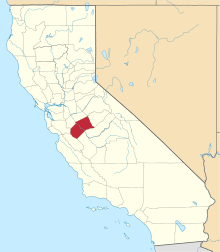 | |
| CDPs | ||
| Unincorporated communities | ||
| Ghost towns |
| |