Santa Catarina da Fonte do Bispo
| Santa Catarina da Fonte do Bispo | ||
|---|---|---|
| Parish | ||
|
The parish centre, with the parochial church of Santa Catarina | ||
| ||
 Santa Catarina da Fonte do Bispo | ||
| Coordinates: 37°09′14″N 7°47′20″W / 37.154°N 7.789°WCoordinates: 37°09′14″N 7°47′20″W / 37.154°N 7.789°W | ||
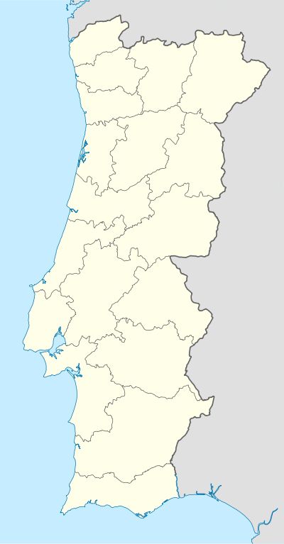
| Country | Portugal | |
| Region | Algarve | |
| Subregion | Algarve | |
| Intermunic. comm. | Algarve | |
| District | Faro | |
| Municipality | Tavira | |
| Area | ||
| • Total | 117.59 km2 (45.40 sq mi) | |
| Population (2011) | ||
| • Total | 1,809 | |
| • Density | 15/km2 (40/sq mi) | |
| Postal code | 8800 | |
| Area code | 281 | |
| Patron | Santa Catarina | |


Santa Catarina da Fonte do Bispo is a civil parish in the municipality of Tavira, in the Portuguese Algarve. The population in 2011 was 1,809,[1] in an area of 117.59 km².[2]
History
The oldest record from this region, the Cartório Notarial de Tavira (of 10 April 1601) identified the organized settlement of Santa Catarina. The church was erected sometime in the 15th century, and compliment the style of the parochial church of the Misericórida in Tavira, which itself was built at the end of the first half of that century. It is assumed that the parish was established sometime prior to the erection of the church. The oldest ecclesiastical records, the births, baptisms, marriages and deaths recorded from this parish correspond to evident from the Torre do Tombo, and situate the parish around 1632.
Fonte do Bispo was a toponomic name referenced as early as the 14th century. The parish was named from Saint Catherine of Alexandria, who perished in 307 AD, referring to a legend stating that an image of Catherine appeared at the fountain of the bishop (Portuguese: Fonte do Bispo): this gave rise to the regions name.
Created from the ecclesiastical parish in 1835, this local authority's records were lost prior to 1886.
Geography

Santa Catarina is a small agglomeration of homes, situated on the edge of the Tavira-Loulé roadway (the Estrada Nacional E.N. 270), approximately 11 kilometres (6.8 mi) from the urban centre of Tavira. The famous Fonte do Bispo is located some distance from this road, along the rocky cliffs.
The parish, is intimately associated with the region's soils. The southern part of the parish, south of the EN 270, is based in limestone, characterized by superficial deposits that extend from the sub-soils. To the north, and parallel the limestone areas, is a narrow strip of red sandstone, known as the grés de Silves, locally referred to as arneiro or pedra amoladeira. To the north of this zone is a mountainous schist zone, with heavily carved valleys and rounded ridges.
The limestone formation is named the Barrocal, and is occupied by orchards, olive trees, almond trees, figs and vineyards, in addition to the cultivation of cereal crops and legumes. The red sandstone grés de Silves has also been used by locals for planting orchards, irrigated by rainwater collected from the slopes of the ridges. The ridge, including areas of the Barrocal and Arneiro, are alluvial zones; the mountains around these areas produce wheat, barley, vineyards and olive orchards.
The Barrocal and Arneiro are zones of disperse settlements, homes isolated from one another, while in the mountain regions, the land is broken by more dense groupings of settlements. Consequently, a toponomic reference to sites (Portuguese: sítios) and mountain (Portuguese: montes) settlements prevail. A sítio is a determine area of the territory with disperse habitat, while the montes is a mountain-top locality, independent of the number of dwellings, but relying on its influence.
Architecture
- Market of Santa Catarina de Fonte do Bispo (Portuguese: Mercado de Santa Catarina de Fonte do Bispo), the Estado Novo-era market, was built in the nationalist style, by the architect Helbling for the Direcção dos Edifícios do Sul;[3]
- Manor of Bela Fria (Portuguese: Solar da Bela Fria/Palacete dos Vaz Velho), in the 18th century, Manuel Vaz Velho, once confectioner to the Royal Court (then cook) of John V, then knight in the Order of Christ by King Joseph, he was a resident of Tavira, ordering the construction of the manorhouse in Bela Fria; in 2003, public works were anticipated for the rehabilitation of the property in order to adapt its use as a tourist residence, forming the Sociedade Albargaria Solar da Bela Fria Lda[4]
References
- ↑ Instituto Nacional de Estatística
- ↑ Direção-Geral do Território
- ↑ Gordalina, Rosário; Agarez, Ricardo (2007), SIPA, ed., Mercado de Santa Catarina de Fonte do Bispo (PT050814040051) (in Portuguese), Lisbon, Portugal: SIPA – Sistema de Informação para o Património Arquitectónico, retrieved 14 February 2012
- ↑ Gordalina, Rosário (2011), SIPA, ed., Solar da Bela Fria/Palacete dos Vaz Velho (PT050814040056) (in Portuguese), Lisbon, Portugal: SIPA – Sistema de Informação para o Património Arquitectónico, retrieved 14 February 2012
Parishes of Tavira Municipality | ||
|---|---|---|