Sanriku Coast
The Sanriku Coast (三陸海岸 sanriku kaigan) is a coastal region on the Pacific Ocean, extending from southern Aomori prefecture,[1] through Iwate prefecture and northern Miyagi prefecture in northeastern Honshū, which is Japan's main island.[2] The name comes from the historical region of Sanriku (or "three riku"), referring to the former provinces of Rikuō, Rikuchū and Rikuzen.[3]
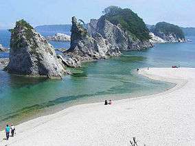
Tourist destination
There are the Tanesashi Coast, the Rikuchu Kaigan National Park and the Minami-Sanriku Kinkazan Quasi-National Park in the Sanriku Coast region.[4]
Earthquakes and tsunami

The bays of this ria coastline tend to amplify the destructiveness of tsunami waves.[5] Significant events which devastated coastal communities include:
- 869 Jogan Sanriku earthquake
- 1611 Keicho Sanriku earthquake
- 1896 Meiji-Sanriku earthquake
- 1933 Sanriku earthquake
- 2011 Tōhoku earthquake and tsunami
Prior to 2011, the tsunami history of Sanriku might have been interpreted as a story of progressively fewer casualties due to human intervention and planning. The 2011 disaster created a new baseline for analysis of regularly occurring tsunamis.[6]
See also
Notes
- ↑ Japan-i, Sanriku Coastline/Kamaishi Daikannon
- ↑ Japan Aerospace Exploration Agency, Sanriku Coast; Sanriku
- ↑ Nippon-Kichi, 三陸リアス式海岸 Sanriku-riasushiki-kaigan Saw-tooth Sanriku Coastline
- ↑ 種差海岸を国立公園に編入へ 環境省方針 (in Japanese). Daily Tohoku. October 5, 2010. Retrieved March 15, 2011.
- ↑ Satake, Kenji (2005). Tsunamis: Case Studies and Recent Developments. Advances in Natural and Technological Hazards Research (Book 23). Springer. p. 99. ISBN 1402033265.
- ↑ Clancy, Gregory. "Sanriku: Japan's 'Tsunami Coast'," The Telegraph (UK). March 14, 2011.
Coordinates: 39°58′14″N 141°57′15″E / 39.9706°N 141.9542°E