San Juan Comalapa
| San Juan Comalapa | |
|---|---|
| Municipality and town | |
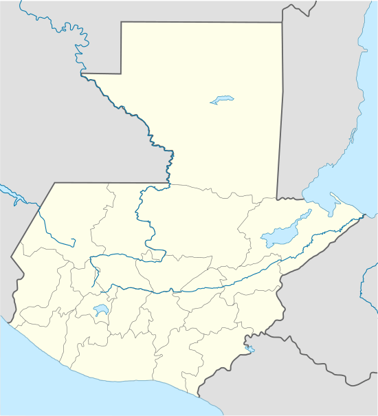 San Juan Comalapa Location in Guatemala | |
| Coordinates: 14°44′N 90°53′W / 14.733°N 90.883°W | |
| Country |
|
| Department |
|
| Government | |
| • Mayor (2016-2020) | Justo Rufino Simlox Pichiyá[1] |
| Time zone | Central Time (UTC+6) |
| Climate | Cwb |
San Juan Comalapa is a municipality in the Chimaltenango department of Guatemala.
San Juan Comalapa is sometimes called the "Florence of America", because of the many Kaqchikel painters living there. It is also the birthplace of Rafael Álvarez Ovalle, who composed Guatemala national anthem. The painting tradition started in the 1930s, when Kaqchikel painter Andrés Curruchich (1891–1969) started painting with oil. His creativity was noted so much that he started showing his art in the United States and achieved international success. Because of this, Curruchiche decided to teach the new generations his form of painting. Today there are some 500 painters in San Juan Comalapa, and the majority of them still use the techniques of Curruchiche. These painters are dedicated to paint the costums, life experiences and traditions of the Indian towns.
History
Spanish colony

In the 16th century, during the period of the Spanish conquest of Guatemala, the shore of the lake was the scene of a battle in which the Spanish and their Kaqchikel allies defeated the Tz'utujils. After the Spanish conquest of Guatemala, the Franciscans set up a church and monastery in Panajachel soon afterward, and used the town as a centre to convert the indigenous people of the region to the Roman Catholic faith. The original façade of the church still stands, and is considered one of the gems of the colonial style in Guatemala.
San Juan Comalapa was in charge of the franciscans, who had convents and doctrines in the area covered by the modern departaments of Sacatepéquez, Chimaltenango, Sololá, Quetzaltenango, Totonicapán, Suchitepéquez and Escuintla. The "Provincia del Santísimo Nombre de Jesús" (English:"Province of the most Holy Name of Jesus"), as the Franciscan area was then called, reached up to 24 convents.[2] By 1700, San Juan Comalapa had a convent with three priests, in charge of ca. 1800 people, one doctrine and eight cofradías.[2]
Since it had a convent, there was daily Mass attended by cofradías leaders and their wives, who kept lighted candles during most of the ceremony. Also daily, there was religious teaching for 6 year old girls and older starting at 2:00 pm and for boys of the same age starting at sunset; the class lasted for 2 hours and consisted on memorizing the church teaching and prayers and to make some exercises with the catechism and it was run by a priest or by elder natives, called "fiscales".[3] Adults attended Mass every Sunday and holiday and after mass, there were religious teachings in their own language.[3]
Lent was a time of the year when the friars prepared the natives thoroughly, using their own language to accomplish their goals; every Friday of Lent there was a procession following the Rosary steps all the way to the Calvary temple.[4]
In 1754, as part of the borbon reforms, the Franciscans where forced to, gave their doctrines to the secular clergy; thus, when archbishop Pedro Cortés y Larraz visited Panajachel in 1770, he described it as a curato.[5]
20th century
The town was much devastated by an earthquake in 1976. The town is home to the longest mural in Guatemala which chronicles the town's history from pre-Columbian times through colonization, the earthquake, the Guatemalan civil war, until the present.[6]
Sister cities

San Juan Comalapa has close ties to the city Stord in Norway, they are friendship cities.
Climate
San Juan Comalapa has a subtropical highland climate (Köppen: Cwb).
| Climate data for San Juan Comalapa | |||||||||||||
|---|---|---|---|---|---|---|---|---|---|---|---|---|---|
| Month | Jan | Feb | Mar | Apr | May | Jun | Jul | Aug | Sep | Oct | Nov | Dec | Year |
| Average high °C (°F) | 19.7 (67.5) |
20.8 (69.4) |
22.2 (72) |
23.0 (73.4) |
22.4 (72.3) |
20.7 (69.3) |
20.9 (69.6) |
21.4 (70.5) |
20.7 (69.3) |
20.2 (68.4) |
19.9 (67.8) |
19.58 (67.24) |
20.957 (69.728) |
| Daily mean °C (°F) | 14.0 (57.2) |
14.7 (58.5) |
16.0 (60.8) |
17.2 (63) |
17.5 (63.5) |
16.7 (62.1) |
16.6 (61.9) |
16.6 (61.9) |
16.3 (61.3) |
15.9 (60.6) |
14.8 (58.6) |
14.3 (57.7) |
15.88 (60.59) |
| Average low °C (°F) | 8.4 (47.1) |
8.6 (47.5) |
9.8 (49.6) |
11.4 (52.5) |
12.6 (54.7) |
12.8 (55) |
12.3 (54.1) |
11.9 (53.4) |
11.9 (53.4) |
11.6 (52.9) |
9.8 (49.6) |
8.8 (47.8) |
10.83 (51.47) |
| Average precipitation mm (inches) | 4 (0.16) |
6 (0.24) |
8 (0.31) |
37 (1.46) |
115 (4.53) |
296 (11.65) |
222 (8.74) |
228 (8.98) |
271 (10.67) |
147 (5.79) |
46 (1.81) |
9 (0.35) |
1,389 (54.69) |
| Source: Climate-Data.org[8] | |||||||||||||
Geographic location
San Juan Comapala is surrounded by Chimaltenango Department municipalities:[9]
 |
Santa Apolonia | San José Poaquil | | |
| Tecpán | |
San Martín Jilotepeque[9] | ||
| ||||
| | ||||
| Santa Cruz Balanyá | Zaragoza |
See also
-
 Guatemala portal
 -
 Geography portal
 - List of places in Guatemala
Notes and references
References
- ↑ "Alcaldes electos en el departamento de Chimaltenango". Municipalidades de Guatemala (in Spanish). Guatemala. 7 September 2015. Archived from the original on October 2, 2015. Retrieved 2 October 2015.
- 1 2 García Añoveros 1989, p. 891
- 1 2 García Añoveros 1989, p. 896
- ↑ García Añoveros 1989, p. 897
- ↑ Cortés y Larraz 2001, p. 409-412.
- ↑ Sethna, Cyrus. "The Woman Behind Guatemala's Longest Mural". quepasa.gt. Que Pasa? Magazine. Retrieved 8 December 2015.
- ↑ La Ilustración Guatemalteca 1897, p. 249.
- ↑ "Climate: San Juan Comalapa". Climate-Data.org. Retrieved 11 October 2015.
- 1 2 "Municipios del departamento de Chimaltenango". SEGEPLAN (in Spanish). Guatemala. Archived from the original on 7 July 2015. Retrieved 22 July 2015.
Bibliography
- Cortés y Larraz, Pedro (2001) [1770]. García, Jesús María; Blasco, Julio Martín, eds. Descripción Geográfico-Moral de la Diócesis de Goathemala. Corpus Hispanorum de Pace. Segunda Serie (in Spanish). Consejo Superior de Investigaciones Científicas. ISBN 9788400080013. ISSN 0589-8056.
- García Añoveros, Jesús (1989). "Las misiones franciscanas de la Mosquitia nicaragüense" (PDF). Actas del III Congreso Internacional sobre los franciscanos en el nuevo mundo (Siglo XVII) (in Spanish). Madrid, Spain: DEIMOS; Universidad Internacional de Andalucía.
Coordinates: 14°44′N 90°53′W / 14.733°N 90.883°W
External links
Capital: Chimaltenango | ||
| Municipalities |  | |