Sallum
| Sallum | |
|---|---|
 | |
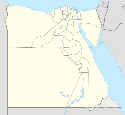 Sallum Location in Egypt | |
| Coordinates: 31°30′13″N 25°06′54″E / 31.50361°N 25.11500°ECoordinates: 31°30′13″N 25°06′54″E / 31.50361°N 25.11500°E | |
| Country |
|
| Governorate | Matruh |
| Elevation | 3 ft (1 m) |
| Population (2006) | |
| • Total | 14,393 |
| Time zone | EST (UTC+2) |
Sallum, As Sallum, or Sollum (Arabic: السلوم "Alternative", Egyptian Arabic pronunciation: [essælˈluːm], Latin: Catabathmus Maior; Plynos Limen; Tetrapyrgia) is a village in Egypt, near the Mediterranean Sea, east of the border with Libya, and around 145 km (90 mi) from Tobruk.
Sallum is mainly a Bedouin community. It has little if any tourist activity or organized historical curiosities. It is a regional trading center.
Sallum was the ancient Roman port of Baranis, and there are some Roman wells still remaining in the area. It rests on the Egyptian North Coast, but the location along the border with Libya, about as far west as one may travel in Egypt, means that it is out of the way of almost everything, with few attractions other than a World War II Commonwealth war cemetery. There is a local post office and a National Bank of Egypt branch.
History
Sallum is mentioned, in historical terms, to denote the extent of the initial Italian invasion into Egypt, from Libya, and the Italian Tenth Army built a series of forts in the vicinity of Sallum and Sidi Barrani.
There was fighting near Sallum in the Libyan-Egyptian War of 1977.
Sallum was a destination point during the total solar eclipse on March 29, 2006, as expeditions traveled to the best observation point. [1]
Climate
Köppen-Geiger climate classification system classifies its climate as hot desert (BWh), as the rest of Egypt, but typically as the northern coast of Egypt, has its temperatures moderated by blowing winds from the Mediterranean Sea.
| Climate data for Salum | |||||||||||||
|---|---|---|---|---|---|---|---|---|---|---|---|---|---|
| Month | Jan | Feb | Mar | Apr | May | Jun | Jul | Aug | Sep | Oct | Nov | Dec | Year |
| Record high °C (°F) | 30.3 (86.5) |
33.4 (92.1) |
37.4 (99.3) |
42.4 (108.3) |
44.2 (111.6) |
47.3 (117.1) |
41.7 (107.1) |
47.2 (117) |
43.0 (109.4) |
41.4 (106.5) |
36.6 (97.9) |
32.0 (89.6) |
47.3 (117.1) |
| Average high °C (°F) | 18.6 (65.5) |
19.6 (67.3) |
21.4 (70.5) |
24.2 (75.6) |
26.8 (80.2) |
30.0 (86) |
31.3 (88.3) |
31.1 (88) |
29.6 (85.3) |
27.4 (81.3) |
23.9 (75) |
20.2 (68.4) |
25.3 (77.5) |
| Daily mean °C (°F) | 13.8 (56.8) |
14.5 (58.1) |
16.1 (61) |
18.6 (65.5) |
21.2 (70.2) |
24.7 (76.5) |
26.2 (79.2) |
26.4 (79.5) |
25.0 (77) |
22.6 (72.7) |
18.9 (66) |
15.3 (59.5) |
20.3 (68.5) |
| Average low °C (°F) | 9.8 (49.6) |
10.3 (50.5) |
11.8 (53.2) |
14.1 (57.4) |
16.9 (62.4) |
20.3 (68.5) |
21.9 (71.4) |
22.3 (72.1) |
20.9 (69.6) |
18.5 (65.3) |
14.8 (58.6) |
11.3 (52.3) |
16.1 (61) |
| Record low °C (°F) | 3.7 (38.7) |
4.8 (40.6) |
6.1 (43) |
8.5 (47.3) |
9.9 (49.8) |
14.0 (57.2) |
18.0 (64.4) |
18.4 (65.1) |
15.4 (59.7) |
12.9 (55.2) |
7.3 (45.1) |
6.5 (43.7) |
3.7 (38.7) |
| Average precipitation mm (inches) | 21 (0.83) |
15 (0.59) |
7 (0.28) |
6 (0.24) |
2 (0.08) |
1 (0.04) |
0 (0) |
0 (0) |
0 (0) |
13 (0.51) |
10 (0.39) |
17 (0.67) |
92 (3.62) |
| Average precipitation days (≥ 1.0 mm) | 2.7 | 1.1 | 0.7 | 0.8 | 0.2 | 0.1 | 0.0 | 0.0 | 0.1 | 1.1 | 1.0 | 1.3 | 9.1 |
| Average relative humidity (%) | 59 | 58 | 59 | 58 | 60 | 59 | 62 | 65 | 64 | 62 | 59 | 59 | 60.3 |
| Mean monthly sunshine hours | 217.0 | 211.9 | 279.0 | 297.0 | 306.9 | 369.0 | 393.7 | 378.2 | 327.0 | 300.7 | 219.0 | 210.8 | 3,510.2 |
| Mean daily sunshine hours | 7.0 | 7.5 | 9.0 | 9.9 | 9.9 | 12.3 | 12.7 | 12.2 | 10.9 | 9.7 | 7.3 | 6.8 | 9.6 |
| Source #1: NOAA[2] | |||||||||||||
| Source #2: Arab Meteorology Book (sun only)[3] | |||||||||||||
See also
- Halfaya Pass
- Military history of Italy during World War II
- Military history of Egypt during World War II
Notes
- ↑ "Valoria La Buena annular eclipse expedition" (report), Solar Physics Group, Astrophysics Lab, University of Rome, January 10, 2007, webpage (mostly Italiano): ICRA-solar: mentions Sidi Barrani observation area.
- ↑ "Salloum Climate Normals 1961–1990". National Oceanic and Atmospheric Administration. Retrieved April 5, 2015.
- ↑ "Appendix I: Meteorological Data" (PDF). Springer. Retrieved January 17, 2016.
External links
- Photograph of twilight Sidi Barrani solar eclipse (Oct. 2005, copyright 2005-2007 Magyar Csillagászati Egyesület): Hungarian-foto Sidi-twilight (540x345, 38 KB).
- Photograph of solar eclipse at Sidi Barrani (Oct. 2005, copyright 2005-2007 Magyar Csillagászati Egyesület): Hungarian-foto Sidi-eclipse (9 kb).
- Photograph of Sidi Barrani observers (Oct. 2005, copyright 2005-2007 Magyar Csillagászati Egyesület): Hungarian-foto Sidi-people (50 kb).
- MSN Map