Salisbury, Maryland
| City of Salisbury | |||
|---|---|---|---|
| City | |||
|
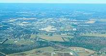
Main Street in Salisbury | |||
| |||
| Motto: The Comfortable Side of Coastal[1] | |||
 Location in Wicomico County and the state of Maryland | |||
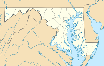 Salisbury  Salisbury Location within the state of Maryland | |||
| Coordinates: 38°21′57″N 75°35′36″W / 38.36583°N 75.59333°WCoordinates: 38°21′57″N 75°35′36″W / 38.36583°N 75.59333°W | |||
| Country | United States | ||
| State | Maryland | ||
| County | Wicomico | ||
| Founded | 1732 | ||
| Incorporated | 1854 | ||
| Government | |||
| • Type | Strong-mayor | ||
| • Mayor | Jacob R. Day (Democrat) | ||
| • City Council |
| ||
| Area[2] | |||
| • City | 13.87 sq mi (35.92 km2) | ||
| • Land | 13.40 sq mi (34.71 km2) | ||
| • Water | 0.47 sq mi (1.22 km2) 3.39% | ||
| Elevation | 26 ft (8 m) | ||
| Population (2010)[3] | |||
| • City | 30,343 | ||
| • Estimate (2012[4]) | 31,243 | ||
| • Density | 2,264.4/sq mi (874.3/km2) | ||
| • Metro | 125,203 | ||
| 2010 CSA pop'n. 176,657 | |||
| Time zone | Eastern (UTC−5) | ||
| • Summer (DST) | Eastern (UTC−4) | ||
| ZIP codes | 21801-21804 | ||
| Area code | 410, 443 | ||
| FIPS code | 24-69925 | ||
| GNIS feature ID | 0591221 | ||
| Website | www.ci.salisbury.md.us | ||


Salisbury /ˈsɔːlzbəri/ is a city in and the county seat of Wicomico County, Maryland, United States,[5] and the largest city in the state's Eastern Shore region. The population was 30,343 at the 2010 census. Salisbury is the principal city of the Salisbury, Maryland-Delaware Metropolitan Statistical Area. The city is the commercial hub of the Delmarva Peninsula and calls itself "The Comfortable Side of Coastal".[1]
Salisbury is located near several major cities: Baltimore 106 miles (171 km); Washington, D.C. 119 miles (192 km), Philadelphia 128 miles (206 km), Norfolk 132 miles (212 km), and Wilmington 96 miles (154 km).
History

Salisbury's location at the head of Wicomico River was a major factor in growth. At first it was a small colonial outpost set up by Lord Baltimore. In 1732, Salisbury became an official port, growing to be second only to Baltimore as the most active seaport in Maryland.
The Gillis-Grier House, Honeysuckle Lodge, Sen. William P. Jackson House, Pemberton Hall, Perry-Cooper House, Poplar Hill Mansion, Union Station, and F. Leonard Wailes Law Office are listed on the National Register of Historic Places.[6]
Salisbury's location at the head of the Wicomico River was seen to be a convenient location for trading purposes. Due to the similar physical attributes as well as the nationality of Salisbury's founders, many historians believe that the name was inspired from the City of Salisbury, England, an ancient cathedral city.
Salisbury also had a role in the Civil War, as it served as a location where Union forces encamp in order to search for sympathizers from the South. These Union forces also worked to inhibit the movement of contraband to Confederate forces in the South.
Disaster struck Salisbury in both 1860 and 1866, as fires burned through two thirds of the Town. Although met with adversity, the resolve of the people of Salisbury was unshaken as the county in which Salisbury was located in continued to grow, and Salisbury was considered to be the heart, or major town, of the county.
In 1867, when the Wicomico County was formed out of parts of both Somerset and Worcester Counties, Salisbury became the government seat.
Today, Salisbury attracts a wide variety of different businesses in addition to county, state, and federal government offices.
Adding to the diversity of Salisbury, the City is host to a wide variety of events celebrating local culture and the arts. These events include 3rd Friday, an event held in downtown Salisbury on the third Friday of each month, celebrating local music, artists, and non profit organizations and 1st Saturday, another arts and music event held downtown on the First Saturday of the month.
Salisbury is also home to a City Park: The Salisbury Zoo, the Centre at Salisbury Mall, and the Wicomico Youth & Civic Center (Civic Center Website here).
Geography

Salisbury is located at 38°21′57″N 75°35′36″W / 38.36583°N 75.59333°W (38.365806, -75.593361).[8]
According to the United States Census Bureau, the city has a total area of 13.87 square miles (35.92 km2), of which 13.40 square miles (34.71 km2) is land and 0.47 square miles (1.22 km2) is water.[2] The city has a varying elevation of 17 to 45 feet (5.2 to 13.7 m) above sea level.
Climate
Salisbury's location on the Atlantic Coastal Plain in Maryland gives it a humid subtropical climate, with hot, humid summers and, on average, cool to mild winters. However, in winter the area is also subject to some intervening periods of much more intense cold and even occasional blizzards usually characteristic of more northern regions. The monthly daily average temperature ranges from 37.9 °F (3.3 °C) in January to 78.6 °F (25.9 °C) in July; there are 22 days of 90 °F (32 °C)+ highs annually and 5.6 days where the high fails to rise above freezing. On average, Salisbury annually receives 45.9 inches (1,170 mm) of precipitation, with 9.9 inches (25.1 cm) of snowfall. The Köppen climate classification subtype for this climate is "Cfa" (Humid Subtropical Climate).[9]
| Climate data for Salisbury, Maryland (1981–2010 normals) | |||||||||||||
|---|---|---|---|---|---|---|---|---|---|---|---|---|---|
| Month | Jan | Feb | Mar | Apr | May | Jun | Jul | Aug | Sep | Oct | Nov | Dec | Year |
| Average high °F (°C) | 46.0 (7.8) |
49.0 (9.4) |
57.3 (14.1) |
67.5 (19.7) |
75.7 (24.3) |
83.6 (28.7) |
87.4 (30.8) |
85.6 (29.8) |
79.8 (26.6) |
69.9 (21.1) |
60.0 (15.6) |
49.5 (9.7) |
67.6 (19.8) |
| Average low °F (°C) | 29.8 (−1.2) |
31.5 (−0.3) |
37.8 (3.2) |
46.3 (7.9) |
55.0 (12.8) |
64.9 (18.3) |
69.8 (21) |
68.0 (20) |
61.3 (16.3) |
49.9 (9.9) |
41.8 (5.4) |
33.2 (0.7) |
49.1 (9.5) |
| Average precipitation inches (mm) | 3.61 (91.7) |
3.24 (82.3) |
4.40 (111.8) |
3.61 (91.7) |
3.51 (89.2) |
3.92 (99.6) |
4.54 (115.3) |
4.77 (121.2) |
4.04 (102.6) |
3.23 (82) |
3.42 (86.9) |
3.60 (91.4) |
45.89 (1,165.7) |
| Average snowfall inches (cm) | 3.4 (8.6) |
3.3 (8.4) |
.9 (2.3) |
.2 (0.5) |
0 (0) |
0 (0) |
0 (0) |
0 (0) |
0 (0) |
0 (0) |
.2 (0.5) |
1.8 (4.6) |
9.9 (25.1) |
| Average precipitation days (≥ 0.01 in) | 10.4 | 9.3 | 10.8 | 10.8 | 10.4 | 9.8 | 9.9 | 9.3 | 7.8 | 8.3 | 9.0 | 10.2 | 116 |
| Average snowy days (≥ 0.1 in) | 2.0 | 1.6 | .6 | .3 | 0 | 0 | 0 | 0 | 0 | 0 | .1 | 1.0 | 5.5 |
| Source: NOAA (snowfall at Wicomico Regional Airport)[10][11] | |||||||||||||
Demographics
| Historical population | |||
|---|---|---|---|
| Census | Pop. | %± | |
| 1850 | 947 | — | |
| 1870 | 2,064 | — | |
| 1880 | 2,581 | 25.0% | |
| 1890 | 2,905 | 12.6% | |
| 1900 | 4,277 | 47.2% | |
| 1910 | 6,690 | 56.4% | |
| 1920 | 7,553 | 12.9% | |
| 1930 | 10,997 | 45.6% | |
| 1940 | 13,313 | 21.1% | |
| 1950 | 15,141 | 13.7% | |
| 1960 | 16,302 | 7.7% | |
| 1970 | 15,252 | −6.4% | |
| 1980 | 16,429 | 7.7% | |
| 1990 | 20,592 | 25.3% | |
| 2000 | 23,743 | 15.3% | |
| 2010 | 30,343 | 27.8% | |
| Est. 2015 | 32,899 | [12] | 8.4% |
2012 estimate | |||
Salisbury is the principal city of the Salisbury, Maryland-Delaware Metropolitan Statistical Area, which consists of Somerset, Wicomico, and Worcester counties in Maryland and Sussex County in Delaware.[13]
2010 census
As of the census[3] of 2010, there were 30,343 people, 11,983 households, and 6,040 families residing in the city. The population density was 2,264.4 inhabitants per square mile (874.3/km2). There were 13,401 housing units at an average density of 1,000.1 per square mile (386.1/km2). The racial makeup of the city was 55.7% White, 34.4% African American, 0.3% Native American, 3.2% Asian, 0.1% Pacific Islander, 3.1% from other races, and 3.2% from two or more races. Hispanic or Latino of any race were 7.0% of the population.
There were 11,983 households of which 29.1% had children under the age of 18 living with them, 26.4% were married couples living together, 19.1% had a female householder with no husband present, 5.0% had a male householder with no wife present, and 49.6% were non-families. 32.5% of all households were made up of individuals and 12% had someone living alone who was 65 years of age or older. The average household size was 2.42 and the average family size was 3.04.
The median age in the city was 28.1 years. 21.7% of residents were under the age of 18; 22.9% were between the ages of 18 and 24; 25.4% were from 25 to 44; 18.8% were from 45 to 64; and 11.1% were 65 years of age or older. The gender makeup of the city was 46.3% male and 53.7% female.
2000 census
As of the census[14] of 2000, there were 23,743 people, 9,061 households, and 4,802 families residing in the city. The population density was 2,145.5 people per square mile (828.1/km²). There were 9,612 housing units at an average density of 868.6 per square mile (335.2/km²). The racial makeup of the city was 60.71% White, 32.32% African American, 0.23% Native American, 3.19% Asian, 0.03% Pacific Islander, 1.47% from other races, and 2.06% from two or more races. Hispanic or Latino of any race were 3.39% of the population.
There were 9,061 households out of which 27.4% had children under the age of 18 living with them, 30.4% were married couples living together, 18.2% had a female householder with no husband present, and 47.0% were non-families. 33.5% of all households were made up of individuals and 12.2% had someone living alone who was 65 years of age or older. The average household size was 2.36 and the average family size was 3.00. In 2005, 324 new single family homes were built, with an average value of $119,358.
In the city the age distribution of the population shows 21.8% under the age of 18, 21.8% from 18 to 24, 26.9% from 25 to 44, 17.0% from 45 to 64, and 12.5% who were 65 years of age or older. The median age was 29 years. For every 100 females there were 87.2 males. For every 100 females age 18 and over, there were 82.9 males.
The median income for a household in the city was $29,191, and the median income for a family was $35,527. Males had a median income of $26,829 versus $21,920 for females. The per capita income for the city was $15,228. About 16.5% of families and 23.8% of the population were below the poverty line, including 28.9% of those under age 18 and 10.2% of those age 65 or over.
Crime
In an article in 2013, based on 2012 crime data, The Daily Times noted the city ranked 25th in the nation for "violent offenses", out of 839 places surveyed with populations between 25,000-50,000.[15] Crime in Salisbury was noted in 2014 as being at the lowest level in at least 10 years.[16] The Part One crimes, which are typically homicide, rape, robbery, and the likes, decreased to 2,091 in 2013, down from 2,776 in 2004, and the peak of 3,168 in 2006. This is while the city's population has grown from 23,743 in 2000 to 30,343 in 2010. The Mayor estimated that the average weekday population of Salisbury is 150,000 to 170,000 people with commuters included.
NeighborhoodScout annually publishes a list of the Top 100 Most Dangerous Cities in the U.S., in which Salisbury was ranked 85th for 2016,[17] however the FBI cautions against using the data to rank cities.[18]
Salisbury witnessed one of the most recent lynchings in Maryland history. In December 1931, a white mob dragged Matthew Williams, a man accused of murdering his white employer, from his hospital bed. The mob threw Williams from a third-floor window, stabbed him with an ice pick, attached him to a truck, dragged him to the court house, and there hung him from a tree, after which they paraded his dead body through the black part of Salisbury, after which they torched his body.[19] No one was put on trial for the murder.[19] As of 2007, there was no commemoration of the crime.[20]
Government
Salisbury is a municipality within Wicomico County. The form of government is strong-mayor, as defined by the City Charter. In this form, executive functions are vested in a popularly elected mayor who serves a four-year term; currently Jacob R. Day. The Mayor is responsible for overseeing the various departments in the city, although most day-to-day functions are managed by the city administrator. Legislative and oversight functions are the purview of the elected council. The five council members are elected to four-year terms from the city's five districts. City elections are non-partisan. The council meets in regular session the second and fourth Monday of each month in Council Chambers. Council work sessions are held the first and third Monday of each month.
The City Government has numerous Boards and Commissions,[21] some of which are quasi-judicial, including:
- Bicycle & Pedestrian Advisory Committee
- Board of Zoning Appeals
- Building Board of Adjustments and Appeals
- Central City District Commission
- Disability Advisory Committee
- Elections Board
- Ethics Commission
- Friends of Poplar Hill Mansion
- Historic District Commission
- Housing Board of Adjustments and Appeals
- Marina Committee
- Parks and Recreation Committee
- Planning & Zoning Commission
- Revolving Loan Advisory Committee
- Sustainability Advisory Committee
- Traffic and Safety Advisory Committee
- Zoo Commission
The City government is housed at Government Office Building at the intersection of West Church Street and North Division Street, downtown. The facility is shared by Salisbury and Wicomico County. The city and county maintain a joint Planning and Zoning department.
Mayors of Salisbury
There have been 28 Mayors of Salisbury, listed below.[22]
| Name | From | To |
|---|---|---|
| A. G. Toadvine | 1888 | 1890 |
| Thomas Humphreys | 1890 | 1894 |
| Randolph Humphreys | 1894 | 1898 |
| Jehu T. Parsons | 1898 | 1900 |
| C. R. Disharoon | 1900 | 1904 |
| Charles E. Harper | 1904 | 1910 |
| William F. Bounds | 1910 | 1912 |
| B. Frank Kennerly | 1912 | 1914 |
| William F. Bounds | 1914 | 1916 |
| I. E. Jones | 1916 | 1920 |
| W. Arthur Kennerly | 1920 | 1924 |
| L. Thomas Parker, Sr. | 1924 | 1928 |
| Wade H. Insley, Sr. | 1928 | 1934 |
| E. Sheldon Jones | 1934 | 1936 |
| Alfred T. Truitt, Sr. | 1936 | 1938 |
| Arthur W. Boyce | 1938 | 1940 |
| Virgil Hitchens | 1940 | 1946 |
| E. R. White, Jr. | 1946 | 1950 |
| Rollie W. Hastings | 1950 | 1958 |
| Jeremiah Valiant | 1958 | 1959 |
| Boyd E. McLernon | 1959 | 1962 |
| Frank H. Morris | 1962 | 1966 |
| Dallas G. Truitt | 1966 | 1974 |
| Elmer F. Ruark | 1974 | 1982 |
| W. Paul Martin | 1982 | 1998 |
| Barrie Parsons Tilghman | 1998 | 2009 |
| James P. Ireton, Jr. | 2009 | 2015 |
| Jacob R. Day | 2015 | - |
All-America City Award
On June 18, 2010 Salisbury received the All-America City Award.[23]
The City received the award for three projects:[24]
- The revitalization of Rose and Lake Street neighborhoods in partnership with nonprofit organization Salisbury Neighborhood Housing, Inc, the State of Maryland, Parkside High School CTE program, Hebron Savings Bank, and a grant from the Community Foundation of the Eastern Shore.
- The Youth Leadership Academy which developed leadership in students in grades 8-11.[25]
- Homeless initiatives including the Code Blue Shelter operated by nonprofit organization Hope And Life Outreach (HALO) with assistance for veterans from nonprofit NATRA, Inc., which provides counseling services.
Economy and businesses
According to the US Conference of Mayors, the Salisbury MD-DE Metropolitan Statistical Area had the 42nd fastest rate of job growth in the nation in 2015. This is the fastest growing US metropolitan area east of the Missouri River and north of the Research Triangle.[26]
Perdue Farms, a multi-national poultry corporation, is headquartered in Salisbury. Other industries in Salisbury include electronic component manufacturing, pharmaceuticals, shipbuilding, and agriculture.
Some of the major employers in Salisbury include: Salisbury University, Verizon, Peninsula Regional Medical Center, The Knowland Group and Pepsi Bottling of Delmarva. Peninsula Regional Medical Center employs more Salisbury residents than any other company, while Perdue Farms is the largest employer headquartered in Salisbury (with nearly 22,000 employees). The labor market within 15 miles (24 km) of Salisbury is 85,000, and at a 30-mile (48 km) radius 101,000 people.
Piedmont Airlines, a regional airline, is headquartered in unincorporated Wicomico County,[27] on the grounds of Salisbury-Ocean City Wicomico Regional Airport near Salisbury.[28]
Education
Public schools are under the jurisdiction of Wicomico County Public Schools which includes three high schools, three post secondary institutions. Additionally, several private institutions maintain academic programs in the city.
Post secondary:
Public: Salisbury University and Wor-Wic Community College
Secondary:
Public: James M. Bennett High School, Parkside High School, Wicomico High School, Salisbury Middle School, Wicomico Middle School, and Bennett Middle School
Private: Salisbury Baptist Academy, Salisbury Christian School, The Salisbury School, Faith Baptist School, and Stepping Stones Learning Academy.
Elementary:
Public: Chipman, Glen Avenue, North Salisbury, Westside Intermediate, Pinehurst, Pemberton, Prince Street, West Salisbury and East Salisbury
Private: Wicomico Day School, The Salisbury School, Salisbury Christian School, St. Frances de Sales (Roman Catholic), Faith Baptist School and Stepping Stones Learning Academy.
Media
Periodicals
- The Daily Times
- Salisbury Independent – weekly publication of Independent Newsmedia Inc.
- Grand Living Magazine – bimonthly magazine
- The Metropolitan Magazine – monthly magazine
- Wicomico Weekly – weekly publication of the Daily Times
Radio
- WRAU – 88.3 FM – Public radio
- W206AY – 89.1 FM – Religious
- WSCL – 89.5 FM – National Public Radio, Classical
- W204AY – 89.9 FM – Religious
- WDIH – 90.3 FM – Religious
- WESM – 91.3 FM – Jazz
- W220CT – 91.9 FM – Christian contemporary
- WICO – 92.5 FM – Talk
- WZBH – 93.5 FM – Rock
- WKDB – 95.3 FM – Adult contemporary
- WKZP – 95.9 FM – Top 40
- WXSU – 96.3 FM – College
- WAVD – 97.1 FM – Classic hits
- WKTT – 97.5 FM – Country
- WGBG-FM – 98.5 FM – Classic rock
- WSBY – 98.9 FM – Urban adult contemporary
- WWFG – 99.9 FM – Country
- WJKI – 103.5 FM – Classic rock
- WOCQ – 103.9 FM – Hip-Hop
- WQHQ – 104.7 FM – Adult contemporary
- W286AX – 105.1 FM – Christian contemporary
- WLVW – 105.5 FM – Gospel/Christian
- WKHI – 107.7 FM – Country
- WTGM – 960 AM – Sports
- WICO – 1320 AM – Talk
- WJDY – 1470 AM – Fox Sports Radio
Television
- WBOC Channel 16, DT 16.1 CBS
- WBOC Classics, DT 16.2 Antenna TV
- WBOC-DT2 (Fox 21 Delmarva) DT 21.2 Fox
- WRDE Channel 31, DT 31.1 NBC
- WRDE-DT2 (MyCoziTV) DT 31.2 MyNetworkTV & Cozi TV
- WMDT Channel 47, DT 47.1 ABC
- WMDT-DT2 (The CW 3 Delmarva) DT 47.2 The CW
- WMDT-DT3 (Me-TV) DT 47.3 Me-TV
- WCPB Channel 28, DT 58.1 & 58.2 PBS—additional subchannels 58.3-58.5
- PAC 14 Public, Educational, and Government Access Television Channel 14 (Comcast)
Culture
Museums and other historic facilities include: Salisbury University Arboretum; Salisbury Zoo; Ward Museum of Wildfowl Art; Arthur W. Perdue Stadium; Edward H. Nabb Center for Delmarva History and Culture; Chipman Cultural Center; Poplar Hill Mansion; Port of Salisbury Marina; Wicomico Youth and Civic Center.
Parks and playgrounds
The City maintains numerous parks including Comfort Safety Zone Playground, Doverdale Park and Playground, Elizabeth W. Woodcock Park and Playground, Jeannete P. Chipman Boundless Park and Playground (fully handicapped accessible), Lake Street Park and Playground, Newtown Park, Newtown – Camden Tot Lot Park and Playground, Riverwalk Park, Salisbury City Park and Zoo, and Waterside Park and Playground.
Wicomico County maintains recreational fields and courts at each of the county schools. The county also maintains other parks in Salisbury: Billy Gene Jackson, Sr. Park, Coulbourn Mill Pond Park, Indian Village Playground, Leonards Mill Park, Pemberton Historical Park, Schumaker Park, and Winterplace Park.[29]
Sports

Salisbury has a rich history of supporting baseball. The Eastern Shore Baseball League was headquartered there; two franchises—the Salisbury Cardinals and the Salisbury Indians—called the city home. Today, the Delmarva Shorebirds represent the town in the South Atlantic League. The Eastern Shore Baseball Hall of Fame is housed at the Arthur W. Perdue Stadium. The Shorebirds are a Single-A Affiliate of the Baltimore Orioles.
Salisbury also is home to Division 3 Salisbury Seagulls. The Seagulls have been dominant in football, field hockey, baseball, Men's Rugby and lacrosse, including multiple NCAA lacrosse national titles. Seagull Stadium hosts the university's football team while Maggs Gymnasium hosts basketball.
Salisbury also has the Wicomico Stallions, a minor league football team, and the Salisbury Rollergirls, an all-female, competitive, WFTDA-member, flat-track roller derby league.
With the Wicomico Youth & Civic Center recently ending its ban on sales, Salisbury is rumored to be a future destination for a Federal Hockey League expansion team.
Cityscape
Salisbury's oldest neighborhoods boast Federal, Georgian, and Victorian architecture. The city also has expanding areas of town homes, suburbs, and strip malls. Each neighborhood attracts distinct demographics. Several 55 and older communities have been constructed in the last decade.
Neighborhoods:[30] Church St Area, Downtown, Harbor Pointe, Mt Hermon Rd, North End (Business), Park, Pinehurst, Smith St Area, Westside, Doverdale Area, Eastside, Johnson Lake Area, Newtown, North – Industrial, Princeton Area, Rt 13 South, University – South
Events
- 1st Saturday[31] – Held the 1st Saturday of every month in Downtown Salisbury, a free music event.
- 3rd Friday[32] – Held the 3rd Friday of every month on the Downtown Plaza, a free art and entertainment event featuring live music, local artists, and vendors.
- Critical Mass – Second Wednesday of the month 5:30pm in front of Guerrieri University Center
- Salisbury Community Band[33] – Offers 5 summer concerts on Sunday evenings in the summer from the Bandstand in the City Park
- Purnell-Thomas Memorial Tennis Tournament[34] – Held each August at Salisbury University
- Sea Gull Century[35] – Cycle 62 mi (100 km) or 100 mi (160 km) of Maryland's Eastern Shore each October. (hosted by Salisbury University)
- Christmas Parade[36] – Held the first Sunday of each December, sponsored by the Salisbury Jaycees
Organizations
Community participation through various groups fosters friendliness and betterment. Organizations that sponsor events within the city include: Salisbury Area Chamber of Commerce, The Salisbury Junior Chamber of Commerce (aka Salisbury Jaycees), Junior Achievement of the Eastern Shore, Community Foundation of the Eastern Shore, Salisbury Symphony Orchestra, Community Players of Salisbury, and the Peace Alliance of the Lower Shore. Several churches within the community also boast impressive musical programs, notably Wicomico Presbyterian Church and Asbury United Methodist Church.
Sister cities
Transportation
Roads
Salisbury is served by two major highways—U.S. Route 13, one of the major north–south routes of the Delmarva Peninsula, and U.S. Route 50, one of the major east–west routes on the peninsula. US 13 connects Salisbury to Dover, Delaware and Norfolk, Virginia and is known as the Ocean Highway, while US 50 serves as the main route between the Baltimore/Washington region and many of the major cities on Delmarva, including Ocean City; it is known as the Ocean Gateway. US 13 and US 50 originally passed through the central business district, but have been subsequently rerouted onto the Salisbury Bypass, a 3/4 beltway around the city that allows through traffic on US 13 and US 50 to bypass the downtown area; earlier routes of both highways are now U.S. Route 13 Business and U.S. Route 50 Business. Earlier still, US 13 was routed along Division Street and US 50 along Main Street.
The city is also served by Maryland Route 12, a rural highway that connects Salisbury to the town of Snow Hill, and Maryland Route 349, a rural highway that connects Salisbury to Nanticoke and Quantico.
Air and sea
The city is served by daily scheduled American Eagle service to both Philadelphia, Pennsylvania and Charlotte, North Carolina at the Wicomico Regional Airport. Additionally, the Port of Salisbury offers respite for recreational boaters and commercial tug boats.[38] Salisbury's navigable stop on the Wicomico River is the second largest and second busiest commercial port in Maryland.[39][40]
Public transportation
The city is also served by Shore Transit, which provides local bus service throughout the city, and also services points outside the city within the tri-county area, such as Ocean City's public transportation system. The major transfer point is on Calvert Street, in downtown Salisbury.[41]
Notable people

- James Cannon Jr., bishop for the Methodist Episcopal Church[42]
- Norman Conway, Maryland state delegate from 1987-2014[43]
- Alexis Denisof, actor[44]
- John Glover, actor[45]
- Fernando Guerrero,[46] professional boxer
- Linda Hamilton, actor[45][47]
- John Woodland Hastings, expert in bioluminescence[48]
- Bruce Howard, MLB pitcher[49]
- William Humphreys Jackson, Congressman from 1901–1905 and 1907–1909[50]
- William Purnell Jackson, Maryland Congressman from 1912–1914, State Treasurer 1918–1920[51]
- Reid Klopp, professional soccer player[52]
- Landon Milbourne (born 1987), basketball player for Hapoel Eilat of the Israeli Basketball Premier League[53]
- Ogden Nash,[45] author and poet
- Frank Perdue,[45] businessman
- Jessica Lee Rose, actor[54]
- Paul Sarbanes,[45] Maryland's longest-serving U.S. Senator, retired 2007
- Mike Seidel,[45] meteorologist at The Weather Channel since 1992
- Kevin Shaffer, NFL football player[55]
- Matthew Williams was lynched on December 4, 1931 in Salisbury[56]
References
- 1 2 "Salisbury Brand Presentation" (PDF). BrandTouch. Retrieved 2016-09-07.
- 1 2 "US Gazetteer files 2010". United States Census Bureau. Archived from the original on 2012-01-24. Retrieved 2013-01-25.
- 1 2 "American FactFinder". United States Census Bureau. Retrieved 2013-01-25.
- ↑ "Population Estimates". United States Census Bureau. Archived from the original on 2013-06-17. Retrieved 2013-06-26.
- ↑ "Find a County". National Association of Counties. Archived from the original on 2011-05-31. Retrieved 2011-06-07.
- ↑ National Park Service (2010-07-09). "National Register Information System". National Register of Historic Places. National Park Service.
- ↑ Salisbury, MD Area Chamber of Commerce. "Salisbury History". Salisbury, MD Area Chamber of Commerce. Retrieved 21 October 2016.
- ↑ "US Gazetteer files: 2010, 2000, and 1990". United States Census Bureau. 2011-02-12. Retrieved 2011-04-23.
- ↑ Climate Summary for Salisbury, Maryland
- ↑ "Station Name: MD SALISBURY". National Oceanic and Atmospheric Administration. Retrieved 2013-03-30.
- ↑ "NowData – NOAA Online Weather Data". National Oceanic and Atmospheric Administration. Retrieved 2011-12-20.
- ↑ "Annual Estimates of the Resident Population for Incorporated Places: April 1, 2010 to July 1, 2015". Retrieved July 2, 2016.
- ↑ "OMB BULLETIN NO. 13-01" (PDF). Office of Management and Budget. February 28, 2013. Retrieved October 31, 2013.
- ↑ "American FactFinder". United States Census Bureau. Archived from the original on 2013-09-11. Retrieved 2008-01-31.
- ↑ "FBI: Downward trend in violent crime stalls in Salisbury". The Daily Times. Archived from the original on 2014-12-17. Retrieved 2014-12-22.
- ↑ "Serious crime down in Salisbury". The Daily Times. Archived from the original on 2014-12-18. Retrieved 2014-12-18.
- ↑ "NeighborhoodScout's Most Dangerous Cities". NeighborhoodScout. Retrieved 2016-08-22.
- ↑ "FBI report: Violent crime down nationwide". Washington Times. Retrieved 2014-12-22.
- 1 2 Brown, DeNeen (20 July 2015). "History of Lynchings on Maryland's Eastern Shore". Washington Post.
- ↑ http://www.washingtontimes.com, The Washington Times. "Long-ago lynchings still roil Eastern Shore". The Washingtion Times. Retrieved 2016-05-15.
- ↑ City of Salisbury Boards and Commissions
- ↑ Maryland Manual On-Line - Salisbury Mayors. Retrieved April 24, 2009.
- ↑ Salisbury Named All-America City The Daily Times (Salisbury). Accessed 2010-06-19.
- ↑ All-America City 2010: Salisbury, Maryland’s presentation Accessed 2010-06-19.
- ↑ 2009 Youth Leadership Academy Held at SU Accessed 2010-06-19.
- ↑ "2015 Metro Jobs and Gross Metro Product." US Conference of Mayors. Retrieved on June 13, 2019.
- ↑ "Career Opportunities." Piedmont Airlines. Retrieved on May 20, 2009.
- ↑ "About Piedmont." Piedmont Airlines. Retrieved on May 20, 2009.
- ↑ Wicomico County Recreations and Parks Family Recreation Parks
- ↑ Salisbury Police Department Neighborhood Map
- ↑ 1st Saturday
- ↑ 3rd Friday
- ↑ Salisbury City Park Tradition of music continues
- ↑ Purnell-Thomas Memorial Tennis Tournament Archived January 21, 2015, at the Wayback Machine.
- ↑ Sea Gull Century
- ↑ Salisbury Jaycees Christmas Parade
- ↑ Sister Cities Association of Salisbury / Wicomico County
- ↑ "Salisbury Marina". City of Salisbury. Retrieved 3 October 2016.
- ↑ DelmarvaNow.com - Dredging Funding Concerns Raised. Archived August 17, 2014, at the Wayback Machine. Retrieved on April 18, 2009.
- ↑ Mich, Bill (20 May 2014). "Possible Port of Salisbury Expansion". WBOC-TV. Retrieved 3 October 2016.
- ↑ Shore Transit S173 Salisbury Transfer Point
- ↑ Pegram, Thomas R. "James Cannon Jr. (1864–1944)". Encyclopedia Virginia. Virginia Foundation for the Humanities. Retrieved 3 August 2016.
- ↑ "House Of Delegates: Former Delegates: Norman H. Conway". Maryland Manual On-Line. Maryland State Archives. Retrieved 3 August 2016.
- ↑ "Alexis Denisof". Metacritic. Retrieved 13 August 2015.
- 1 2 3 4 5 6 "Who's who from Salisbury". delmarvaNOW.com. The Daily Times. Retrieved 2014-09-23.
- ↑ SaddoBoxing.com Spotlight - Fernando Guerrero. Retrieved April 18, 2009
- ↑ Bang, Steinar. "Internet Movie Database: Linda Hamilton – Biography". Retrieved 2007-03-21.
- ↑ Slotnik, Daniel E. "J. W. Hastings, 87, a Pioneer in Bioluminescence Research, Dies". New York Times. Retrieved 3 August 2016.
- ↑ "Bruce Howard". Baseball Reference.com. Retrieved 3 August 2016.
- ↑ "JACKSON, William Humphreys, (1839 - 1915)". Biographical Directory of the United States Congress. United States Congress. Retrieved 12 June 2015.
- ↑
- United States Congress. "Salisbury, Maryland (id: J000029)". Biographical Directory of the United States Congress.
- ↑ "Reid Klopp". National Football Teams. national football teams.com. Retrieved 3 August 2016.
- ↑
- ↑ Gentile, Gary (September 14, 2006). "Sudden Fame Amazes 'Lonelygirl15' Star". Washington Post. Associated Press. Retrieved 3 August 2016.
- ↑ "Players: Kevin Shaffer". NFL Stats. NFL Enterprises LLC. Retrieved 3 August 2016.
- ↑ "Matt Williams (b. 1908 - d. 1931)". Biographical Series. Archives of Maryland .
External links
-
 Media related to Salisbury, Maryland at Wikimedia Commons
 -
 Salisbury (Maryland) travel guide from Wikivoyage
 -
 Geographic data related to Salisbury, Maryland at OpenStreetMap
 - City of Salisbury official website
- Salisbury Area Chamber of Commerce
- Salisbury Jaycees
- Sister Cities Association of Salisbury / Wicomico County

Annapolis (capital) | |
| Topics |
|
| Society | |
| Regions | |
| Cities | |
| Towns | |
| CDPs |
|
| Counties | |
Municipalities and communities of Wicomico County, Maryland, United States | ||
|---|---|---|
| Cities | 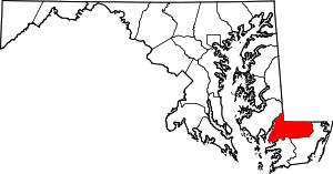 | |
| Towns | ||
| CDPs | ||
| Unincorporated communities | ||
| Footnotes | ‡This populated place also has portions in an adjacent county or counties | |
| Counties | | |
|---|---|---|
| Principal city | ||
| Places 5k-20k | ||
| Places 1k-5k | ||