Sainte-Cécile-les-Vignes
| Sainte-Cécile-les-Vignes | ||
|---|---|---|
|
Town hall | ||
| ||
 Sainte-Cécile-les-Vignes | ||
|
Location within Provence-A.-C.d'A. region 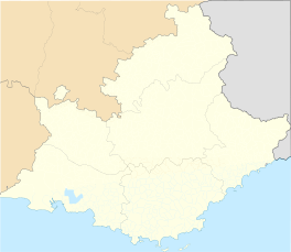 Sainte-Cécile-les-Vignes | ||
| Coordinates: 44°14′47″N 4°53′13″E / 44.2464°N 4.8869°ECoordinates: 44°14′47″N 4°53′13″E / 44.2464°N 4.8869°E | ||
| Country | France | |
| Region | Provence-Alpes-Côte d'Azur | |
| Department | Vaucluse | |
| Arrondissement | Avignon | |
| Canton | Bollène | |
| Intercommunality | Aygues Ouvèze en Provence | |
| Government | ||
| • Mayor (2001–2008) | Max Ivan | |
| Area1 | 19.82 km2 (7.65 sq mi) | |
| Population (2006)2 | 2,251 | |
| • Density | 110/km2 (290/sq mi) | |
| Time zone | CET (UTC+1) | |
| • Summer (DST) | CEST (UTC+2) | |
| INSEE/Postal code | 84106 / 84290 | |
| Elevation |
83–138 m (272–453 ft) (avg. 130 m or 430 ft) | |
|
1 French Land Register data, which excludes lakes, ponds, glaciers > 1 km² (0.386 sq mi or 247 acres) and river estuaries. 2 Population without double counting: residents of multiple communes (e.g., students and military personnel) only counted once. | ||

.svg.png)
Sainte-Cécile-les-Vignes is a commune in the Vaucluse department in the Provence-Alpes-Côte d'Azur region in southeastern France.
Nearby cities are Orange and the smaller Bollène. It is also not far from the Mont Ventoux.
Maurice Trintignant, a motor racing driver and vintner, was born here on 30 October 1917.

The church of Sainte-Cécile-les-Vignes
Twin towns
See also
References
External links
- Félix Charpentier Sculptor of Sainte-Cécile-les-Vignes War Memorial.
| Wikimedia Commons has media related to Sainte-Cécile-les-Vignes. |
This article is issued from Wikipedia - version of the 5/31/2015. The text is available under the Creative Commons Attribution/Share Alike but additional terms may apply for the media files.