St. Charles Parish, Louisiana
| Saint Charles Parish, Louisiana | |
|---|---|
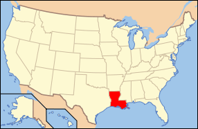
 Location in the U.S. state of Louisiana | |
 Louisiana's location in the U.S. | |
| Founded | 1807 |
| Named for | Saint Charles |
| Seat | Hahnville |
| Largest community | Luling |
| Area | |
| • Total | 411 sq mi (1,064 km2) |
| • Land | 279 sq mi (723 km2) |
| • Water | 132 sq mi (342 km2), 32% |
| Population | |
| • (2010) | 52,780 |
| • Density | 189/sq mi (73/km²) |
| Congressional districts | 2nd, 6th |
| Time zone | Central: UTC-6/-5 |
| Website |
www |
St. Charles Parish (French: Paroisse de Saint-Charles) is a parish located in the U.S. state of Louisiana. As of the 2010 census, the population was 52,780.[1] The parish seat is Hahnville.[2] The parish was formed in 1807.[3] It was originally part of the German Coast, an area along the east bank of the Mississippi River that was settled by numerous German pioneers in the 1720s.
St. Charles Parish is included in the New Orleans-Metairie, LA Metropolitan Statistical Area.
Geography
According to the U.S. Census Bureau, the parish has a total area of 411 square miles (1,060 km2), of which 279 square miles (720 km2) is land and 132 square miles (340 km2) (32%) is water.[4]
Major highways
 Interstate 10
 Interstate 310
 U.S. Highway 61
 U.S. Highway 90
 Louisiana Highway 18
 Louisiana Highway 3127
 Louisiana Highway 48
Adjacent parishes
- Jefferson Parish (east)
- Lafourche Parish (southwest)
- St. John the Baptist Parish (northwest)
Government
St. Charles Parish is governed by an executive branch and legislative branch. The executive branch is headed by the Parish President; currently Larry Cochran, a previous councilman.
The legislative branch consists of a nine-member council. The parish is divided into seven districts which are represented by a district council member. In addition to the seven district seats, there are also two at-large seats which are elected on a parish-wide basis. The at-large seats are divided into an "A" seat and a "B" seat. The "A" seat representative must be a resident of the parish's east bank while the "B" seat must be held by a resident of the west bank.[5] The last parish council election was in October 2015.
Members of the St. Charles Parish Council as of September 2015:
| District | Council Member |
|---|---|
| At-Large Division "A" | Carolyn Schexnaydre |
| At-Large Division "B" | Jarvis Lewis |
| 1 | Terrell Wilson |
| 2 | Mary Tastet (interim) |
| 3 | Wendy Benedetto |
| 4 | Paul Hogan |
| 5 | Larry Cochran |
| 6 | Traci Fletcher |
| 7 | Julia Fisher-Perrier |
Demographics
| Historical population | |||
|---|---|---|---|
| Census | Pop. | %± | |
| 1810 | 3,291 | — | |
| 1820 | 3,862 | 17.4% | |
| 1830 | 5,147 | 33.3% | |
| 1840 | 4,700 | −8.7% | |
| 1850 | 5,120 | 8.9% | |
| 1860 | 5,297 | 3.5% | |
| 1870 | 4,867 | −8.1% | |
| 1880 | 7,161 | 47.1% | |
| 1890 | 7,737 | 8.0% | |
| 1900 | 9,072 | 17.3% | |
| 1910 | 11,207 | 23.5% | |
| 1920 | 8,586 | −23.4% | |
| 1930 | 12,111 | 41.1% | |
| 1940 | 12,321 | 1.7% | |
| 1950 | 13,363 | 8.5% | |
| 1960 | 21,219 | 58.8% | |
| 1970 | 29,550 | 39.3% | |
| 1980 | 37,259 | 26.1% | |
| 1990 | 42,437 | 13.9% | |
| 2000 | 48,072 | 13.3% | |
| 2010 | 52,780 | 9.8% | |
| Est. 2015 | 52,812 | [6] | 0.1% |
| U.S. Decennial Census[7] 1790-1960[8] 1900-1990[9] 1990-2000[10] 2010-2013[1] | |||
As of the census of 2000, there were 48,072 people, 16,422 households, and 13,088 families residing in the parish. The population density was 170 people per square mile (65/km²). There were 17,430 housing units at an average density of 62 per square mile (24/km²). The racial makeup of the parish was 72.40% White, 25.23% African American, 0.26% Native American, 0.55% Asian, 0.01% Pacific Islander, 0.64% from other races, and 0.91% from two or more races. Hispanic or Latino of any race were 2.80% of the population.
There were 16,422 households out of which 43.40% had children under the age of 18 living with them, 60.40% were married couples living together, 14.70% had a female householder with no husband present, and 20.30% were non-families. 16.70% of all households were made up of individuals and 5.40% had someone living alone who was 65 years of age or older. The average household size was 2.90 and the average family size was 3.27.
In the parish the population was spread out with 30.30% under the age of 18, 8.30% from 18 to 24, 31.40% from 25 to 44, 21.00% from 45 to 64, and 9.00% who were 65 years of age or older. The median age was 34 years. For every 100 females there were 95.20 males. For every 100 females age 18 and over, there were 91.70 males.
The median income for a household in the parish was $45,139, and the median income for a family was $50,562. Males had a median income of $40,651 versus $24,780 for females. The per capita income for the parish was $19,054. About 9.30% of families and 11.40% of the population were below the poverty line, including 14.20% of those under age 18 and 12.40% of those age 65 or over.
Education
St. Charles Parish Public Schools operates public schools.
Communities

Notable residents
- Darren Barbier, Luling, former head football coach at Nicholls State University
- Alfred Blue, Boutte, NFL running back
- LaRon Byrd, Hahnville, NFL wide receiver
- Mutt Carey, Hahnville, jazz trumpeter whose family moved to New Orleans when he was a child
- Joel Chaisson, Destrehan, State Senate President from 2008 to 2012
- Dana "Pokey" Chatman, Ama, WNBA Chicago Sky head coach, former LSU women's basketball coach
- Barbara Colley, Luling, mystery and romance novelist
- Burnell Dent, Rose, NFL linebacker
- Jean Noel Destréhan, Destrehan, U.S. Senator
- Jesse Duplantis, Destrehan, televangelist
- Hoffman Franklin Fuller, Destrehan, professor-emeritus at Tulane University Law School
- Michael Hahn, Hahnville, 19th Governor of Louisiana and U.S. Representative
- Shelley Hennig, Destrehan and St. Rose, actress and Miss Teen USA
- Curtis Johnson, St. Rose, head football coach at Tulane University and NFL assistant coach
- Damaris Johnson, Norco, NFL wide receiver
- Dawan Landry, Ama, NFL safety[11]
- LaRon Landry, Ama, NFL safety (younger brother of Dawan Landry).[11]
- Rondell Mealey, Norco, NFL running back
- Gregory A. Miller, Norco, attorney in Destrehan and state representative[12]
- Jerico Nelson, Destrehan, NFL safety
- Jeremy Parquet, Norco, NFL offensive lineman
- George T. Oubre, Norco, state senator
- Rusty Rebowe, Norco, NFL linebacker
- Tim Rebowe, Norco, head football coach at Nicholls State University
- Ed Reed, St. Rose, NFL safety
- Darius Reynaud, born in Luling, NFL wide receiver
- Darryl Richard, St. Rose, NFL defensive lineman
- Garland Robinette, Boutte, journalist and news anchor
- Mike Scifres, Destrehan, NFL punter
- Gary Smith, Jr., Norco, state senator
- Margaret Taylor-Burroughs, St. Rose, co-founder of the DuSable Museum of African American History
- Josh Victorian, St. Rose, NFL cornerback
- Darius Vinnett, St. Rose, NFL cornerback
- Devon Walker, Destrehan, Tulane and NFL safety
See also
- Acadiana
- German Coast
- 1811 German Coast Uprising, largest slave rebellion in U.S. history
- National Register of Historic Places listings in St. Charles Parish, Louisiana
- New Orleans-Metairie-Hammond, LA-MS CSA
- New Orleans metropolitan area
- River Parishes
- Bonnet Carré Spillway
- Waterford Nuclear Generating Station
References
- 1 2 "State & County QuickFacts". United States Census Bureau. Retrieved August 18, 2013.
- ↑ "Find a County". National Association of Counties. Retrieved 2011-06-07.
- ↑ "St. Charles Parish". Center for Cultural and Eco-Tourism. Retrieved September 6, 2014.
- ↑ "2010 Census Gazetteer Files". United States Census Bureau. August 22, 2012. Retrieved September 1, 2014.
- ↑ "Four vie for two seats on Council". NOLA.com. Retrieved 2010-07-22.
- ↑ "County Totals Dataset: Population, Population Change and Estimated Components of Population Change: April 1, 2010 to July 1, 2015". Retrieved July 2, 2016.
- ↑ "U.S. Decennial Census". United States Census Bureau. Retrieved September 1, 2014.
- ↑ "Historical Census Browser". University of Virginia Library. Retrieved September 1, 2014.
- ↑ "Population of Counties by Decennial Census: 1900 to 1990". United States Census Bureau. Retrieved September 1, 2014.
- ↑ "Census 2000 PHC-T-4. Ranking Tables for Counties: 1990 and 2000" (PDF). United States Census Bureau. Retrieved September 1, 2014.
- 1 2 Bryant, Howard. "'Dirty-Dirty' Landry: Just What the Redskins Need". The Washington Post. Retrieved 2010-05-24.
- ↑ "Mary Sparacello, St. Charles Parish-based 56th Louisiana House district draws trio of hopefuls, September 28, 2011". The Times-Picayune. Retrieved August 26, 2013.
External links
Government
Geology
- McCulloh, R. P., P. V. Heinrich, and J. Snead, 2003, Ponchatoula 30 x 60 minute geologic quadrangle. Louisiana Geological Survey, Baton Rouge, Louisiana.
Hydrology
- White, V.E., 2015, Water resources of St. Charles Parish, Louisiana U.S. Geological Survey.
 |
St. John the Baptist Parish | Lake Pontchartrain | | |
| |
Jefferson Parish | |||
| ||||
| | ||||
| Lafourche Parish |
Municipalities and communities of St. Charles Parish, Louisiana, United States | ||
|---|---|---|
| CDPs | | |
| Other Unincorporated communities | ||
| Footnotes | ‡This populated place also has portions in an adjacent parish or parishes | |
Coordinates: 29°55′N 90°22′W / 29.91°N 90.36°W