Saint-Véran
| Saint-Véran | ||
|---|---|---|
|
A view within Saint-Véran, in August 2008 | ||
| ||
 Saint-Véran | ||
|
Location within Provence-A.-C.d'A. region 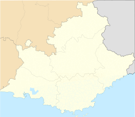 Saint-Véran | ||
| Coordinates: 44°42′03″N 6°52′09″E / 44.7008°N 6.8692°ECoordinates: 44°42′03″N 6°52′09″E / 44.7008°N 6.8692°E | ||
| Country | France | |
| Region | Provence-Alpes-Côte d'Azur | |
| Department | Hautes-Alpes | |
| Arrondissement | Briançon | |
| Canton | Aiguilles | |
| Intercommunality | Queyras | |
| Government | ||
| • Mayor (2008–2014) | Danielle Guignard | |
| Area1 | 44.75 km2 (17.28 sq mi) | |
| Population (2008)2 | 282 | |
| • Density | 6.3/km2 (16/sq mi) | |
| Time zone | CET (UTC+1) | |
| • Summer (DST) | CEST (UTC+2) | |
| INSEE/Postal code | 05157 / 05350 | |
| Elevation |
1,756–3,175 m (5,761–10,417 ft) (avg. 2,040 m or 6,690 ft) | |
|
1 French Land Register data, which excludes lakes, ponds, glaciers > 1 km² (0.386 sq mi or 247 acres) and river estuaries. 2 Population without double counting: residents of multiple communes (e.g., students and military personnel) only counted once. | ||


Saint-Véran is a commune in the Hautes-Alpes department in southeastern France in the Queyras Regional Natural Park.
Geography
Saint-Véran, located in the French Alps is the most elevated commune in France.[1] It is the third highest village in Europe, after Trepalle in Italy and Juf in Switzerland.
The permanent population is around 300 but swells with tourists in both summer and winter. In addition to tourism the main activities are agriculture and woodcraft.
Name
The village is named after Saint Véran, 6th century Bishop of Cavaillon who in legend drove away a dragon.
The Observatoire de Saint-Véran was constructed nearby by the Observatoire de Paris in the early 1970s.
Population
| Historical population | ||
|---|---|---|
| Year | Pop. | ±% |
| 1962 | 236 | — |
| 1968 | 220 | −6.8% |
| 1975 | 232 | +5.5% |
| 1982 | 275 | +18.5% |
| 1990 | 257 | −6.5% |
| 1999 | 267 | +3.9% |
| 2008 | 282 | +5.6% |
See also
References
- ↑ Page 505, Chapter Hautes Alpes, book France, Collection Guide vert, publisher Le Michelin, 2009
External links
| Wikimedia Commons has media related to Saint-Véran. |