Saint-Antoine-sur-Richelieu, Quebec
| Saint-Antoine-sur-Richelieu | |
|---|---|
| Municipality | |
 Location within La Vallée-du-Richelieu RCM. | |
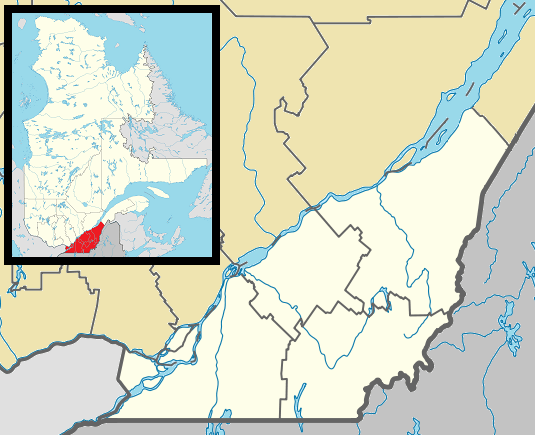 Saint-Antoine-sur-Richelieu Location in southern Quebec. | |
| Coordinates: 45°47′N 73°11′W / 45.783°N 73.183°WCoordinates: 45°47′N 73°11′W / 45.783°N 73.183°W[1] | |
| Country |
|
| Province |
|
| Region | Montérégie |
| RCM | La Vallée-du-Richelieu |
| Constituted | November 6, 1982 |
| Government[2][3] | |
| • Mayor | Martin Lévesque |
| • Federal riding | Verchères—Les Patriotes |
| • Prov. riding | Borduas |
| Area[2][4] | |
| • Total | 67.90 km2 (26.22 sq mi) |
| • Land | 65.72 km2 (25.37 sq mi) |
| Population (2011)[4] | |
| • Total | 1,659 |
| • Density | 25.2/km2 (65/sq mi) |
| • Pop 2006-2011 |
|
| • Dwellings | 682 |
| Time zone | EST (UTC−5) |
| • Summer (DST) | EDT (UTC−4) |
| Postal code(s) | J0L 1R0 |
| Area code(s) | 450 and 579 |
| Highways |
|
| Website |
www |
Saint-Antoine-sur-Richelieu is a municipality in southwestern Quebec, Canada, on the Richelieu River in the Regional County Municipality of La Vallée-du-Richelieu. The population as of the Canada 2011 Census was 1,659.
Demographics
PopulationPopulation trend:[5]
|
LanguageMother tongue language (2006)[6]
|
See also
References
- ↑ Reference number 55651 of the Commission de toponymie du Québec (French)
- 1 2 Ministère des Affaires municipales, des Régions et de l'Occupation du territoire: Saint-Antoine-sur-Richelieu
- ↑ Parliament of Canada Federal Riding History: VERCHÈRES--LES PATRIOTES (Quebec)
- 1 2 2011 Statistics Canada Census Profile: Saint-Antoine-sur-Richelieu, Quebec
- ↑ Statistics Canada: 1996, 2001, 2006, 2011 census
- ↑ 2006 Statistics Canada Community Profile: Saint-Antoine-sur-Richelieu, Quebec
 |
Contrecoeur | Saint-Roch-de-Richelieu | | |
| |
Richelieu River Saint-Denis-sur-Richelieu | |||
| ||||
| | ||||
| Calixa-Lavallée | Saint-Marc-sur-Richelieu |
| Cities | |
|---|---|
| Municipalities | |
| |
This article is issued from Wikipedia - version of the 5/6/2013. The text is available under the Creative Commons Attribution/Share Alike but additional terms may apply for the media files.