Saint-Alexis, Quebec
Not to be confused with the former Saint-Alexis parish municipality in Mauricie that is now part of Saint-Alexis-des-Monts.
For other uses, see Saint-Alexis, Quebec (disambiguation).
| Saint-Alexis | |
|---|---|
| Municipality | |
_Quebec_location_diagram.png) Location within Montcalm RCM. | |
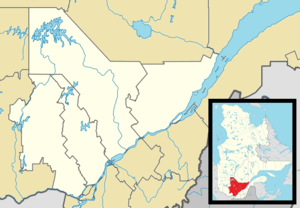 Saint-Alexis Location in central Quebec. | |
| Coordinates: 45°56′N 73°37′W / 45.933°N 73.617°WCoordinates: 45°56′N 73°37′W / 45.933°N 73.617°W[1] | |
| Country |
|
| Province |
|
| Region | Lanaudière |
| RCM | Montcalm |
| Constituted | July 1, 1855 |
| Government[2] | |
| • Mayor | Robert Perreault |
| • Federal riding | Montcalm |
| • Prov. riding | Rousseau |
| Area[2][3][4] | |
| • Total | 43.10 km2 (16.64 sq mi) |
| • Land | 43.32 km2 (16.73 sq mi) |
|
There is an apparent contradiction between two authoritative sources | |
| Population (2011)[3][4] | |
| • Total | 1,267 |
| Time zone | EST (UTC−5) |
| • Summer (DST) | EDT (UTC−4) |
| Postal code(s) | J0K 1T0 |
| Area code(s) | 450 and 579 |
| Highways[5] |
|
Saint-Alexis is a municipality located in Quebec's Lanaudière region, part of the Montcalm Regional County Municipality. It was formed by the amalgamation on December 19, 2012 of the former village municipality and the former parish municipality of the same name (the former was also known as Saint-Alexis-de-Montcalm).
Demographics
Former parish municipality
Population trend:[6]
- Population in 2011: 790 (2006 to 2011 population change: 9.4%)
- Population in 2006: 722
- Population in 2001: 757
- Population in 1996: 755
- Population in 1991: 738
Private dwellings occupied by usual residents: 306 (total dwellings: 309)
Mother tongue:
- English as first language: 1.4%
- French as first language: 98.6%
- English and French as first language: 0%
- Other as first language: 0%
Former village municipality
Population trend:[7]
- Population in 2011: 577 (2006 to 2011 population change: 3.8%)
- Population in 2006: 556
- Population in 2001: 530
- Population in 1996: 503
- Population in 1991: 477
Private dwellings occupied by usual residents: 234 (total dwellings: 236)
Mother tongue:
- English as first language: 1.8%
- French as first language: 96.4%
- English and French as first language: 1.8%
- Other as first language: %
References
- ↑ Reference number 416952 of the Commission de toponymie du Québec (French)
- 1 2 Geographic code 63023 in the official Répertoire des municipalités (French)
- 1 2 Statistics Canada 2011 Census- Saint-Alexis census profile
- 1 2 Statistics Canada 2011 Census - Saint-Alexis census profile
- ↑ Official Transport Quebec Road Map
- ↑ Statistics Canada: 1996, 2001, 2006, 2011 census
- ↑ Statistics Canada: 1996, 2001, 2006, 2011 census
 |
Sainte-Julienne | | ||
| Sainte-Julienne Saint-Esprit |
|
Saint-Jacques | ||
| ||||
| | ||||
| Saint-Esprit |
| Cities/towns | |
|---|---|
| Municipalities | |
| Parishes | |
| |
This article is issued from Wikipedia - version of the 5/23/2014. The text is available under the Creative Commons Attribution/Share Alike but additional terms may apply for the media files.