Sørnes
See also: Sørnes (surname)
| Sørnes | |
|---|---|
| Village | |
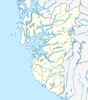 Sørnes 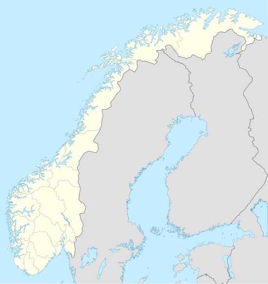 Sørnes Location in Rogaland county | |
| Coordinates: 58°54′42″N 05°40′34″E / 58.91167°N 5.67611°ECoordinates: 58°54′42″N 05°40′34″E / 58.91167°N 5.67611°E | |
| Country | Norway |
| Region | Western Norway |
| County | Rogaland |
| District | Jæren |
| Municipality | Sola |
| Elevation[1] | 11 m (36 ft) |
| Time zone | CET (UTC+01:00) |
| • Summer (DST) | CEST (UTC+02:00) |
| Post Code | 4052 Røyneberg |
Sørnes is a village in Sola municipality in Rogaland county, Norway. The village is located at the southeastern end of the Hafrsfjorden, about 10 kilometres (6.2 mi) southwest of the city of Stavanger. The village is a part of the larger Stavanger/Sandnes metropolitan area. The village lies just west of the European route E39 highway and just a short distance north of the village of Solakrossen.[2]
A large proportion of the population commutes to work in nearby Stavanger. The village is named after the old Sørnes farm (Old Norse: Suđrnes). The first element is suđr which means "southern" and the last element is nes which means "headland".[2]
References
- ↑ "Sørnes, Sola (Rogaland)" (in Norwegian). yr.no. Retrieved 2016-05-21.
- 1 2 Store norske leksikon. "Sørnes" (in Norwegian). Retrieved 2016-05-21.
This article is issued from Wikipedia - version of the 8/4/2016. The text is available under the Creative Commons Attribution/Share Alike but additional terms may apply for the media files.