Rutland – Southern Vermont Regional Airport
| Rutland – Southern Vermont Regional Airport | |||||||||||||||
|---|---|---|---|---|---|---|---|---|---|---|---|---|---|---|---|
|
| |||||||||||||||
 Aerial photo, September 2007 | |||||||||||||||
| IATA: RUT – ICAO: KRUT – FAA LID: RUT | |||||||||||||||
| Summary | |||||||||||||||
| Airport type | Public | ||||||||||||||
| Owner | State of Vermont | ||||||||||||||
| Serves | Rutland, Vermont | ||||||||||||||
| Location | North Clarendon | ||||||||||||||
| Elevation AMSL | 787 ft / 240 m | ||||||||||||||
| Coordinates | 43°31′48″N 072°56′59″W / 43.53000°N 72.94972°WCoordinates: 43°31′48″N 072°56′59″W / 43.53000°N 72.94972°W | ||||||||||||||
| Website | www.FlyRutlandVT.com | ||||||||||||||
| Map | |||||||||||||||
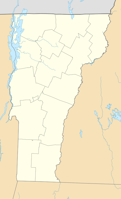 RUT  RUT Location of airport in Vermont/United States | |||||||||||||||
| Runways | |||||||||||||||
| |||||||||||||||
| Statistics (2011) | |||||||||||||||
| |||||||||||||||
Rutland – Southern Vermont Regional Airport[1][2] (IATA: RUT, ICAO: KRUT, FAA LID: RUT), is a state-owned, public use airport located five nautical miles (6 mi, 9 km) south of the central business district of Rutland, a city in Rutland County, Vermont, United States.[1] Situated in North Clarendon, it was formerly known as Rutland State Airport. Scheduled commercial service is subsidized by the Essential Air Service and provided by Cape Air, with three flights daily on nine-passenger Cessna 402 aircraft to Boston with typical flight times of 40 minutes.[3]
Rutland – Southern Vermont Regional Airport is the closest commercial service airport to the mountain resorts of Killington, Pico, Okemo, Stratton, Bromley, Magic Mountain, and Mount Snow. In addition, Suicide Six and Ascutney Mountain resorts are included in RSVRA's airport service area.[4]
Rutland – Southern Vermont is an FAA Part 139 certificated airport. As per Federal Aviation Administration records, the airport had the following passenger boardings ("enplanements") in recent calendar years:
| Calendar Year | Enplanements | Percent Change |
|---|---|---|
| 2013[5] | 5,321 | -10.06% |
| 2012 | 5,916 | -1.35% |
| 2011 | 5,997 | 8.44% |
| 2010[6] | 5,530 | 24.05% |
| 2009 | 4,458 | -11.51% |
| 2008[7] | 5,038 | 121.84% |
| 2007 | 2,271 | 1.20% |
It is included in the National Plan of Integrated Airport Systems for 2013–2017, which categorized it as a non-primary commercial service airport (between 2,500 and 10,000 enplanements per year).[8] Total air cargo carried in 2006 was approximately 520,000 pounds with 1,560 cargo operations via FedEx and UPS.
Name change
Legislation was introduced into the Vermont Senate in January 2007 to change the official name of the airport to Rutland–Southern Vermont Regional Airport.[9] The state agency of transportation, meanwhile, had plans to change the name to Rutland/Southwest Vermont Regional Airport. This provoked some opposition from the town of Bennington on the grounds that the William H. Morse State Airport (located in the town), is currently known as "Southwest Vermont's Airport". The agency indicated that it intended to go ahead with the name change anyway, claiming that Bennington's opposition came too late in the process.[10] However, the agency changed the name to Rutland Southern Vermont Regional Airport on August 15, 2007.[11][12]
Facilities and aircraft
Rutland – Southern Vermont Regional Airport covers an area of 345 acres (140 ha) at an elevation of 787 feet (240 m) above mean sea level. It has two asphalt paved runways: 1/19 is 5,003 by 100 feet (1,525 x 30 m) and 13/31 is 3,170 by 75 feet (966 x 23 m).[1]
For the 12-month period ending July 30, 2011, the airport had 31,770 aircraft operations, an average of 87 per day: 75% general aviation, 22% air taxi, and 3% military. At that time there were 45 aircraft based at this airport: 80% single-engine, 9% multi-engine, 4% jet, 4% helicopter, and 2% ultralight.[1]
Currently, the Rutland – Southern Vermont Regional Airport Technical Advisory Committee is proposing a 1,000 feet (300 m) runway extension to alleviate the constraints posed by the current main runway length and the limited road access to the region. In its current configuration, the main runway is severely limiting to charters, business jets, and 50+ passenger regional jets. Part 91 Subpart K, imposed by the FAA on fractional jet operators in 2005 has reduced runway planning performance by 40 percent.[13]
Airline and destination
The following airline offers scheduled passenger service:
| Airlines | Destinations |
|---|---|
| Cape Air | Boston |
References
- 1 2 3 4 5 FAA Airport Master Record for RUT (Form 5010 PDF). Federal Aviation Administration. Effective November 15, 2012.
- ↑ Rutland – Southern Vermont Regional Airport (official site)
- ↑ "Cape Air Plans Service To Rutland; Two-Year EAS Subsidy To Support Round-Trip Flights To Logan Airport". Rutland Business Journal. October 15, 2007.
- ↑ "Alpine". Ski Vermont. Archived from the original on July 28, 2010.
- ↑ "Enplanements at all Commercial Service Airports" (PDF, 82 KB). CY 2013 Passenger Boarding and All-Cargo Data. Federal Aviation Administration. September 29, 2014. External link in
|work=(help) - ↑ "Enplanements for CY 2010" (PDF, 189 KB). CY 2010 Passenger Boarding and All-Cargo Data. Federal Aviation Administration. October 4, 2011. External link in
|work=(help) - ↑ "Enplanements for CY 2008" (PDF, 1.0 MB). CY 2008 Passenger Boarding and All-Cargo Data. Federal Aviation Administration. December 18, 2009. External link in
|work=(help) - ↑ "2013–2017 NPIAS Report, Appendix A" (PDF, 6.48 MB). National Plan of Integrated Airport Systems. Federal Aviation Administration. September 27, 2012. Retrieved 2014-02-14. External link in
|work=(help) - ↑ Vermont Legislative: 2007–2008 Session, Bill S.0033: The Rutland-Southern Vermont Regional Airport
- ↑ "Bennington sought say in airport renaming". Rutland Herald. January 26, 2007.
- ↑ "Airport rebranded; Officials hope new name better defines facility, region". Rutland Herald. August 16, 2007.
- ↑ "Airport that serves Rutland has new name". Associated Press. August 16, 2007.
- ↑ "Fractional Aircraft Ownership". National Business Aviation Association.
Other sources
- Essential Air Service documents (Docket OST-2005-21681) from the U.S. Department of Transportation:
- Order 2005-8-23 (August 30, 2005): re-selecting Champlain Enterprises, Inc., d/b/a CommutAir, to provide essential air service at Rutland, Vermont, at an annual subsidy rate of $849,705, for the two-year period November 1, 2005, through October 31, 2007.
- Order 2007-6-6 (June 6, 2007): prohibiting Champlain Enterprises, Inc., d/b/a CommutAir, operating as Continental Connection, from terminating its subsidized essential air service (EAS) at Plattsburgh and Saranac Lake/Lake Placid, New York, and Rutland, Vermont, at the end of its 90-day notice period, and requesting long-term proposals from carriers interested in providing EAS at all three communities, for a new two-year period, with or without subsidy.
- Order 2007-9-13 (September 13, 2007): selecting Big Sky Transportation Co., d/b/a Big Sky Airlines, operating as Delta Connection, to provide subsidized EAS at Plattsburgh and Saranac Lake/Lake Placid, New York, utilizing 19-seat Beech 1900-D aircraft, at an annual subsidy rate of $2,408,294, and Hyannis Air Service, Inc., d/b/a Cape Air, to provide subsidized EAS at Rutland, Vermont, with 9-seat Cessna 402s, at annual subsidy rate of $839,746. The carriers will provide EAS at their respective communities for two-year terms beginning when they inaugurate full service.
- Order 2009-8-11 (August 18, 2009): re-selecting Hyannis Air Service, Inc., d/b/a Cape Air, operating as JetBlue Airways code-share partner, to provide subsidized essential air service (EAS) at Rutland, Vermont, for the four-year period of November 1, 2009, through October 31, 2013, for an annual subsidy rate of $797,151.
External links
- Rutland – Southern Vermont Regional Airport
- Rutland Southern VT Regional (RUT) at Vermont Airport Directory
- Aerial image as of May 1994 from USGS The National Map
- FAA Terminal Procedures for RUT, effective December 8, 2016
- Resources for this airport:
- FAA airport information for RUT
- AirNav airport information for KRUT
- ASN accident history for RUT
- FlightAware airport information and live flight tracker
- NOAA/NWS latest weather observations
- SkyVector aeronautical chart, Terminal Procedures