Ferry Hinksey Road

Ferry Hinksey Road is a road in west Oxford, England, leading south from the Botley Road.[1] The road leads to the Osney Mead Industrial Estate to the east, started in 1961.[2] To the east is Osney Ditch.
History
The road is named after the village of Ferry Hinksey, now known as North Hinksey, on the other side of Hinksey Stream, one of the branches of the River Thames in Oxford. There was once a punt ferry that operated over Bulstake Stream.[3]
The most notable path between Oxford and North Hinksey, a continuation of Ferry Hinksey Road, is a metalled bridleway and cycle track, variously known as Willow Walk and Ruskin's Ride. The latter is named after John Ruskin (1819–1900) who used to pass this way between Ferry Hinksey and Oxford, where he was the first Slade Professor of Fine Art from 1869.[4] The path was originally built in 1876–77 by Aubrey Harcourt (1852–1904), a major local landowner,[5] but was not made open to the public until 1922. There is also a smaller unmade path which begins alongside the large back garden of The Fishes and crosses Hinksey Stream by a bridge at the site of the old ferry, which linked Ferry Hinksey with Oxford. The ferry ceased operation in 1928. The various streams are now crossed by small bridges. A 'Ferry Cottage' still remains.
A poem called Ferry Hinksey by Laurence Binyon (1869–1943) describes the bucolic nature of the area before Osney Mead Industrial Estate was developed.[3]
Buildings and companies
Arup Associates designed the building for the Oxford Mail and Times in 1970–2.[6] West Oxford Community Primary School,[7] formerly West Oxford First School,[8] is also located here. Oxford Open Learning, a distance learning company, is at King's Meadow off Ferry Hinksey Road.[9]
Gallery
-

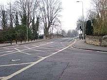
View of Ferry Hinksey Road
-

Footpath and cycleway to North Hinksey off Ferry Hinksey Road
-
Bridge off Ferry Hinksey Road to the right
-

The large electrical substation on Ferry Hinksey Road
-

Pollarded willow trees along the edge of the playing fields by Ferry Hinksey Road
-

Sports field off Ferry Hinksey Road
-

School building
See also
- Ruskin's diggers at Ferry Hinksey (1874)
References
- ↑ "Sold House Prices on Ferry Hinksey Road". Oxford Mail. Retrieved 8 August 2011.
- ↑ Ann Spokes Symonds; Nigel Morgan (2010). The Origins of Oxford Street Names. Robert Boyd Publications. p. 166. ISBN 978-1-899536-99-3.
- 1 2 Hibbert, Christopher, ed. (1988). "Ferry Hinksey Road". The Encyclopaedia of Oxford. Macmillan. p. 141. ISBN 0-333-39917-X.
- ↑ Batchelor, John (2000). John Ruskin: No Wealth but Life. London: Chatto & Windus. p. 290. ISBN 1-85619-580-5.
- ↑ Hanson, W. J. (1996). A Thousand Years: A study of the interaction between people and environment in the Cumnor, Wytham and North Hinksey Area. Wytham Publications.
- ↑ Sherwood, Jennifer; Pevsner, Nikolaus (1974). The Buildings of England: Oxfordshire. Penguin Books. pp. 334–335. ISBN 0-14-071045-0.
- ↑ "Contact Us". West Oxford Community Primary School, UK. Retrieved 8 August 2011. External link in
|publisher=(help) - ↑ Ofsted (1994). West Oxford First School, Ferry Hinksey Road, Oxford. Office for Standards in Education, UK.
- ↑ "Contact us". Oxford Open Learning, UK. Retrieved 8 August 2011. External link in
|publisher=(help)
Coordinates: 51°45′02″N 1°16′35″W / 51.75054°N 1.27643°W