Rudston
| Rudston | |
 All Saints Church, Rudston |
|
 Rudston |
|
| Population | 409 (2011 census)[1] |
|---|---|
| OS grid reference | TA096676 |
| Civil parish | Rudston |
| Unitary authority | East Riding of Yorkshire |
| Ceremonial county | East Riding of Yorkshire |
| Region | Yorkshire and the Humber |
| Country | England |
| Sovereign state | United Kingdom |
| Post town | DRIFFIELD |
| Postcode district | YO25 |
| Dialling code | 01262 |
| Police | Humberside |
| Fire | Humberside |
| Ambulance | Yorkshire |
| EU Parliament | Yorkshire and the Humber |
| UK Parliament | East Yorkshire |
Coordinates: 54°05′36″N 0°19′32″W / 54.093358°N 0.325471°W
Apr2006.jpg)

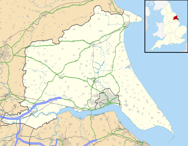
Rudston is a small village and civil parish in the East Riding of Yorkshire, England. It is situated between Driffield and Bridlington approximately 6 miles (9.7 km) to the west of Bridlington, and lies on the B1253 road. The Gypsey Race (an intermittent stream) runs through the village, which lies in the Great Wold Valley. There are a number of Neolithic sites associated with the stream and its valley. It is the current Seat of the Clan Macdonald of Sleat.
According to the 2011 UK census, Rudston parish had a population of 409,[1] an increase on the 2001 UK census figure of 390.[2]
The place-name 'Rudston' is first attested in the Domesday Book of 1086, and means 'rood' or 'cross' stone, referring to the monolith.[3] However, the name 'rud' derives from Old Norse ruð, meaning a clearing or pasture. So the place name could be stone in the clearing, Ruðstane. Nearby Howes of Duggleby and Ba'l (In Ugaritic mythology Baal is the lord of the storm; he bears a mace where Thor will grasp a hammer) also indicate Norse Viking place names rather than Anglo-Saxon origins.
Here stands the Rudston Monolith; at over 25 feet (7.6 m) tall, it is the tallest standing stone in England, and gave the village its name; it is Grade I listed.[4][5]
Rudston is the centre of an unparalleled grouping of four Neolithic cursus monuments: cursus A,[6] cursus B,[7] cursus C[8] and cursus D.[9] At least one end of each cursus rests on an elevated chalk ridge on the sides of the Great Wold Valley. Cursuses A and C cross the Gypsey Race, whilst the other ends of cursuses B and D probably lie under the village.
Rudston Roman villa, noted for its mosaics, was first excavated in 1839. It was subsequently re-excavated in the 1930s, 1960s and 1970s.[10][11]
Rudston Grade I listed Anglican parish church is dedicated to All Saints.[12] Of 14th-century origin, it was restored in 1861 by George Fowler Jones.[13] It contains the gigantic organ, originally of four manuals, given by Sir Alexander McDonald of the Isles. Now a 3 manual instrument, it stands at the west end of the church in the original case. The author Winifred Holtby was born in Rudston and is buried in the church graveyard.[14]Since September 2014, the North Aisle of the church has a small heritage area including a 3D map of the village with sites of interest noted and a set of information boards about the history of the village.[15]
Thorpe Hall to the east of the village was designated a Grade II* listed building in 1952 and is now recorded in the National Heritage List for England, maintained by Historic England.[16]
References
- 1 2 "Key Figures for 2011 Census: Key Statistics: Area: Rudston CP (Parish)". Neighbourhood Statistics. Office for National Statistics. Retrieved 6 February 2013.
- ↑ "2001 Census: Key Statistics: Parish Headcounts: Area: Rudston CP (Parish)". Neighbourhood Statistics. Office for National Statistics. Retrieved 19 May 2008.
- ↑ Ekwall, Eilert. Concise Oxford Dictionary of English Place-names. p. 395.
- ↑ Historic England. "Rudston Mnolith (79482)". PastScape. Retrieved 28 April 2013.
- ↑ Historic England. "Monolith approximately 7 Metres North of Church of All Saints, Rudston (1083402)". National Heritage List for England. Retrieved 16 April 2012.
- ↑ Historic England. "Rudston Cursus A (79500)". PastScape. Retrieved 28 April 2013.
- ↑ Historic England. "Rudston Cursus B (1036040)". PastScape. Retrieved 28 April 2013.
- ↑ Historic England. "Rudston Cursus C (1036047)". PastScape. Retrieved 28 April 2013.
- ↑ Historic England. "Rudston Cursus D (1036049)". PastScape. Retrieved 28 April 2013.
- ↑ "Rudston Charioteer Mosaic". A History of the World. BBC. Retrieved 16 April 2012.
- ↑ "Roman Villa, Rudston, East Yorkshire". Roman-Britain.org. Retrieved 16 April 2012.
- ↑ Historic England. "Church of All Saints (1162387)". National Heritage List for England. Retrieved 16 April 2012.
- ↑ Pevsner, Nikolaus; The Buildings of England. Yorkshire: York and the East Riding p. 332; Penguin (1972); reprinted 1975, Pevsner Architectural Guides. ISBN 0140710434
- ↑ "Winifred Holtby". Find a Grave. 22 May 2004. Retrieved 11 February 2011.
- ↑ "Rudston Heritage Centre". Retrieved 3 February 2016.
- ↑ Historic England. "Thorpe Hall (1346645)". National Heritage List for England. Retrieved 16 August 2013.
- Gazetteer — A–Z of Towns Villages and Hamlets. East Riding of Yorkshire Council. 2006. p. 10.
External links
| Wikimedia Commons has media related to Rudston. |