Rodó de Canalbona
| Rodó de Canalbona | |
|---|---|
 The Estany de Canalbona located near the peak | |
| Highest point | |
| Elevation | 3,004 m (9,856 ft) |
| Listing | Mountains in Catalonia |
| Coordinates | 42°39′45.19″N 1°24′6.194″E / 42.6625528°N 1.40172056°ECoordinates: 42°39′45.19″N 1°24′6.194″E / 42.6625528°N 1.40172056°E |
| Geography | |
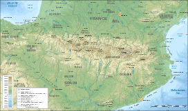 Rodó de Canalbona Location in the Pyrenees | |
| Location |
Ariège, France Pallars Sobirà, Spain |
| Parent range | Montcalm Massif, Pyrenees |
| Geology | |
| Mountain type | Granite |
| Climbing | |
| First ascent | Unknown |
| Easiest route | From the refugi de Vallferrera, Alins |
Rodó de Canalbona or Pic Rodó de Canalbona is a mountain of Catalonia. Located in the Montcalm Massif, Pyrenees, at the border between France and Spain, it has an altitude of 3004 metres above sea level.[1]
Mountaineers use a route that goes over the ridge towards Pica d'Estats. It is not an easy ascent.[2]
The Estanyol Occidental de Canalbona or Estany de Canalbona is a small glacial lake located between the Pic de Canalbona and the "Rodó de Canalbona", at the base of the "Collet Fals" in the Montcalm Massif near the "Pica d'Estats". The lake drains towards the Catalan side. The ice usually is totally melted at the end of the summer.
See also
References
- ↑ "Mapa Topogràfic de Catalunya". Institut Cartogràfic de Catalunya. Retrieved May 22, 2010..
- ↑ Mapa Pica d'Estats, ed. Alpina. 1:25.000
This article is issued from Wikipedia - version of the 12/6/2015. The text is available under the Creative Commons Attribution/Share Alike but additional terms may apply for the media files.