River Keer
| River Keer | |
| River | |
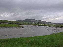 Bend in the Keer (with Warton Crag in the background) near Carnforth, Lancashire, England | |
| Country | United Kingdom |
|---|---|
| Part | England |
| County | Lancashire, Cumbria |
The River Keer is a river in Lancashire, England.
For parts of its course, the Keer marks the boundary between Lancashire and Cumbria, as well as the ancient counties of Lancashire and Westmorland.
The river rises on Docker Moor near the village of Whittington and follows a westerly course, passing the villages of Capernwray, Borwick and Warton, as well as Pine Lake, before reaching Carnforth, after which the river runs through salt marshes before pouring into the Kent estuary and Morecambe Bay.
Coordinates: 54°07′44″N 2°47′33″W / 54.12889°N 2.79250°W
| Rivers | |
|---|---|
| Canals | |
| Others | |
This article is issued from Wikipedia - version of the 3/16/2016. The text is available under the Creative Commons Attribution/Share Alike but additional terms may apply for the media files.