Rio Negro Bridge
Coordinates: 3°7′19″S 60°04′46″W / 3.12194°S 60.07944°W
| Manaus—Iranduba Bridge | |
|---|---|
| Coordinates | 3°7′19″S 60°04′46″W / 3.12194°S 60.07944°W |
| Carries | 4 lanes of roadway |
| Crosses | Rio Negro |
| Locale | Manaus Iranduba |
| Official name | Rio Negro Bridge[1] |
| Characteristics | |
| Design | Cable-stayed bridge |
| Total length | ca 3,595 metres (11,795 ft) |
| Height | 158 metres (518 ft)[1] |
| Longest span | 2x200 metres (660 ft) |
| Clearance above | 55 metres (180 ft)[1] |
| History | |
| Opened | 24 October 2011 |
The Rio Negro Bridge (Portuguese: Ponte Rio Negro) is a cable-stayed bridge over the Rio Negro with 3,595 metres (11,795 ft) of length that links the cities of Manaus and Iranduba in Brazil.[2]
 Bridge in sunset
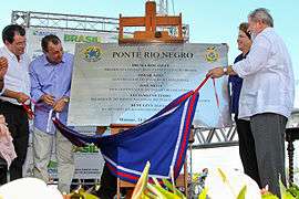 Inauguration of the bridge
 ponte rio negro
References
External links
This article is issued from Wikipedia - version of the 5/3/2015. The text is available under the Creative Commons Attribution/Share Alike but additional terms may apply for the media files.