Rifle, Colorado
| Rifle, Colorado | |
|---|---|
| City | |
|
Motto: "Embracing our past, shaking hands with our future" | |
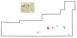 Location in Garfield County and the state of Colorado | |
| Coordinates: 39°32′13″N 107°46′58″W / 39.53694°N 107.78278°WCoordinates: 39°32′13″N 107°46′58″W / 39.53694°N 107.78278°W | |
| Country |
|
| State |
|
| County[1] | Garfield County |
| Founded | 1882[2] |
| Incorporated | August 18, 1905[3] |
| Founded by | Abram Maxfield |
| Government | |
| • Type | Home Rule Municipality[1] |
| • Mayor | Randy Winkler |
| • Mayor Pro Tem | Barbra Clifton |
| • Councilors |
Joe Elliot Ed Green Theresa Hamilton Annick Pruett Dana Wood |
| • City Manager | Matt Sturgeon |
| Area | |
| • Total | 5.7 sq mi (14.7 km2) |
| • Land | 5.6 sq mi (14.5 km2) |
| • Water | 0.08 sq mi (0.2 km2) |
| Elevation[4] | 5,348 ft (1,630 m) |
| Population (2010) | |
| • Total | 9,172 |
| • Density | 1,636/sq mi (631.8/km2) |
| Time zone | Mountain (MST) (UTC-7) |
| • Summer (DST) | MDT (UTC-6) |
| ZIP code[5] | 81650 |
| Area code(s) | 970 |
| FIPS code | 08-64255 |
| GNIS feature ID | 0174045 |
| Website |
www |
The City of Rifle is a Home Rule Municipality in Garfield County, Colorado, United States. The population was 9,172 at the 2010 census,[6] up from 6,784 at the 2000 census. Rifle is a regional center of the cattle ranching industry located along Interstate 70 and the Colorado River just east of the Roan Plateau, which dominates the western skyline of the town. The town was founded in 1882[2] by Abram Maxfield, and was incorporated in 1904 along Rifle Creek, near its mouth on the Colorado. The community takes its name from the creek.[7]
History
The land that Rifle resides on was once in the heart of the Ute Nation, a classification of the Indigenous peoples of the Great Basin. The most common tribe in the area were the Tabagauche, who hunted and lived on the land slightly to the east of Rifle in the Roaring Fork Valley. Due to their location, the Tabagauche were somewhat less exposed to white settlers, and to some extent their ways remained less altered than other native peoples. In 1879, Nathan Meeker was appointed as the director of the White River Ute Agency (the town of Meeker 40 miles north of Rifle was named after him). Meeker had no training or knowledge of Ute culture, and launched into a campaign centered on sedentary agriculture and European-American schooling. As this clashed with the culture of the nomadic Utes, he was met with resistance. It all came to a head when Meeker had the pasture and racetrack for the Ute's horses plowed under. The event that followed is known as the Meeker Massacre, during which Meeker and his 10 employees were killed. Aftermath of the conflict resulted in nearly all members of the Ute nation being forcibly removed from Colorado into eastern Utah, despite the fact that they had been formerly guaranteed the land on which they were residing by the federal government.[8]
Rifle became more and more settled as the 19th century gave way to the 20th. In 1889, the railroad cut through from the east and ended in Rifle for a while before connecting lines were completed. This opened up the floodgates for new travelers, settlers, and trade. Long drives of cattle over the mountains towards the Front Range and Denver became a thing of the past. Rifle was now a thriving hub for commerce. If it needed to be shipped east to a buyer's market, or shipped west into ranching country, it came through town.
The first major economy known to Rifle was ranching. The land surrounding the town was arid, and much of it was unsuitable for farming without irrigation. Despite the large stretches of land available, tension arose and manifested between those who tended cattle and those who herded sheep. Good grazing practices were not in place, and the summer pastures at the top of the Roan Plateau were contested over. One rancher lost two-thirds of his flock and went bankrupt when competing cowboys drove the sheep over the cliff.
Rifle is located in the east portion of the Piceance Basin. The basin is home to different forms of fossil fuels, the largest quantity of which is oil shale. The unreliability of this fossil fuel has left the city in the throes of a cycling boom and bust economy.
As of 2007, an organization called the Campaign to Save Roan Plateau has been engaged in an effort to minimize oil and gas drilling on the top of the Roan Plateau, which locals call the Bookcliffs. The Roan Plateau is accessible from the JQS Trail, located 3 miles (5 km) north of Rifle, or from the Piceance Creek road.[9]
.jpg)
Geography
Rifle is located at 39°32′13″N 107°46′58″W / 39.53694°N 107.78278°W (39.536992, -107.782709)[10] in the valley of the Colorado River where Rifle Creek joins from the north. Most of the city is on the north side of the river, but there is some city land to the south. Interstate 70 passes through the city along the south side of the river, with access from Exit 90. I-70 leads east 26 miles (42 km) to Glenwood Springs, the Garfield County seat, and southwest 60 miles (97 km) to Grand Junction. U.S. Route 6 runs along the north side of the Colorado River through Rifle, providing a local parallel route to I-70. Colorado State Highway 13 intersects I-70 and US-6, passing through the southern and western parts of Rifle, then leading north 41 miles (66 km) to Meeker.
According to the United States Census Bureau, the city of Rifle has a total area of 5.7 square miles (14.7 km2), of which 5.6 square miles (14.5 km2) is land and 0.1 square miles (0.2 km2), or 1.18%, is water.[11]
Climate
| Climate data for Rifle | |||||||||||||
|---|---|---|---|---|---|---|---|---|---|---|---|---|---|
| Month | Jan | Feb | Mar | Apr | May | Jun | Jul | Aug | Sep | Oct | Nov | Dec | Year |
| Record high °F (°C) | 62 (17) |
69 (21) |
81 (27) |
92 (33) |
99 (37) |
102 (39) |
104 (40) |
102 (39) |
99 (37) |
88 (31) |
79 (26) |
65 (18) |
104 (40) |
| Average high °F (°C) | 41 (5) |
47 (8) |
58 (14) |
66 (19) |
75 (24) |
86 (30) |
92 (33) |
90 (32) |
81 (27) |
69 (21) |
53 (12) |
41 (5) |
66.6 (19.2) |
| Average low °F (°C) | 12 (−11) |
18 (−8) |
25 (−4) |
31 (−1) |
40 (4) |
47 (8) |
53 (12) |
52 (11) |
43 (6) |
32 (0) |
23 (−5) |
12 (−11) |
32.3 (0.2) |
| Record low °F (°C) | −38 (−39) |
−34 (−37) |
−16 (−27) |
4 (−16) |
17 (−8) |
22 (−6) |
33 (1) |
31 (−1) |
21 (−6) |
7 (−14) |
−16 (−27) |
−27 (−33) |
−38 (−39) |
| Average precipitation inches (cm) | 1 (3) |
1 (3) |
.9 (2.3) |
1.1 (2.8) |
1.2 (3) |
.9 (2.3) |
1.2 (3) |
.9 (2.3) |
1.6 (4.1) |
1.4 (3.6) |
1.1 (2.8) |
1.1 (2.8) |
15.5 (39.4) |
| Source: weather.com[12] | |||||||||||||
Demographics
| Historical population | |||
|---|---|---|---|
| Census | Pop. | %± | |
| 1900 | 273 | — | |
| 1910 | 698 | 155.7% | |
| 1920 | 865 | 23.9% | |
| 1930 | 1,287 | 48.8% | |
| 1940 | 1,373 | 6.7% | |
| 1950 | 1,525 | 11.1% | |
| 1960 | 2,135 | 40.0% | |
| 1970 | 2,150 | 0.7% | |
| 1980 | 3,215 | 49.5% | |
| 1990 | 4,636 | 44.2% | |
| 2000 | 6,784 | 46.3% | |
| 2010 | 9,172 | 35.2% | |
| Est. 2015 | 9,563 | [13] | 4.3% |
As of the census[15] of 2010, there were 9,172 people, 3,221 households, and 2,230 families residing in the city. The population density was 1,581.1 people per square mile (610.6/km²). There were 2,586 housing units at an average density of 602.7 per square mile (232.7/km²). The racial makeup of the city was 81.0% White, 0.5% African American, 1.3% Native American, 0.6% Asian, 0.1% Pacific Islander, 13.4% from other races, and 3.1% from two or more races. Hispanic or Latino of any race were 30.4% of the population.
There were 3,221 households, out of which 40% had children under the age of 18 living with them, 30.8% were married couples living together, 10.1% had a female householder with no husband present, and 30.8% were non-families. 23.5% of all households were made up of individuals and 7.1% had someone living alone who was 65 years of age or older. The average household size was 2.81 and the average family size was 3.35.
In the city the population was spread out with 30.6% under the age of 18, ||||| 9.2% from 18 to 24, 34.4% from 25 to 44, 17.1% from 45 to 64, and 8.5% who were 65 years of age or older. The median age was 31 years. For every 100 females there were 106.1 males. For every 100 females age 18 and over, there were 105.7 males.
The median income for a household in the city was $42,734, and the median income for a family was $48,714. Males had a median income of $36,517 versus $25,527 for females. The per capita income for the city was $17,376. About 3.4% of families and 6.4% of the population were below the poverty line, including 7.8% of those under age 18 and 9.8% of those age 65 or over.
Tourism and attractions
Rifle Mountain Park, located 16 miles (26 km) north of Rifle, is maintained by the City of Rifle. It is popular with rock climbers.[16] Other outside attractions near the city include Rifle Falls State Park,[17] Rifle Falls Fish Hatchery,[18] Rifle Gap State Park,[19] Harvey Gap State Park, [20] and access to BLM land, including Hubbard Mesa Open Area,[21] Rifle Arch,[22] and the Roan Plateau.[23]
6 miles (10 km) north of the center of the city is Rifle Creek Golf Course.[24]
in 2014, the New Ute theater was opened in downtown Rifle.[25]
Rifle is home to the Garfield County Fair Grounds. One week out of the year, the city bustles with activities surrounding family and professional rodeos, Xtreme bull riding, live music, and a demolition derby.[26]
Popular culture
On August 10, 1972, Christo and Jeanne-Claude completed the Valley Curtain project at Rifle Gap, 6 miles (10 km) north of town. The completed curtain hung for only 28 hours before it was ripped by a gust of wind.[27]
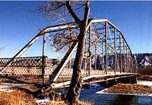
A portion of the film Vanishing Point was filmed in Rifle. Scenes include a shot of Kowalski's car crossing Rifle Bridge, and confronting Utah state patrol cars.
Rifle is also mentioned in Stephen King's The Stand.
In the summer of 2014, a popular local restaurant, Shooter's Grill,[28] made national news when it was advertised that the owner encouraged the servers to participate in open carry.[29] Patrons of the restaurant were also welcome to display their firearms when dining.
See also
References
- 1 2 "Active Colorado Municipalities". State of Colorado, Department of Local Affairs. Archived from the original on November 22, 2010. Retrieved 2007-09-01.
- 1 2 City of Rifle website
- ↑ "Colorado Municipal Incorporations". State of Colorado, Department of Personnel & Administration, Colorado State Archives. 2004-12-01. Retrieved 2007-09-02.
- ↑ "US Board on Geographic Names". United States Geological Survey. 2007-10-25. Retrieved 2008-01-31.
- ↑ "ZIP Code Lookup". United States Postal Service. Archived from the original (JavaScript/HTML) on November 22, 2010. Retrieved December 24, 2007.
- ↑ http://quickfacts.census.gov/qfd/states/08/0864255.html
- ↑ Rifle Shots: The Story of Rifle, Colorado, compiled by the Reading Club of Rifle, Colorado, 1973.
- ↑ Marsh, Charles (1982). The Utes of Colorado- People of the Shining Mountains. Boulder, CO: Pruett Publishing Company. ISBN 0871086204.
- ↑ Save Roan Plateau. 1 Dec 2007<http://www.saveroanplateau.org/>.
- ↑ "US Gazetteer files: 2010, 2000, and 1990". United States Census Bureau. 2011-02-12. Retrieved 2011-04-23.
- ↑ "Geographic Identifiers: 2010 Demographic Profile Data (G001): Rifle city, Colorado". American Factfinder. U.S. Census Bureau. Retrieved November 16, 2016.
- ↑ "Monthly Average/ Record Temperatures". Weather.com. Retrieved January 17, 2016.
- ↑ "Annual Estimates of the Resident Population for Incorporated Places: April 1, 2010 to July 1, 2015". Retrieved July 2, 2016.
- ↑ "Census of Population and Housing". Census.gov. Archived from the original on May 11, 2015. Retrieved June 4, 2015.
- ↑ "American FactFinder". United States Census Bureau. Archived from the original on September 11, 2013. Retrieved 2008-01-31.
- ↑ "Mountain Project: Climbing Rifle Mountain Park." Mountain Project. 29 Oct 2001. 1 Dec 2007 <http://www.mountainproject.com/v/colorado/rifle/rifle_mountain_park/105744310>.
- ↑ http://cpw.state.co.us/placestogo/parks/RifleFalls
- ↑ http://cpw.state.co.us/learn/Pages/Hatcheries.aspx
- ↑ http://cpw.state.co.us/placestogo/parks/RifleGap
- ↑ http://cpw.state.co.us/placestogo/Parks/harveygap
- ↑ http://www.blm.gov/style/medialib/blm/co/field_offices/crvfo/recreation_documents.Par.97530.File.dat/Hubbard_Mesa_Open_Area_Brochure_2011.pdf
- ↑ http://www.blm.gov/co/st/en/fo/crvfo/recreation/rifle_arch.html
- ↑ http://www.blm.gov/style/medialib/blm/co/field_offices/crvfo/recreation_documents.Par.65455.File.dat/Roan%20Plateau%201%20Aug%202012.pdf
- ↑ "Rifle, CO - Rifle Creek Golf Course". www.riflecreekgc.com. Retrieved 2015-08-24.
- ↑ "About the Ute Theater - Ute Theater". Retrieved 2015-08-25.
- ↑ http://www.garfieldcountyfair.com/
- ↑ "Valley Curtain." Christo and Jeanne-Claude. 1 Dec 2007 <http://www.christojeanneclaude.net/vc.shtml>.
- ↑ "Home - Shooters Grill Of Rifle". Shooters Grill of Rifle. Retrieved 2015-08-24.
- ↑ http://www.aol.com/article/2014/07/02/shooters-restaurant-employees-carry-guns-in-rifle-co/20924283/
External links
| Wikimedia Commons has media related to Rifle, Colorado. |
- City of Rifle official website
- Citizen Telegram, local newspaper
- Rifle Area Chamber of Commerce
- Rifle Gap State Park
Municipalities and communities of Garfield County, Colorado, United States | ||
|---|---|---|
| Cities | 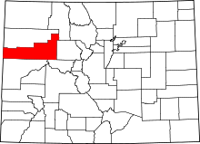 | |
| Towns | ||
| CDPs | ||
| Unincorporated communities | ||