Richville, New York
| Richville, New York | |
|---|---|
| Village | |
 Richville, New York Location within the state of New York | |
| Coordinates: 44°24′46″N 75°23′37″W / 44.41278°N 75.39361°WCoordinates: 44°24′46″N 75°23′37″W / 44.41278°N 75.39361°W | |
| Country | United States |
| State | New York |
| County | St. Lawrence |
| Area | |
| • Total | 0.7 sq mi (1.9 km2) |
| • Land | 0.7 sq mi (1.9 km2) |
| • Water | 0.0 sq mi (0.0 km2) |
| Elevation | 407 ft (124 m) |
| Population (2010) | |
| • Total | 323 |
| Time zone | Eastern (EST) (UTC-5) |
| • Summer (DST) | EDT (UTC-4) |
| FIPS code | 36-61621 |
| GNIS feature ID | 0976888 |
Richville is a village in St. Lawrence County, New York, United States. The population was 323 at the 2010 census. The name is from an early settler.
The Village of Richville is in the southwest corner of the Town of De Kalb and is southwest of the Village of Canton.
Geography
Richville is located at 44°24′46″N 75°23′37″W / 44.41278°N 75.39361°W (44.412874, -75.393608).[1]
According to the United States Census Bureau, the village has a total area of 0.7 square miles (1.8 km2), all of it land.
Richville is located on U.S. Route 11, which is conjoined with New York State Route 812 in the village.
The Oswegatchie River flows northward past the west side of the village.
Demographics
| Historical population | |||
|---|---|---|---|
| Census | Pop. | %± | |
| 1880 | 339 | — | |
| 1890 | 336 | −0.9% | |
| 1900 | 331 | −1.5% | |
| 1910 | 307 | −7.3% | |
| 1920 | 302 | −1.6% | |
| 1930 | 302 | 0.0% | |
| 1940 | 274 | −9.3% | |
| 1950 | 254 | −7.3% | |
| 1960 | 292 | 15.0% | |
| 1970 | 334 | 14.4% | |
| 1980 | 336 | 0.6% | |
| 1990 | 311 | −7.4% | |
| 2000 | 274 | −11.9% | |
| 2010 | 323 | 17.9% | |
| Est. 2015 | 320 | [2] | −0.9% |
As of the census[4] of 2000, there were 274 people, 109 households, and 80 families residing in the village. The population density was 371.4 people per square mile (143.0/km²). There were 120 housing units at an average density of 162.7 per square mile (62.6/km²). The racial makeup of the village was 98.91% White, 0.73% African American and 0.36% Native American.
There were 109 households out of which 33.9% had children under the age of 18 living with them, 56.9% were married couples living together, 10.1% had a female householder with no husband present, and 25.7% were non-families. 20.2% of all households were made up of individuals and 5.5% had someone living alone who was 65 years of age or older. The average household size was 2.51 and the average family size was 2.89.
In the village the population was spread out with 23.7% under the age of 18, 9.5% from 18 to 24, 32.8% from 25 to 44, 21.5% from 45 to 64, and 12.4% who were 65 years of age or older. The median age was 37 years. For every 100 females there were 101.5 males. For every 100 females age 18 and over, there were 99.0 males.
The median income for a household in the village was $35,455, and the median income for a family was $39,375. Males had a median income of $35,938 versus $21,500 for females. The per capita income for the village was $16,040. About 8.6% of families and 7.4% of the population were below the poverty line, including 4.4% of those under the age of eighteen and 8.8% of those sixty five or over.
References
- ↑ "US Gazetteer files: 2010, 2000, and 1990". United States Census Bureau. 2011-02-12. Retrieved 2011-04-23.
- ↑ "Annual Estimates of the Resident Population for Incorporated Places: April 1, 2010 to July 1, 2015". Retrieved July 2, 2016.
- ↑ "Census of Population and Housing". Census.gov. Archived from the original on May 11, 2015. Retrieved June 4, 2015.
- ↑ "American FactFinder". United States Census Bureau. Archived from the original on September 11, 2013. Retrieved 2008-01-31.
Municipalities and communities of St. Lawrence County, New York, United States | ||
|---|---|---|
| City | 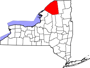 | |
| Towns | ||
| Villages | ||
| CDPs |
| |
| Hamlets | ||