Rice Hill, Oregon
| Rice Hill, Oregon | |
|---|---|
| Unincorporated community | |
 | |
 Rice Hill, Oregon  Rice Hill, Oregon | |
| Coordinates: 43°32′19″N 123°17′24″W / 43.53861°N 123.29000°WCoordinates: 43°32′19″N 123°17′24″W / 43.53861°N 123.29000°W | |
| Country | United States |
| State | Oregon |
| County | Douglas |
| Elevation | 456 ft (139 m) |
| Time zone | Pacific (PST) (UTC-8) |
| • Summer (DST) | PDT (UTC-7) |
| ZIP code | 97462 |
| Area code(s) | 458 and 541 |
| GNIS feature ID | 1158447[1] |
Rice Hill is an unincorporated community in Douglas County, Oregon, United States.[2] It is located about 10 miles (16 km) north of Oakland on Interstate 5.[3]
Rice Hill is a summit that divides the watersheds of Elk Creek and the Umpqua River.[4] It was named either for Isadore F. Rice, who settled in the area in the 1850s, or for William S. Rice, who had a Donation Land Claim at the north end of Rice Valley at about the same time.[4] The two-mile long valley stretches south from the community of Rice Hill.[5] Southern Pacific Railroad (today Union Pacific) has a station on its Siskiyou Line at the summit named Rice Hill.[4] Rice Hill post office was established in 1892, and soon renamed Ricehill.[4] The office closed in 1908.[4] The steep grade of Rice Hill, elevation 710 feet (220 m), was an obstacle for pioneer travelers and it also created problems for the construction of the railroad, as it rises 325 feet (99 m) in 3 miles (4.8 km).[4][6][7]
Rice Hill has complete tourist facilities, including a truck stop, motels, and restaurants.[8][9] It has long been a popular spot to stop for ice cream.[10][11]
References
- ↑ "US Board on Geographic Names". United States Geological Survey. 2007-10-25. Retrieved 2008-01-31.
- ↑ "Rice Hill". Geographic Names Information System. United States Geological Survey. November 28, 1980. Retrieved 2011-01-09.
- ↑ Oregon Atlas & Gazetteer (7th ed.). Yarmouth, Maine: DeLorme. 2008. p. 46. ISBN 0-89933-347-8.
- 1 2 3 4 5 6 McArthur, Lewis A.; McArthur, Lewis L. (2003) [1928]. Oregon Geographic Names (7th ed.). Portland, Oregon: Oregon Historical Society Press. p. 808. ISBN 978-0875952772.
- ↑ "Rice Valley". Geographic Names Information System. United States Geological Survey. November 28, 1980. Retrieved 2011-01-09.
- ↑ Writers' Program of the Work Projects Administration in the State of Oregon (1940). Oregon: End of the Trail. American Guide Series. Portland, Oregon: Binfords & Mort. p. 318. OCLC 4874569.
- ↑ Munford, Kenneth (1978). "The Oregon and California Railroad". Horner Museum Tour Guide Series. Benton County Museum. Retrieved 2011-01-09.
- ↑ Friedman, Ralph (1990). In Search of Western Oregon (2nd ed.). Caldwell, Idaho: The Caxton Printers, Ltd. p. 537. ISBN 0-87004-332-3.
- ↑ "Truck Stops on Major Routes". Oregon Department of Transportation. Retrieved 2011-01-09.
- ↑ Richard, Terry (June 20, 2009). "Next time I'll go for six scoops of Umpqua ice cream's Oregon's 150; here's to statehood". The Oregonian. Retrieved 2011-01-09.
- ↑ Thompson, John (June 7, 1983). "Oregon's Biggest Dipper". The Register-Guard. Retrieved 2011-01-09.
External links
- Images of Rice Hill from Flickr
Municipalities and communities of Douglas County, Oregon, United States | ||
|---|---|---|
| Cities | 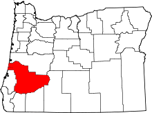 | |
| CDPs | ||
| Unincorporated communities | ||