Rancho Rinconada del Arroyo de San Francisquito
Rancho Rinconada del Arroyo de San Francisquito was a 2,230-acre (9.0 km2) Mexican land grant in present day Santa Clara County, California given in 1841 by Governor Juan Alvarado to María Antonia Mesa.[1] The name means "ranch at the bend in San Francisquito Creek".
The grant was located south of San Francisquito Creek, and encompassed present day Menlo Park and downtown Palo Alto.[2][3]
History
Rafael Soto (1789–1839), the son of De Anza Expedition settlers Ygnacio Soto and María Bárbara Espinosa de Lugo, was born in the Pueblo of San José. Rafael Soto married María Antonia Mesa (b. 1802) in 1819. In 1827, Rafael Soto came to stay on Rancho Cañada del Corte de Madera of Máximo Martínez. In 1835, Rafael Soto and family settled near San Francisquito Creek, selling goods to travelers. Rafael Soto died in 1839. His widow, Antonia Mesa Soto, was granted a one half square league by Governor Juan Bautista Alavardo in 1841.[4] Soto's daughter, María Luisa Soto (1817–1883) married John Coppinger, grantee of Rancho Cañada de Raymundo.[5]
With the cession of California to the United States following the Mexican-American War, the 1848 Treaty of Guadalupe Hidalgo provided that the land grants would be honored. As required by the Land Act of 1851, a claim for Rancho Rinconada del Arroyo de San Francisquito was filed with the Public Land Commission in 1852.[6] The claim was rejected by the Commission on the grounds that there was no description of the granted land either in the grant itself, or the map which accompanied it.[7] On appeal, based on the testimony of Aaron Van Dorn, Deputy United States Surveyor, the District Court confirmed the grant in 1855, and the grant was patented to María Antonia Mesa in 1872.[8]
When Land Commission rejected their claim, the Soto family agreed to give Thomas Seale half the land if he could secure the grant's confirmation. Thomas Seale (1826–1907), was born in Ireland, and came to San Francisco via New Orleans in 1850, where he and his brother, Henry W. Seale (d.1888), operated a contracting business. The brothers received about 1,400 acres (5.7 km2) for their efforts. In 1858, Paul Shore was killed by Samuel J. Crosby on Henry W. Seale's property, and in 1859, Thomas Shore, the brother of Paul, shot and killed Crosby.[9]
In 1887, Seale sold 697 acres (2.8 km2) to Timothy Hopkins (1859–1936) who developed the town which would become Palo Alto. In 1864, Dr. William Newell bought 60 acres (0.2 km2) from Henry W. Seale. The remainder of Seale’s property was farmed until his death in 1888.
References
- ↑ Ogden Hoffman, 1862, Reports of Land Cases Determined in the United States District Court for the Northern District of California, Numa Hubert, San Francisco
- ↑ Diseño del Rancho Rinconada del Arroyo de San Francisquito
- ↑ Early Santa Clara Ranchos, Grants, Patents and Maps
- ↑ Pamela Gullard and Nancy Lund, 1989, History of Palo Alto: The Early Years, Scottwall Associates, ISBN 978-0-942087-04-8
- ↑ Fremont township
- ↑ United States. District Court (California : Northern District) Land Case 129 ND
- ↑ J. P. Munro-Fraser,1881,"History of Santa Clara County, California ", ISBN 978-0-217-84143-6
- ↑ Report of the Surveyor General 1844 - 1886
- ↑ Eugene T.Sawyers, 1922, History of Santa Clara County, Historic Record Company, Los Angeles, Calif.
See also
- Ranchos of Santa Clara County, California
External links
- Diseño del Rancho Rinconada del Arroyo de San Francisquito : Santa Clara Co., Calif. at The Bancroft Library
Coordinates: 37°27′00″N 122°08′24″W / 37.450°N 122.140°W
Municipalities and communities of Santa Clara County, California, United States | ||
|---|---|---|
| Cities and towns | 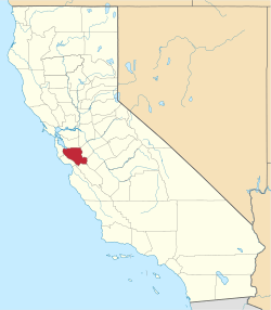 | |
| CDPs | ||
| Unincorporated communities | ||
| CCDs | ||
| Ghost towns | ||