Raman District
| Raman รามัน | |
|---|---|
| Amphoe | |
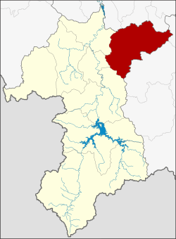 Amphoe location in Yala Province | |
| Coordinates: 6°28′42″N 101°25′27″E / 6.47833°N 101.42417°ECoordinates: 6°28′42″N 101°25′27″E / 6.47833°N 101.42417°E | |
| Country |
|
| Province | Yala |
| Seat | Kayu Boko |
| Area | |
| • Total | 516.1 km2 (199.3 sq mi) |
| Population (2014) | |
| • Total | 91,850 |
| • Density | 142.2/km2 (368/sq mi) |
| Time zone | THA (UTC+7) |
| Postal code | 95140 |
| Geocode | 9506 |
Raman (Thai: รามัน) is a district (Amphoe) in the northeastern part of Yala Province, southern Thailand.
History
The name Raman is actually the Thai corruption of Reman (Jawi: رمان), its original Malay name. Mueang Raman was one of the seven kingdoms, into which the Sultanate of Patani was split in the beginning of the 19th century to reduce the power of the Sultan of Patani after a series of rebellions against the Siamese rulership. Tuan Mansor was appointed as the first ruler and resided in Kota Baru.
In 1917 the district was renamed from Raman to Kota Baru, the seat of the administration.[1] In 1938 it was named back to its historical name.[2]
Seven subdistricts are scheduled to be split off to from the new district Kota Baru in 2015.[3]
Geography
Neighboring districts are (from the north clockwise) Yarang, Thung Yang Daeng and Kapho of Pattani Province, Bacho and Rueso of Narathiwat Province, and Bannang Sata, Krong Pinang and Mueang Yala of Yala Province.
Administration
Central administration
The district Raman is subdivided into 16 subdistricts (Tambon), which are further subdivided into 90 administrative villages (Muban).
| No. | Name | Thai | Villages | Pop.[4] |
|---|---|---|---|---|
| 1. | Kayu Boko | กายูบอเกาะ | 6 | 9,447 |
| 2. | Kalupang | กาลูปัง | 4 | 2,988 |
| 3. | Kalo | กาลอ | 4 | 3,208 |
| 4. | Koto Tuera | กอตอตือร๊ะ | 5 | 5,490 |
| 5. | Kota Baru | โกตาบารู | 4 | 5,418 |
| 6. | Kero | เกะรอ | 7 | 7,374 |
| 7. | Cha-kwa | จะกว๊ะ | 6 | 6,275 |
| 8. | Tha Thong | ท่าธง | 7 | 6,983 |
| 9. | Noen Ngam | เนินงาม | 7 | 6,616 |
| 10. | Balo | บาลอ | 7 | 5,386 |
| 11. | Ba-ngoi | บาโงย | 4 | 2,770 |
| 12. | Buemang | บือมัง | 6 | 5,812 |
| 13. | Yata | ยะต๊ะ | 5 | 5,374 |
| 14. | Wang Phaya | วังพญา | 7 | 6,759 |
| 15. | A-song | อาซ่อง | 6 | 5,428 |
| 16. | Talo Halo | ตะโล๊ะหะลอ | 5 | 6,522 |
Local administration
There are 3 subdistrict municipalities (Thesaban Tambon) in the district:
- Mueang Raman (Thai: เทศบาลตำบลเมืองรามันห์) consisting of parts of the subdistrict Kayu Boko.
- Kota Baru (Thai: เทศบาลตำบลโกตาบารู) consisting of the complete subdistrict Kota Baru.
- Balo (Thai: เทศบาลตำบลบาลอ) consisting of the complete subdistrict Balo.
There are 14 subdistrict administrative organizations (SAO) in the district:
- Kayu Boko (Thai: องค์การบริหารส่วนตำบลกายูบอเกาะ) consisting of parts of the subdistrict Kayu Boko.
- Kalupang (Thai: องค์การบริหารส่วนตำบลกาลูปัง) consisting of the complete subdistrict Kalupang.
- Kalo (Thai: องค์การบริหารส่วนตำบลกาลอ) consisting of the complete subdistrict Kalo.
- Koto Tuera (Thai: องค์การบริหารส่วนตำบลกอตอตือร๊ะ) consisting of the complete subdistrict Koto Tuera.
- Kero (Thai: องค์การบริหารส่วนตำบลเกะรอ) consisting of the complete subdistrict Kero.
- Cha-kwa (Thai: องค์การบริหารส่วนตำบลจะกว๊ะ) consisting of the complete subdistrict Cha-kwa.
- Tha Thong (Thai: องค์การบริหารส่วนตำบลท่าธง) consisting of the complete subdistrict Tha Thong.
- Noen Ngam (Thai: องค์การบริหารส่วนตำบลเนินงาม) consisting of the complete subdistrict Noen Ngam.
- Ba-ngoi (Thai: องค์การบริหารส่วนตำบลบาโงย) consisting of the complete subdistrict Ba-ngoi.
- Buemang (Thai: องค์การบริหารส่วนตำบลบือมัง) consisting of the complete subdistrict Buemang.
- Yata (Thai: องค์การบริหารส่วนตำบลยะต๊ะ) consisting of the complete subdistrict Yata.
- Wang Phaya (Thai: องค์การบริหารส่วนตำบลวังพญา) consisting of the complete subdistrict Wang Phaya.
- A-song (Thai: องค์การบริหารส่วนตำบลอาซ่อง) consisting of the complete subdistrict A-song.
- Talo Halo (Thai: องค์การบริหารส่วนตำบลตะโล๊ะหะลอ) consisting of the complete subdistrict Talo Halo.
References
- ↑ ประกาศกระทรวงมหาดไทย เรื่อง เปลี่ยนชื่ออำเภอ (PDF). Royal Gazette (in Thai). 34 (0 ก): 40–68. 1917-04-29.
- ↑ พระราชกฤษฎีกาเปลี่ยนนามจังหวัด และอำเภอบางแห่ง พุทธศักราช ๒๔๘๑ (PDF). Royal Gazette (in Thai). 55 (0 ก): 658–666. 1938-11-14.
- ↑ http://www.law.moi.go.th/pdf/2558_1_19_2m.pdf
- ↑ "Population statistics 2014" (in Thai). Department of Provincial Administration. Retrieved 2015-03-11.
External links
- amphoe.com (Thai)