R565 road (Ireland)
| ||||
|---|---|---|---|---|
|
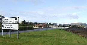
R565 at Portmagee | ||||
| Route information | ||||
| Length: | 18.5 km[1][2] (11.5 mi) | |||
| Major junctions | ||||
| From: |
| |||
| To: | The Promenade, Knightstown | |||
| Road network | ||||
| ||||

The R565 road is a regional road in Ireland. It is a road on the Iveragh Peninsula and Valentia Island in County Kerry.[1][2] The road is part of the Wild Atlantic Way.[3]
The R565 travels west from the N70 to Portmagee. At Portmagee, the road crosses the Maurice O'Neill Memorial Bridge to Valentia Island, the island's only road access. Travelling east across the island via Chapeltown, the road terminates at the port village of Knightstown, where a ferry runs to the mainland. The R565 is 18.5 km (11.5 mi) long.[1]
References
- 1 2 3 Google (16 May 2016). "Ring of Kerry to The Promenade" (Map). Google Maps. Google. Retrieved 16 May 2016.
- 1 2 "S.I. No. 54/2012 – Roads Act 1993 (Classification of Regional Roads) Order 2012". Government of Ireland. 28 Feb 2012. Retrieved 16 May 2016.
- ↑ "Wild Atlantic Way: Explore The Route". Fáilte Ireland. Retrieved 16 May 2016.
This article is issued from Wikipedia - version of the 6/5/2016. The text is available under the Creative Commons Attribution/Share Alike but additional terms may apply for the media files.